30-second GOES-16 imagery of rapidly-developing severe thunderstorms over the Midwest
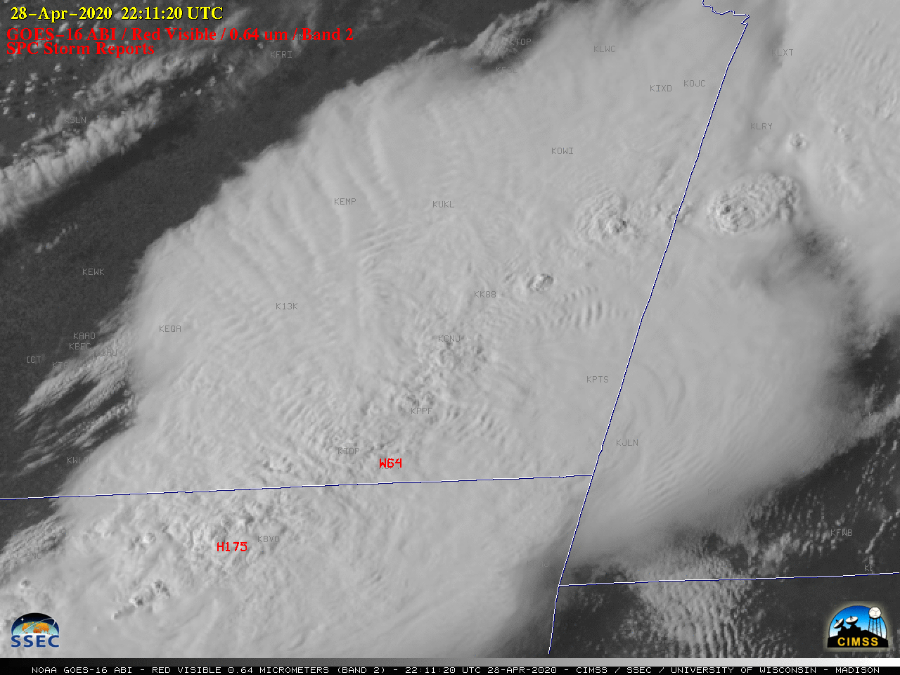
Overlapping 1-minute Mesoscale Domain Sectors provided GOES-16 (GOES-East) “Red” Visible (0.64 µm) images at 30-second intervals (above) — which showed rapidly-developing thunderstorms over northeastern Oklahoma, southeastern Kansas and southwestern Missouri on 28 April 2020. These storms developed along and ahead of an approaching cold front, and produced large hail and damaging winds (SPC Storm Reports).The corresponding 30-second GOES-16... Read More

