Typhoon Vongfong makes landfall in the Philippines
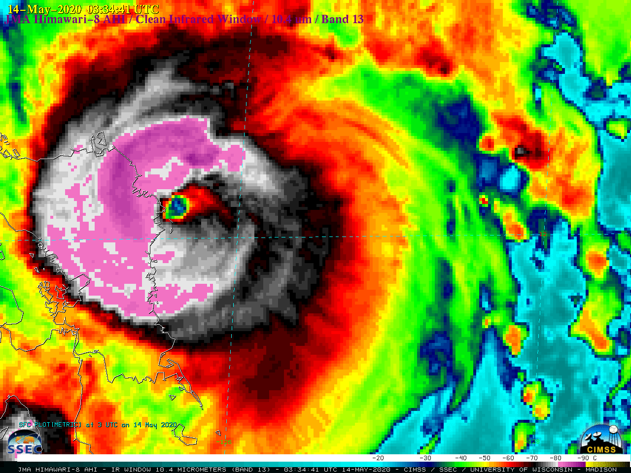
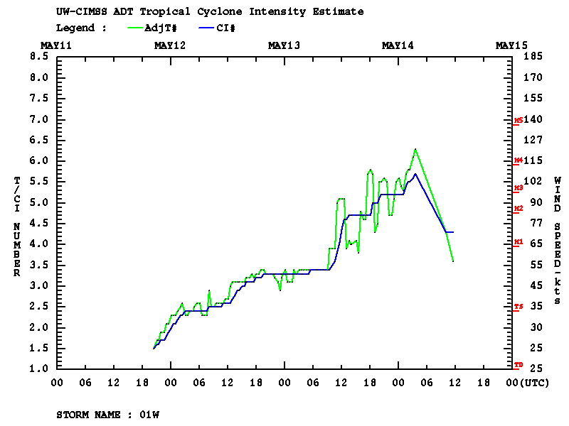
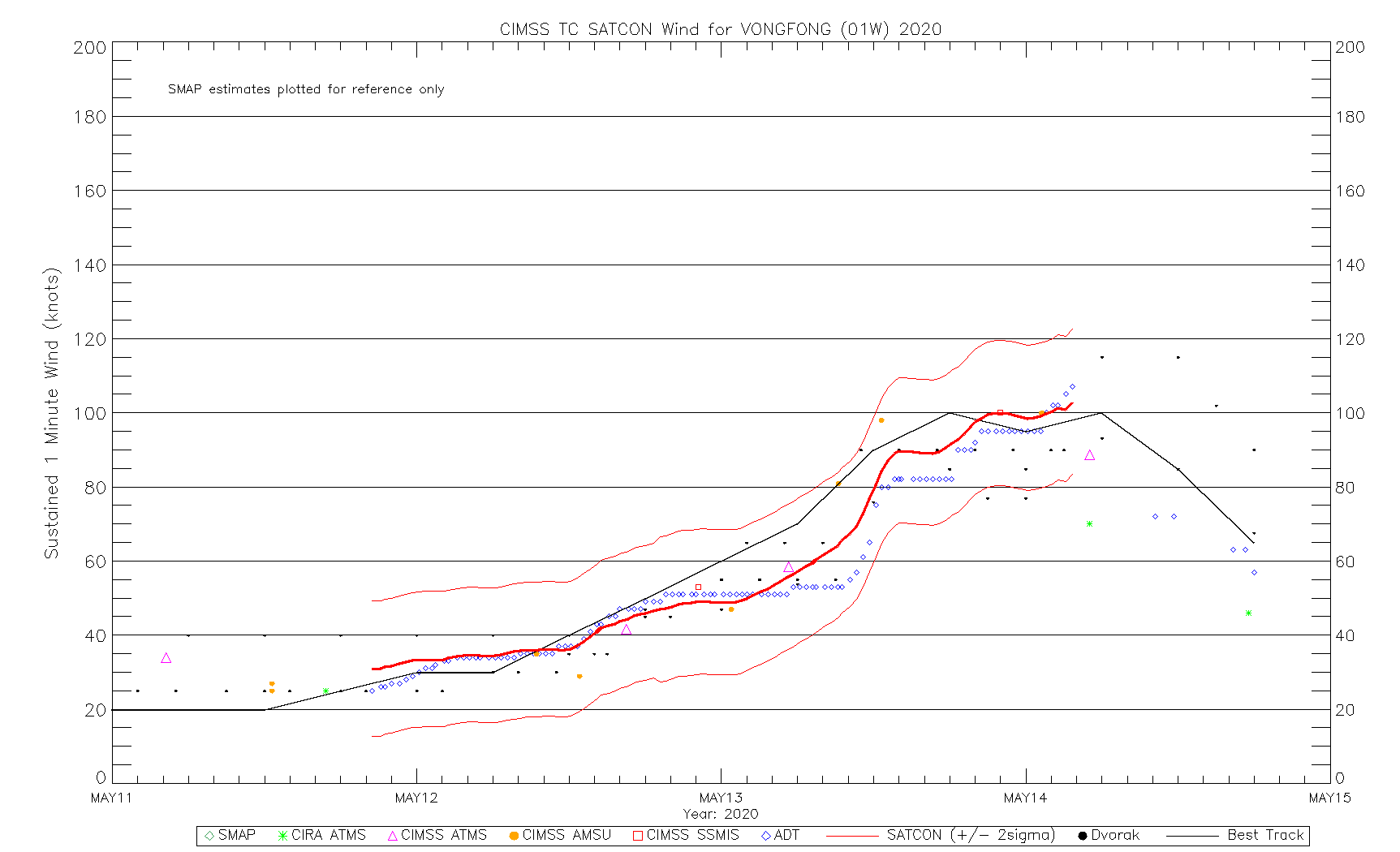
JMA 2.5-minute rapid scan Himawari-8 “Clean” Infrared Window (10.4 µm) images (above) showed Typhoon Vongfong during the 24 hours covering its rapid intensification to Category 3 intensity on 13 May (ADT | SATCON) and eventual landfall on Samar Island in the Philippines as a Category 2 storm on 14 May 2020.... Read More

