Blowing snow and blowing dust in Grand Forks ND
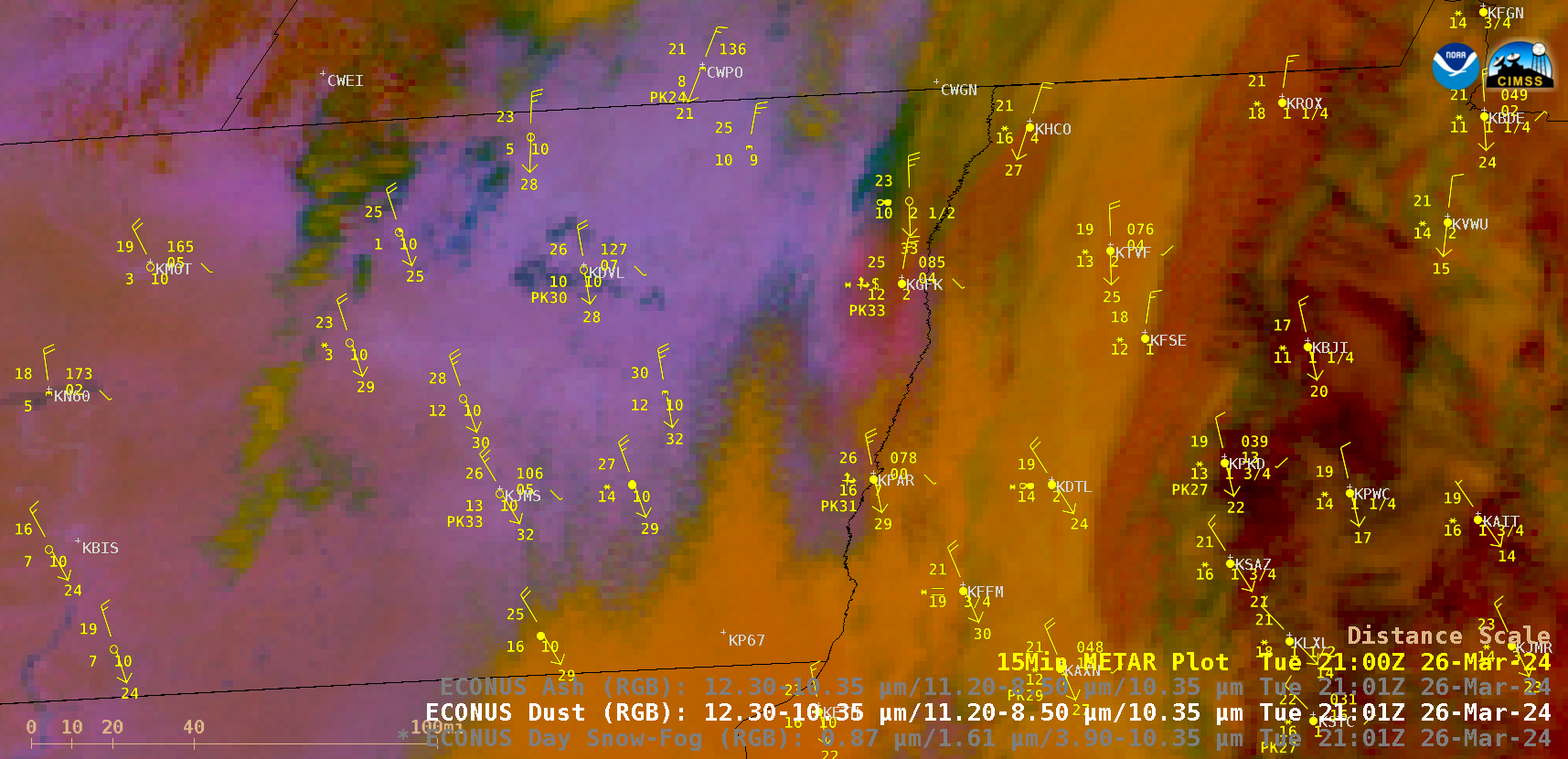
GOES-16 (GOES-East) Day Snow-Fog RGB and Dust RGB images (above) dispayed signatures of convective snow showers (shades of white in Day Snow-Fog RGB imagery) and blowing dust (brighter shades of pink in Dust RGB imagery) that created an unusual combination of blowing snow (BLSN) and blowing dust (BLDU) at Grand Forks, North Dakota... Read More
