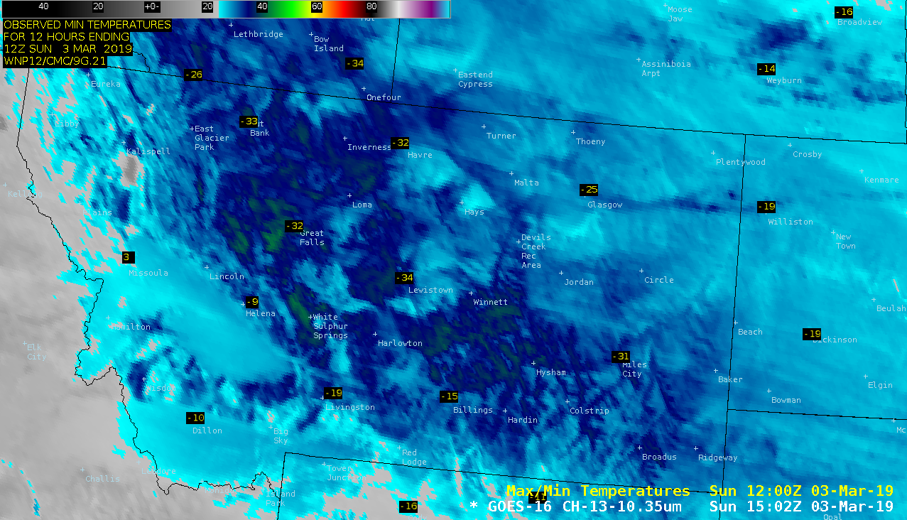
This website works best with a newer web browser such as Chrome, Firefox, Safari or Microsoft Edge. Internet Explorer is not supported by this website.

Category: NOAA-20

Ice accrual from freezing rain/drizzle in the Northeast US

A large central/eastern US winter storm impacted much of the Northeast with rain, snow, freezing rain/drizzle and strong winds on 20 January 2019 (surface analyses) — and a post-storm comparison of GOES-16 (GOES-East)  “Red” Visible (0.64 µm) and Near-Infrared “Snow/Ice” (1.61 µm) images on 22 January (above) revealed a dark 1.61 µm signature (often indicative of significant ice accrual)... Read More

Rope cloud in the East Pacific Ocean

* GOES-17 images shown here are preliminary and non-operational *An 1802 UTC GOES-17 “Red” Visible (0.64 µm) image with an overlay of the 12 UTC surface analysis (above) revealed a well-defined rope cloud which stretched for nearly 1000 miles, marking the cold front position at the time of the image. Rope clouds... Read More