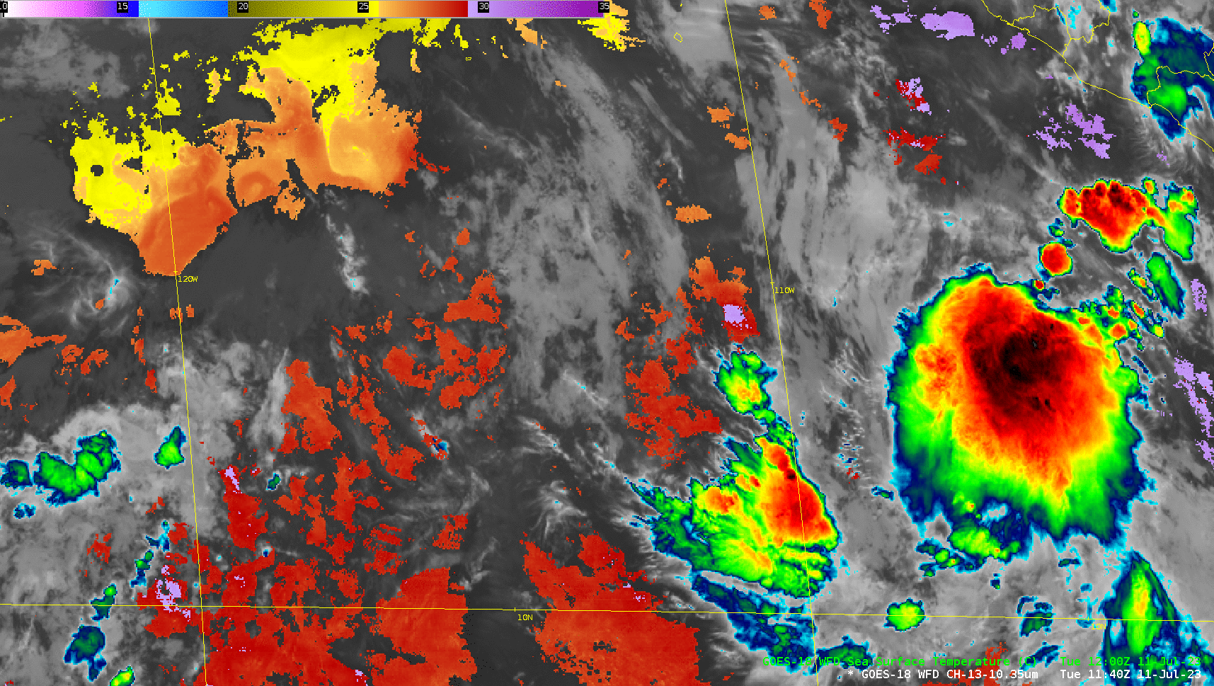
Hurricane Calvin in the Pacific Ocean
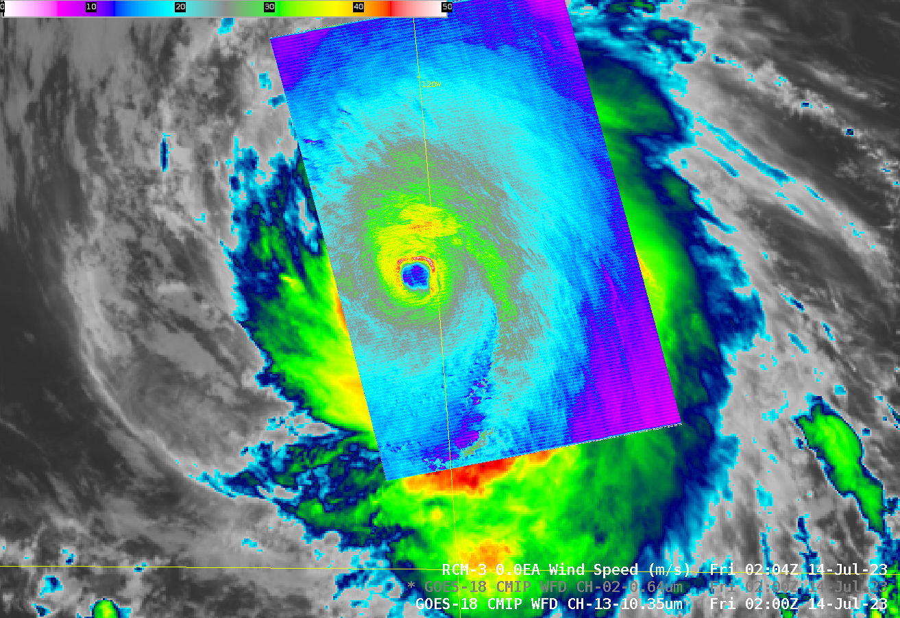
Pacific Hurricane Calvin was sampled by Radar Constellation Mission #3 (RCM-3) shortly after 0200 UTC on 14 July 2023. The SAR winds (click here to access a JAOTech article on this subject!) show strong winds surrounding a not-quite-circular closed eye, with a region of strong winds extending in a curved... Read More
