This website works best with a newer web browser such as Chrome, Firefox, Safari or Microsoft Edge. Internet Explorer is not supported by this website.

Category: Meteosat-12

Elevated Optical Depth from Two Very Different Sources

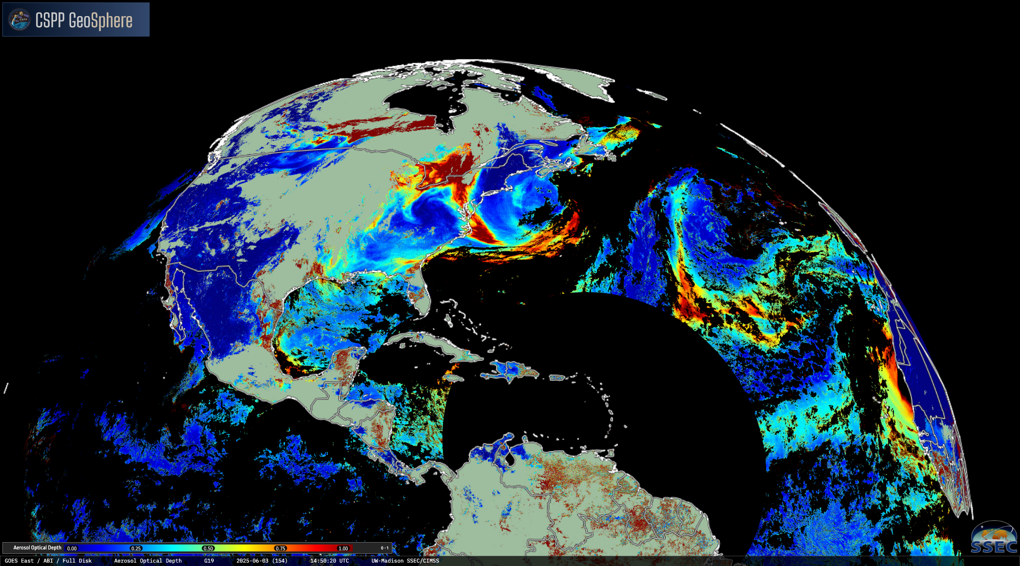
The GOES-19 view of the Northern Hemisphere on the morning of 3 June 2025 showed enhanced aerosol optical depth (AOD) across much of its domain. Large regions of elevated AOD are ceen in the eastern half of the continental United States extending out into the western Atlantic Ocean, while the... Read More

Using geo2grid with FCI data from Meteosat-12

Geo2grid software accesses SatPy libraries that allow for the reading of level-1c netcdf files holding FCI (Flexible Combined Imager) data from the latest operational Meteosat satellite (Meteosat-12). So if you can access to that output, you can create beautiful images as the ones shown above. The RGB shows a storm... Read More

LightningCast applied to new sensors

GOES-19 is slated to become the next operational GOES-East in April. Despite being trained on GOES-16 data, CIMSS and NOAA scientists have been busy evaluating the AI lightning-prediction model, LightningCast, on GOES-19 output to prepare for the operational transition and see how adaptable the model is.Overall, the LightningCast output on... Read More