Satellite indicators of thundersnow during a lake effect snow event in southern Lake Michigan
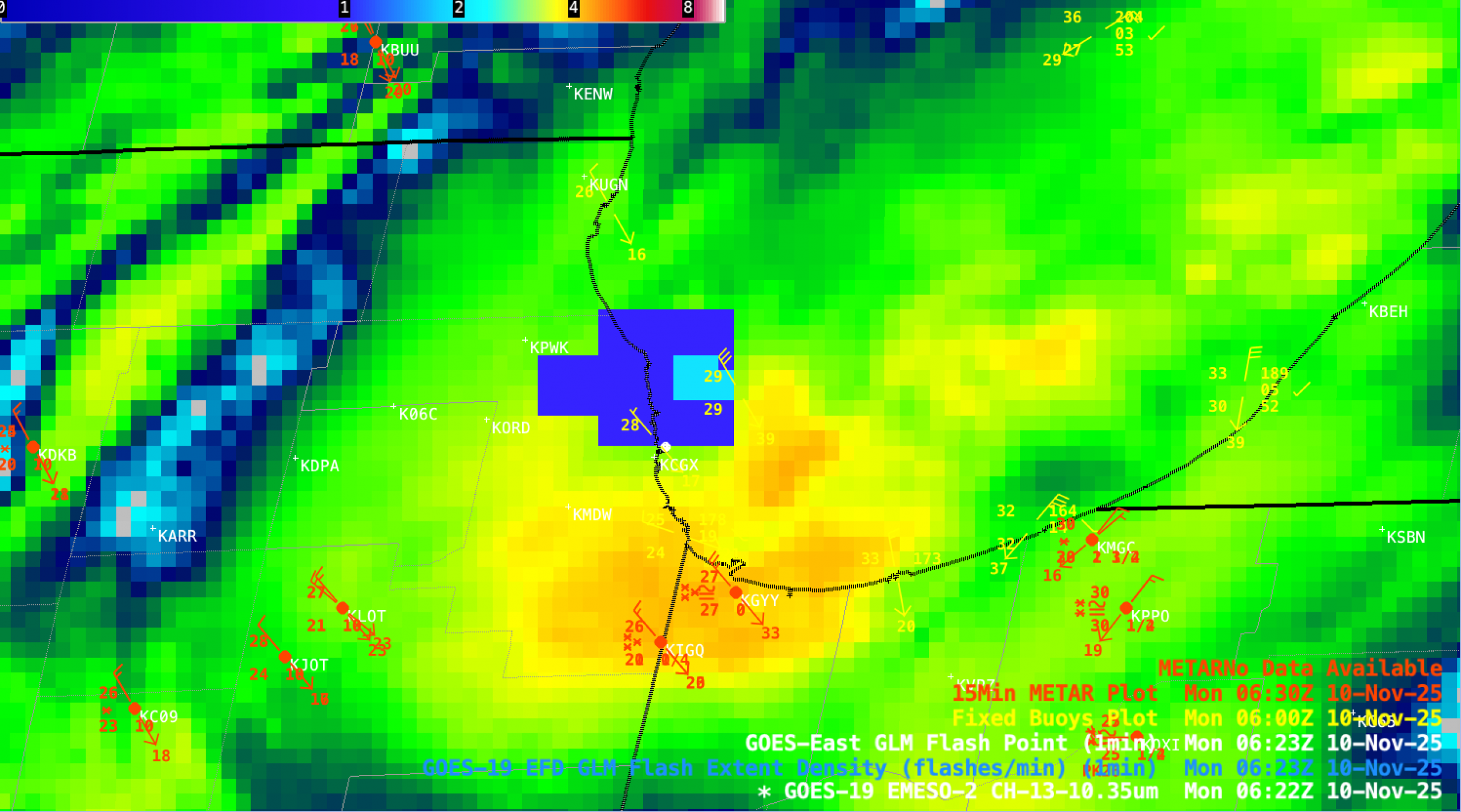
1-minute Mesoscale Domain Sector GOES-19 (GOES-East) Infrared images (above) showed a lake effect cloud band — exhibiting cloud-top infrared brightness temperatures as cold as -49 C (darker shades of orange) — over far southern Lake Michigan that was moving inland across parts of northwest Indiana and northeast Illinois after midnight on... Read More