Snow squalls in New York and Pennsylvania
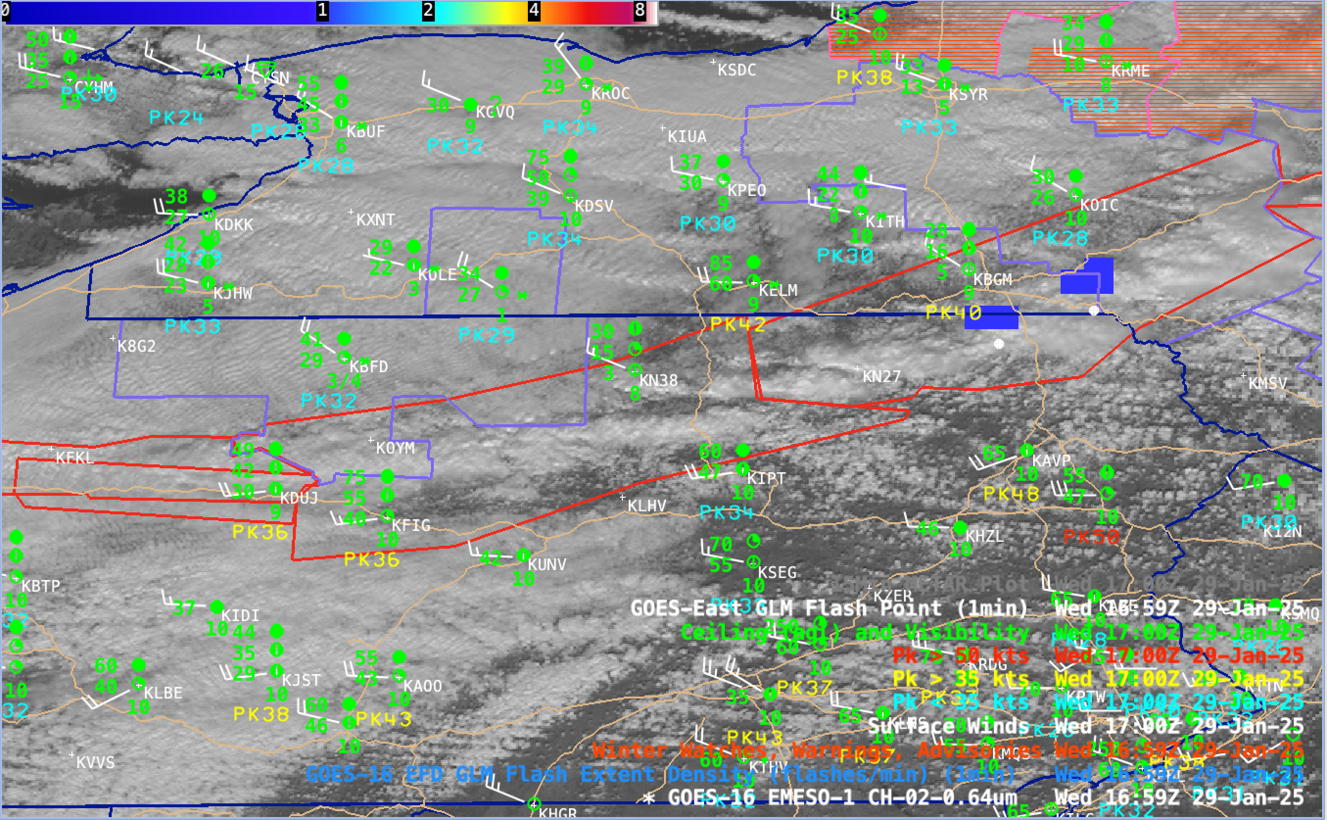
1-minute GOES-16 Red Visible (0.64 µm) images — with plots of Surface Wind barbs (white), Peak Wind gusts (cyan/yellow/red), Ceiling/visibility (green), GLM Flash Extent Density (blue to cyan) / GLM Flash Points (white dots) and Snow Squall Warnings (red polygons) — from 1400-1900 UTC on 29th January; Interstate highways are plotted in beige [click to play MP4 animation]
5-minute CONUS Sector GOES-19 (Preliminary/Non-operational) Day Cloud Phase Distinction RGB images created using Geo2Grid (below) helped to highlight this cold frontal cloud band — the shades of green to yellow indicated that the cloud band was either mixed phase or fully glaciated.

GOES-19 Day Cloud Phase Distinction RGB images, from 1401-1956 UTC on 29th January [click to play animated GIF | MP4]