The May 1980 Mount St. Helens eruption
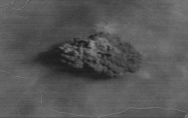
NOAA GOES-3 Visible (0.65 µm) images at 1545 and 1615 UTC (above) showed the volcanic cloud shortly after the explosive eruption of Mount St. Helens on 18 May 1980. GOES-3 was decommissioned in 2016.The corresponding GOES-3 Infrared (11.5 µm) image at 1545 UTC (below) appeared to display a small “enhanced-V” or cold/warm (-65ºC/-47ºC)... Read More

