Smoke over Indonesia and the western tropical Pacific Ocean
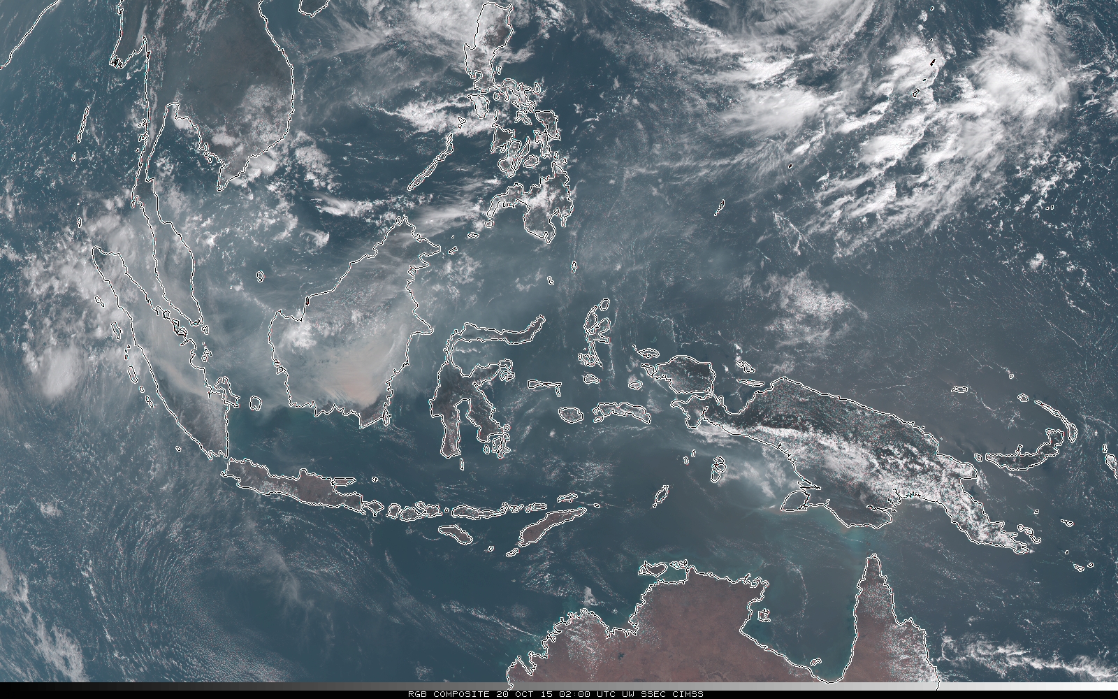
Many of the islands in Indonesia have been shrouded in smoke for much of October. RGB composites from Himawari-8, above, for 0200 UTC on each day from 08-26 October 2015 testify to the dense smoke, especially over the island of Borneo. News reports suggest the haze will persist through the end of the year. This is in... Read More
