Typhoon Champi
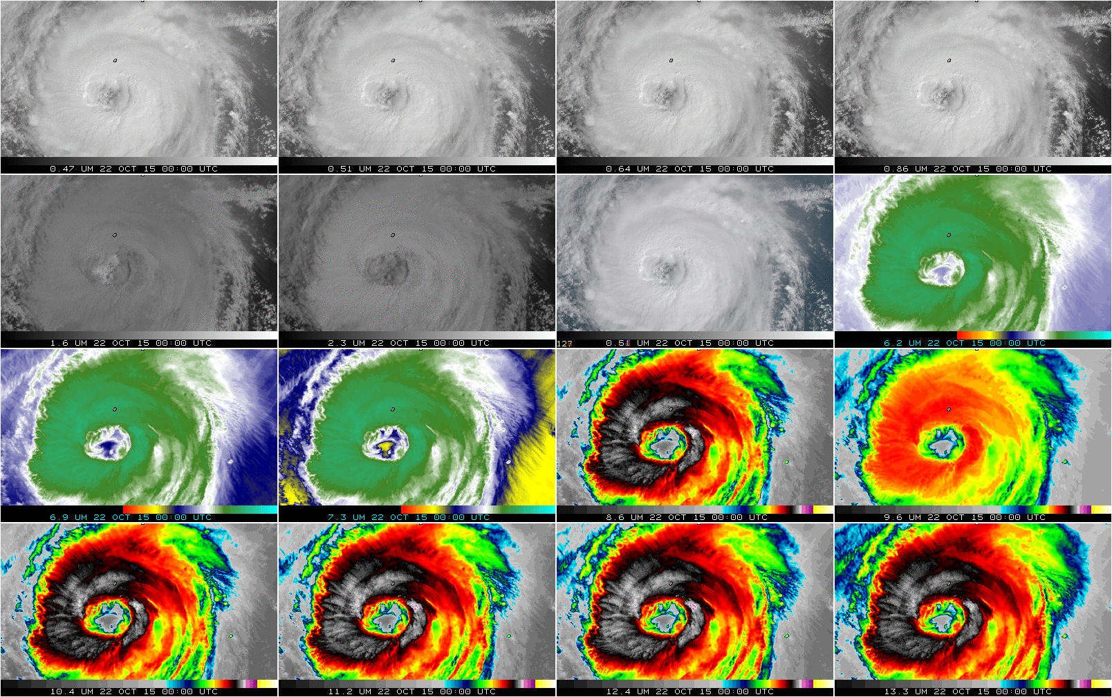
16-panel Himawari-8 multispectral animation of Typhoon Champi, half-hourly from 0000-1230 UTC on 22 October. Top row: 0.47µm, 0.51µm, 0.64µm, 0.86µm ; Second Row: 1.6µm, 2.3µm, RGB Composite (daytime)/3.7µm (Nighttime), 6.2µm; Third Row: 6.9µm, 7.3 µm, 8.6 µm, 9.6 µm; Bottom Row: 10.4µm, 11.2 µm, 12.4µm, 13.3µm (Click to enlarge)
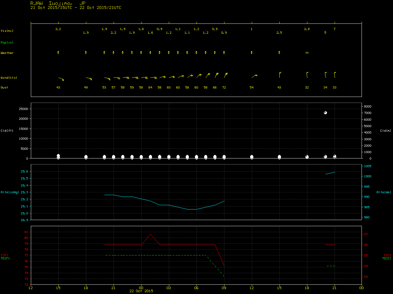
Himawari-8 viewed Typhoon Champi in the North Pacific on 22 October 2015, as shown above. The storm was near peak intensity during this animation, as indicated by the graphs of satellite maximum wind speed and minimum surface pressure shown below (taken from this website). The eye (abnormally large for a Typhoon!) of Champi passed just to the south of the island of Iwo Jima, where a wind gust of 72 knots (83 mph) occurred at 09 UTC (surface observations). The Himawari-8 AHI instrument has 16 channels, as will the GOES-R ABI when it is launched in October 2016.
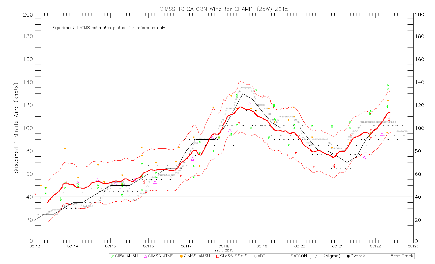
Satellite-estimated maximum wind velocity of Typhoon Champi (click to enlarge)
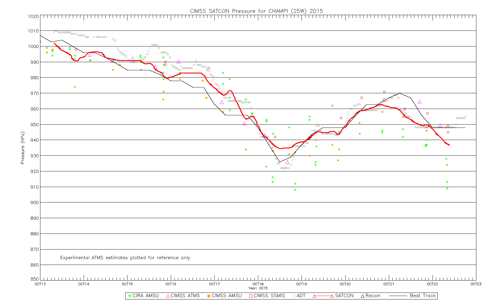
Satellite-estimated minimum surface Mean Sea Level Pressure of Typhoon Champi (Click to enlarge)
The Himawari-8 AHI instrument is also capable of gathering rapid-scan images over specified “Target Areas” every 2.5 minutes; rapid-scan Visible (0.64 µm) images of the eye of Typhoon Champi are shown below (also available as an MP4 animation). The GOES-R ABI will have the capability to scan special mesoscale sectors at 1-minute or even 30-second intervals.
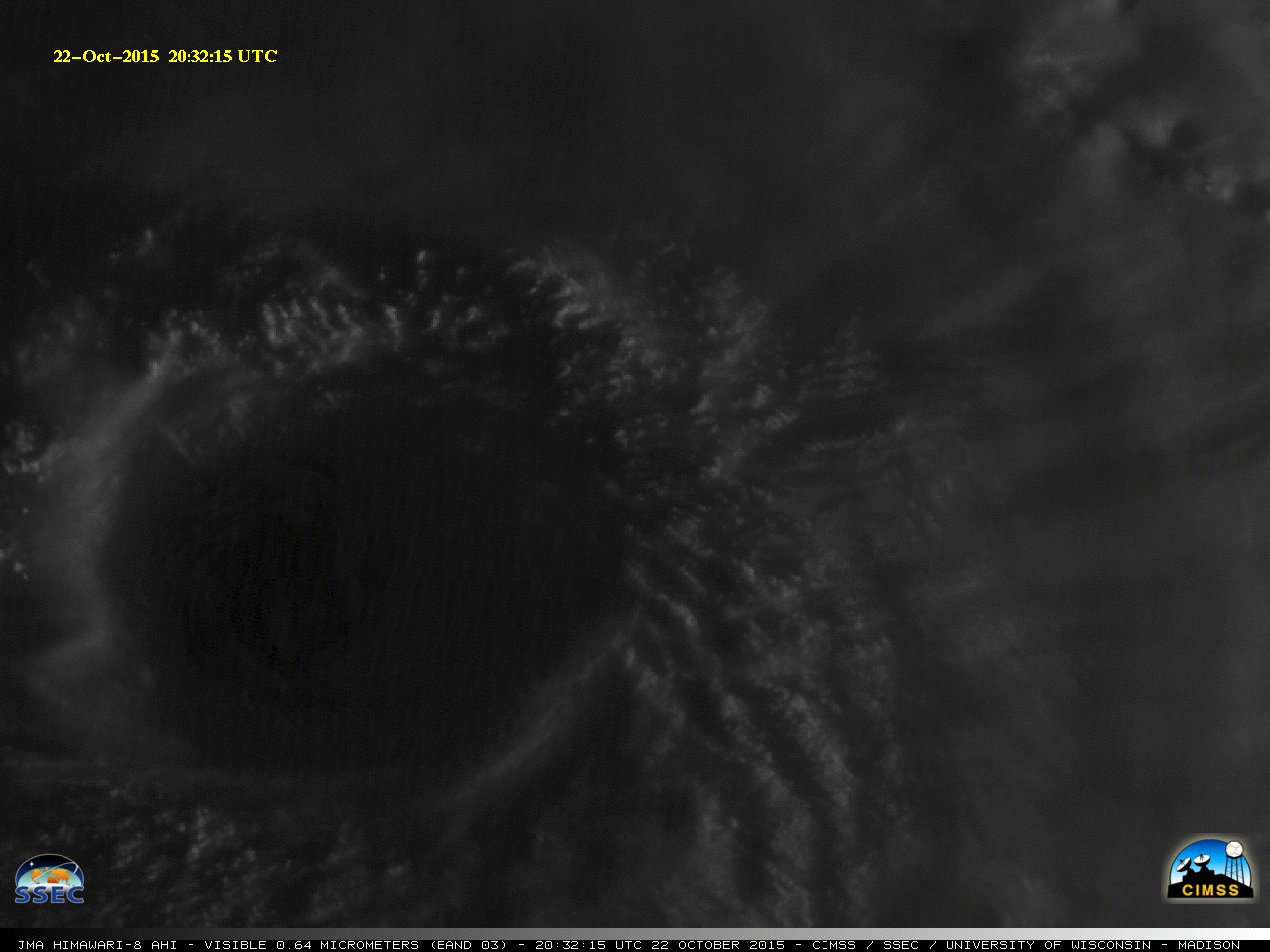
Himawari-8 Visible (0.64 µm) images (click to play animation)
Himawari-8 data — all channels — are routinely available here and here.