This website works best with a newer web browser such as Chrome, Firefox, Safari or Microsoft Edge. Internet Explorer is not supported by this website.

Category: Heavy rain / flooding

Severe thunderstorms in Wisconsin

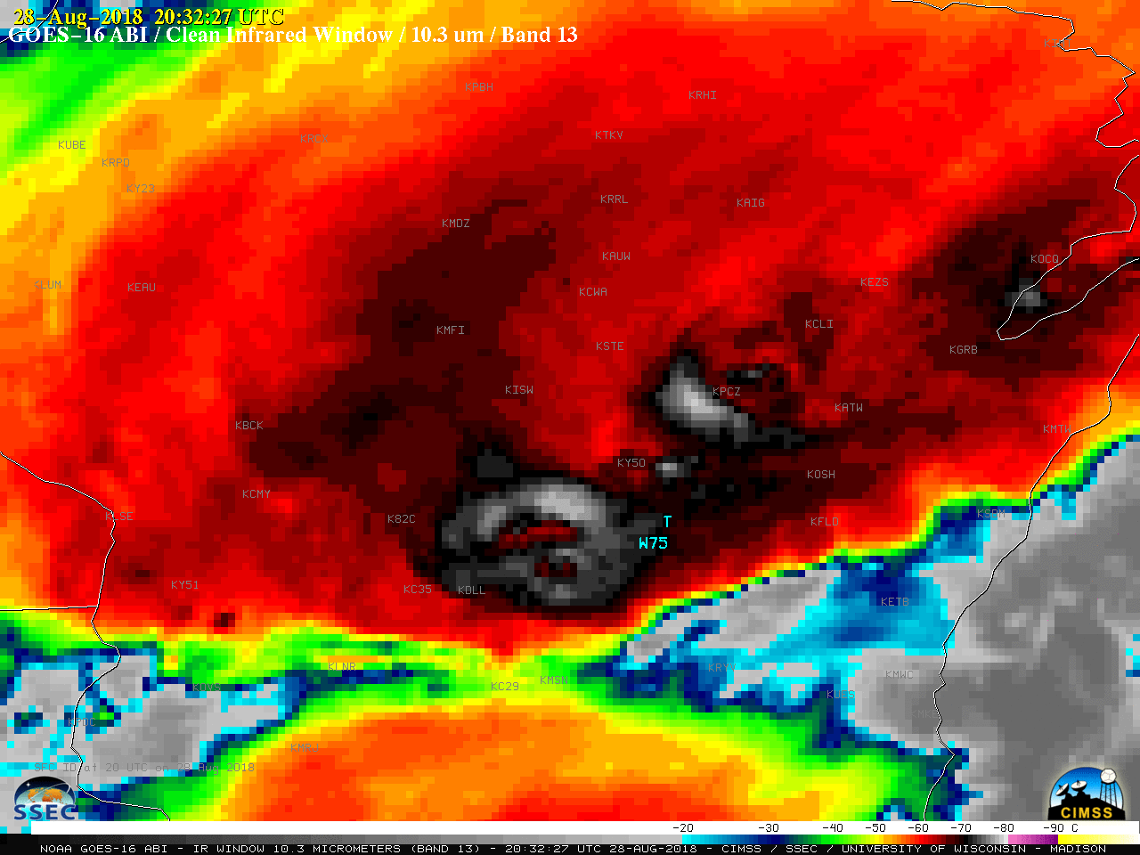
Thunderstorms produced a variety of severe weather (SPC storm reports) as they moved eastward across the Upper Midwest on 28 August 2018. 1-minute Mesoscale Domain Sector GOES-16 (GOES-East) “Red” Visible (0.64 µm) images (above) and “Clean” Infrared Window (10.3 µm) images (below) showed the development and progression of the severe convection across central Wisconsin.Toggles beween Visible and Infrared... Read More

Hurricane Lane

NOAA-20 VIIRS Day/Night Band (0.7 µm) and Infrared Window (11.45 µm) images (above; courtesy of William Straka, CIMSS) showed the eye of Hurricane Lane in the central Pacific Ocean at 1208 UTC on 22 August 2018, a few hours after it reached Category 5 intensity (SATCON). Surface mesovortices were evident within... Read More