Crater Creek Fire in British Columbia produces a pyrocumulonimbus cloud
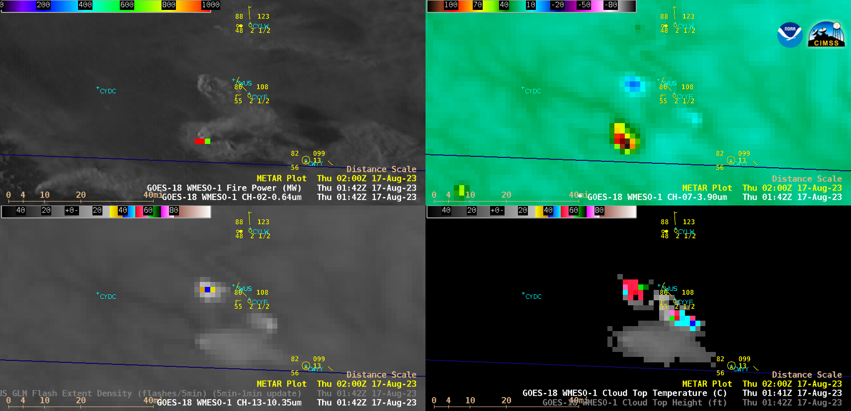
1-minute Mesoscale Domain Sector GOES-18 (GOES-West) “Red” Visible (0.64 µm) + Fire Power derived product (a component of the GOES Fire Detection and Characterization Algorithm FDCA), Shortwave Infrared (3.9 µm), “Clean” Infrared Window (10.3 µm) and Cloud Top Temperature derived product images (above) showed that the Crater Creek Fire — located in far southern British Columbia, less than 10 miles from the Washington border... Read More