Strong thunderstorms move across Alaska’s Seward Peninsula
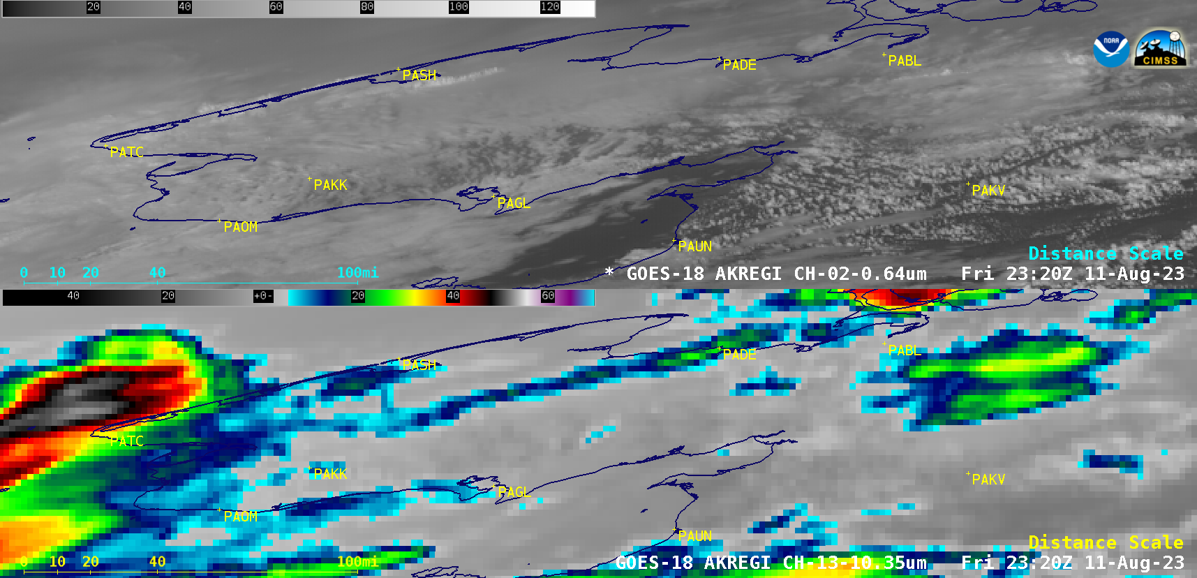
10-minute GOES-18 “Red” Visible (0.64 µm, top) and “Clean” Infrared Window (10.3 µm, bottom) images [click to play animated GIF | MP4]
10-minute Full Disk GOES-18 (GOES-West) “Red” Visible (0.64 µm) and “Clean” Infrared Window (10.3 µm) images (above) showed clusters of convection that moved west-southwestward across Alaska’s Seward Peninsula on 11 August 2023.
Beginning at 2300 UTC, a Mesoscale Domain Sector was positioned to cover western Alaska — providing images at 1-minute intervals (below).
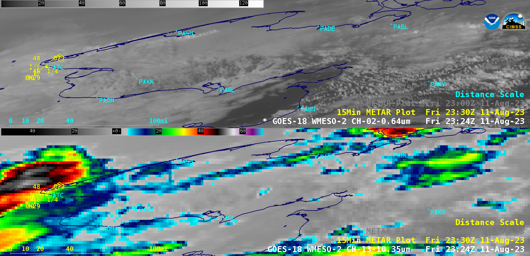
1-minute GOES-18 “Red” Visible (0.64 µm, top) and “Clean” Infrared Window (10.3 µm, bottom) images, with 15-minute METAR surface reports plotted in yellow [click to play animated GIF | MP4]
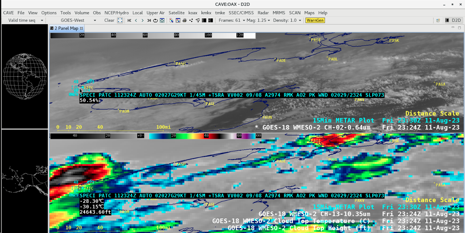
A cursor-sampled METAR report from Tin City, Alaska (PATC) at 2324 UTC (below) indicated that a heavy thunderstorm with rain (+TSRA) was occurring at that time.
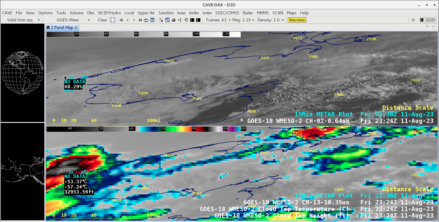
Cursor-sampled values of GOES-18 10.3 µm infrared brightness temperature, Cloud Top Temperature derived product and Cloud Top Height derived product at 2324 UTC [click to enlarge]
A cursor-sampling of GOES-18 10.3 µm infrared brightness temperature, Cloud Top Temperature derived product and Cloud Top Height derived product at 2324 UTC (above) revealed vales of -53.37ºC, -57.24ºC and 32953 ft, respectively. Note that these values were sampled for convective cloud tops that appeared to be located about 20 miles NW of Tin City, over open water — but this was taking parallax into account, which can be significant at higher latitudes (below).
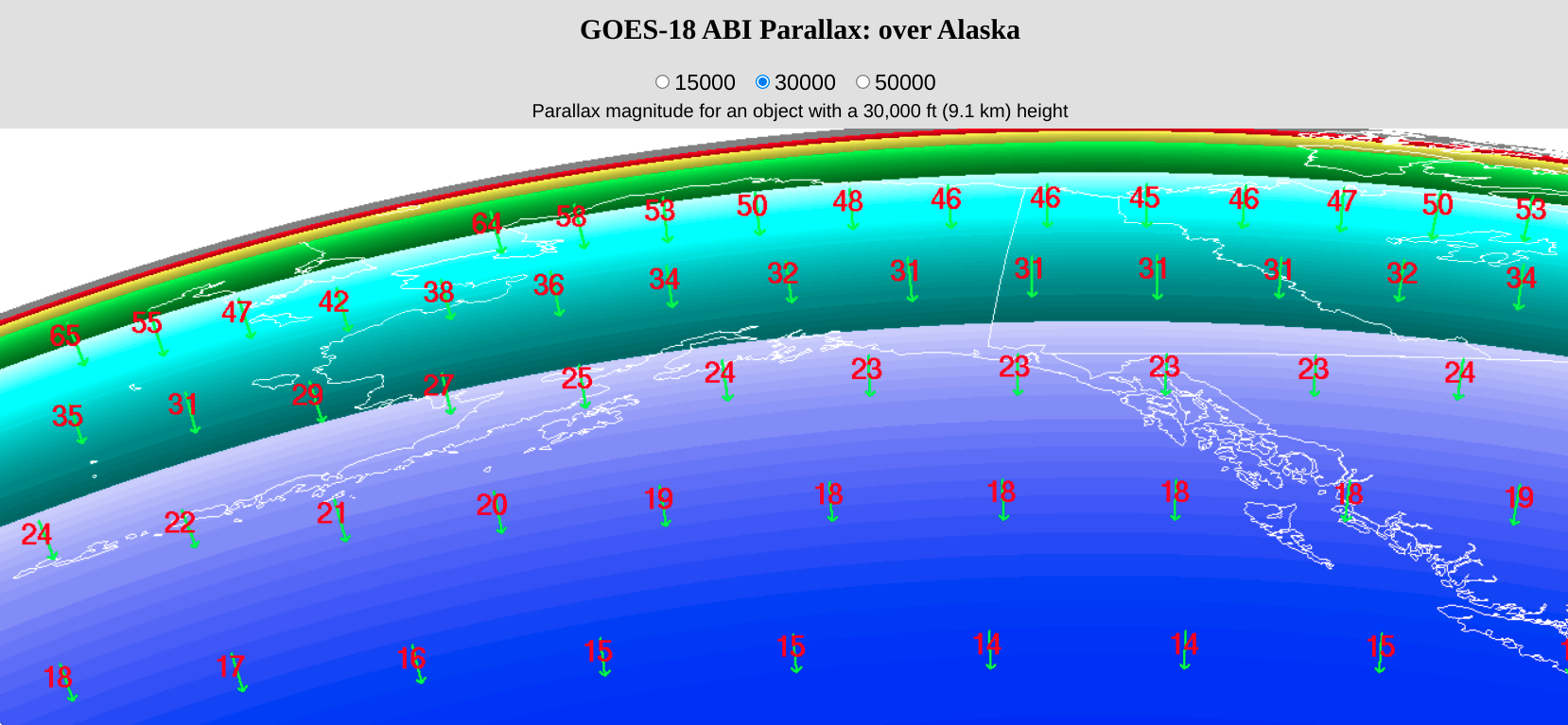
GOES-18 parallax correction vectors (green) and magnitudes (km, red) for a cloud object at an altitude of 30000 feet [click to enlarge]
While summertime thunderstorms are common across much of Interior Alaska, a heavy thunderstorm over the far western portion of the Seward Peninsula is rather rare.


