Global mean values of ABI Bands
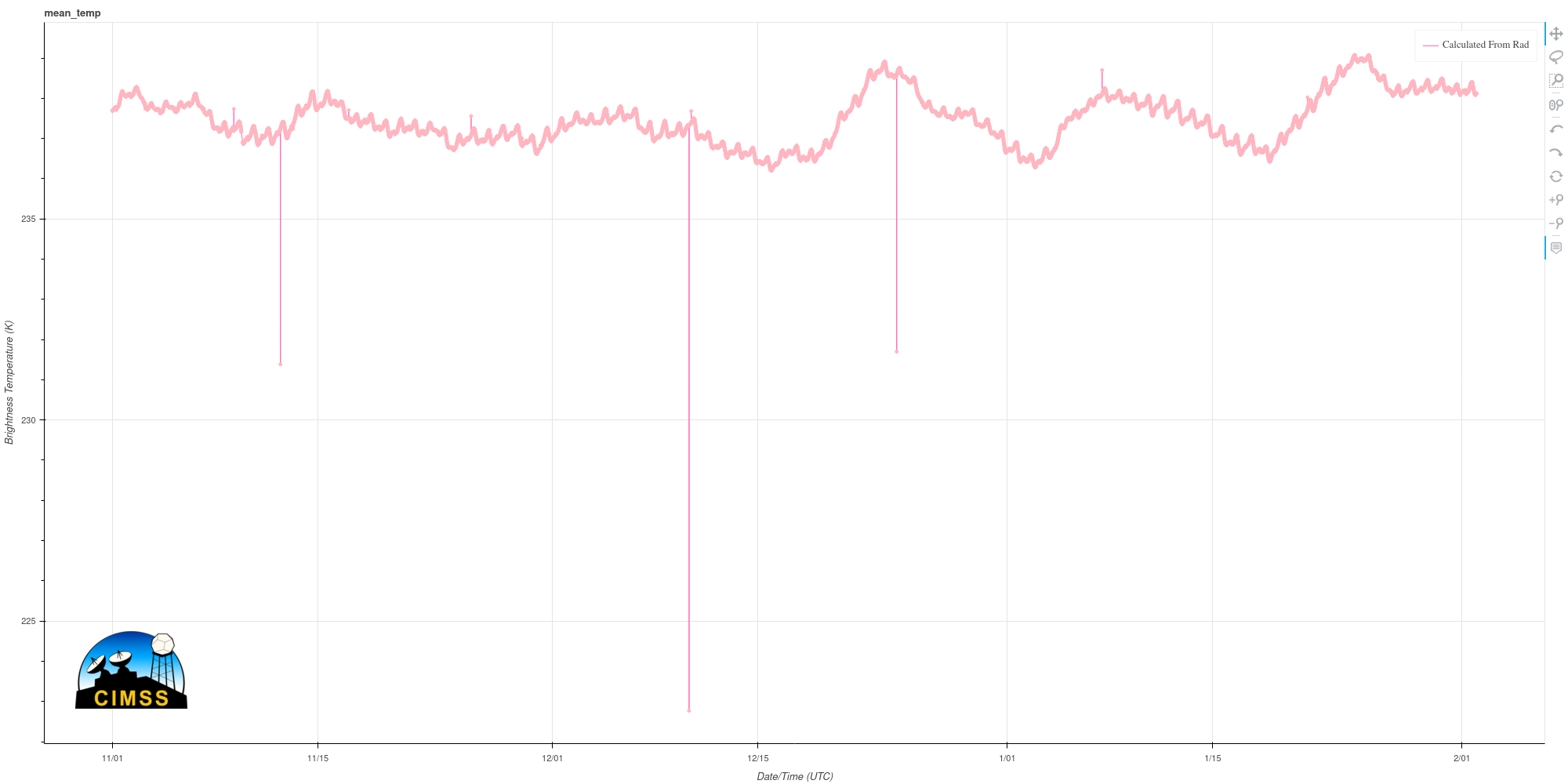
CIMSS scientists have created a website that extracts from the Level 1b ABI files information on the global mean radiance (and maximum, and minimum radiances) for each of the 16 channels at this link. The figure above tracks the global mean temperature of the GOES-16 Band 8 (Upper Level Water Vapor,... Read More
