Severe weather across Indiana and Ohio
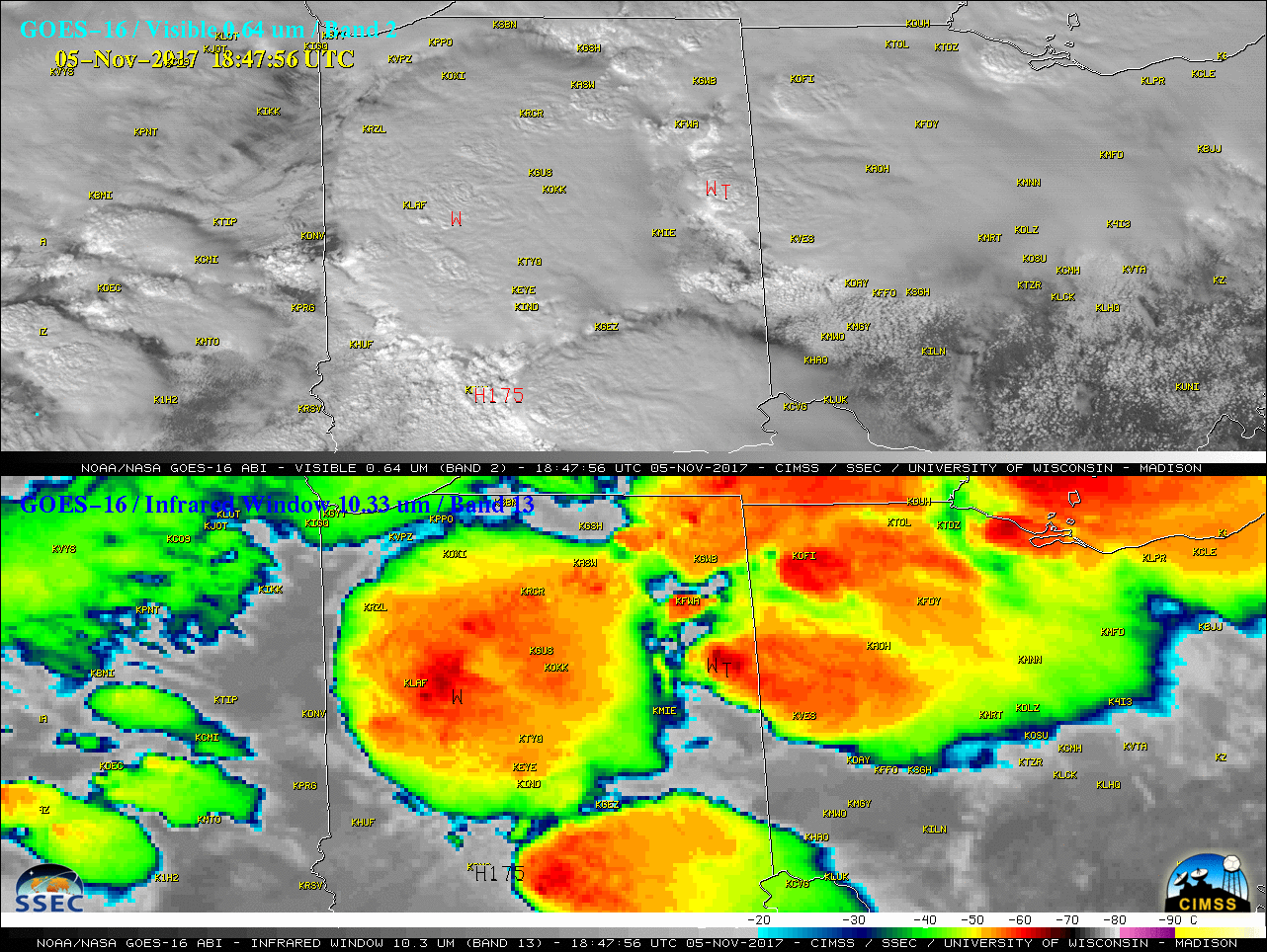
* GOES-16 data posted on this page are preliminary, non-operational and are undergoing testing *An outbreak of severe weather occurred across the Midwestern US on 05 November 2017, with a number of tornadoes (including a 39-mile long track EF-2 tornado) in Indiana and Ohio. A GOES-16 Mesoscale Sector provided imagery at 1-minute intervals during this... Read More
