An RGB computed using the GOES-16 Cirrus Channel
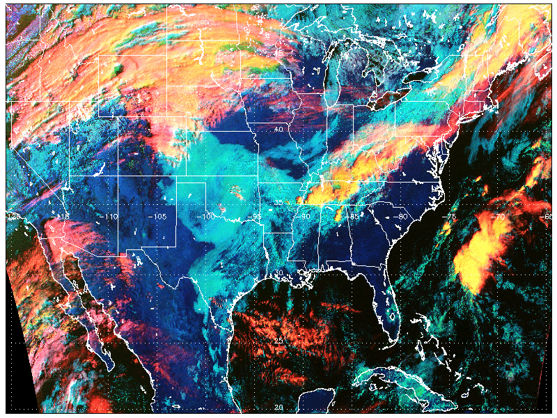
Cloud Type RGB at 1502 UTC on 3 November 2017 (Click to enlarge)
GOES-16 data posted on this page are preliminary, non-operational and are undergoing testing
Red-Green-Blue (RGB) Composite Images are a handy way of showing information from multiple satellite bands (or band differences) at once. The image above shows an RGB created by NOAA Scientist Andy Heidinger that uses the GOES-16 Visible Band (0.64 µm) as the green component, Snow-Ice Band (1.61 µm) as the blue component and Cirrus Band (1.38 µm) as the red component to tease out information about Cloud Type. The Cirrus Channel (unique to GOES-16 as far as Geostationary Satellites are concerned) is a handy channel to use in an RGB because it discriminates very well between high clouds and low clouds. In a moist environment, low clouds are not apparent at all in the Cirrus Band. The toggle below shows the Visible, Snow/Ice and Cirrus Channels at 1502 UTC. Low clouds over Kansas have no signal in the Cirrus channel — there are other differences as well, of course.
In the RGB, Thin cirrus clouds (for example, the contrails over Illinois) are red, opaque ice clouds (over the western Atlantic) are yellow (having a contribution from both Red and Green Components), Low Clouds (over the southern Plains) are Cyan (having a contribution from Blue and Green), snow is Green, and lofted water clouds are white (having a contribution from all three). As the atmosphere dries, the amount of lofting necessary for the Cirrus channel to view a cloud composed of water droplets (and therefore white in the RGB) decreases.
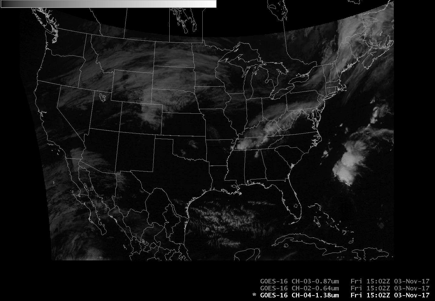
GOES-16 Imagery at 1502 UTC on 3 November 2017: Snow/Ice (1.61 µm), Visible (0.64 µm) and Cirrus Channels (1.38 µm) (Click to enlarge)
The Day Land Cloud RGB (sometimes called ‘Natural Color’) can also be used to estimate cloud type. The toggle below shows how the Cloud Type RGB has more gradations between ice cloud type because of the use of the Cirrus Channel. The Cloud Type RGB also highlights the contrails and thin cirrus more effectively, again because of the use of the Cirrus Channel

Cloud Type RGB (1.38 µm, 0.64 µm, 1.61 µm) and Day/Land/Cloud RGB (1.61 µm, 0.86 µm, 0.64 µm), 1502 UTC on 3 November 2017 (Click to enlarge)
Three toggles below show the Snow/Ice and Visible and Cirrus channels zoomed in over Illinois (where contrails are present), over the western Atlantic (where strong convection is occurring) and over the southwestern United States.
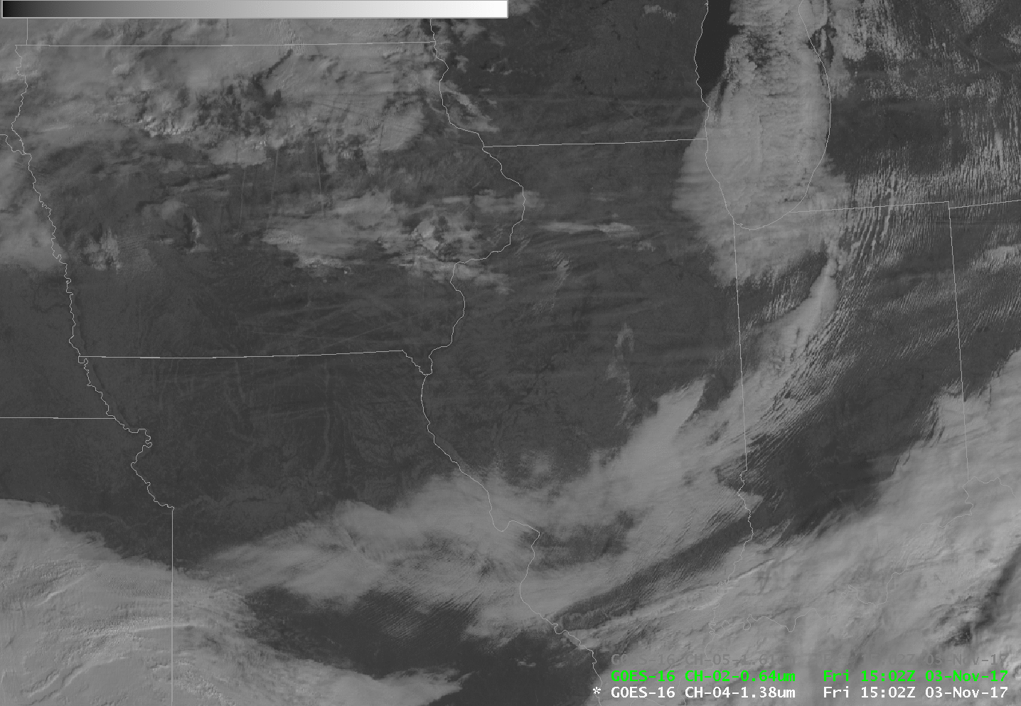
GOES-16 Imagery at 1502 UTC on 3 November 2017: Cirrus Channel (1.38 µm), Visible (0.64 µm) and Snow/Ice (1.61 µm) (Click to enlarge)
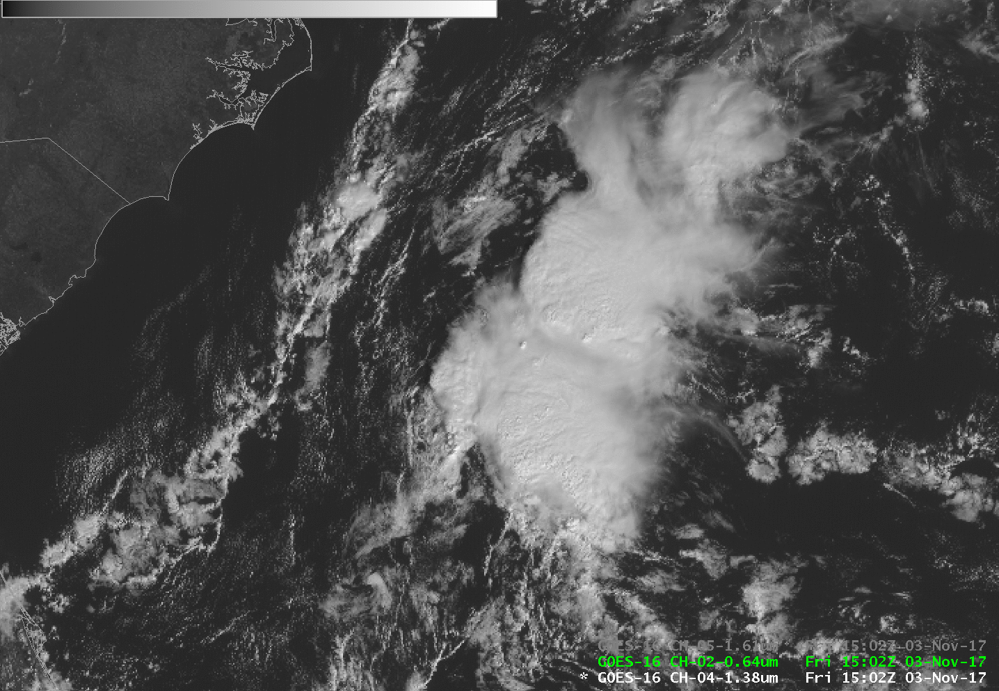
GOES-16 Imagery at 1502 UTC on 3 November 2017: Cirrus Channel (1.38 µm), Visible (0.64 µm) and Snow/Ice (1.61 µm) (Click to enlarge)

GOES-16 Imagery at 1502 UTC on 3 November 2017: Cirrus Channel (1.38 µm), Visible (0.64 µm) and Snow/Ice (1.61 µm) (Click to enlarge)
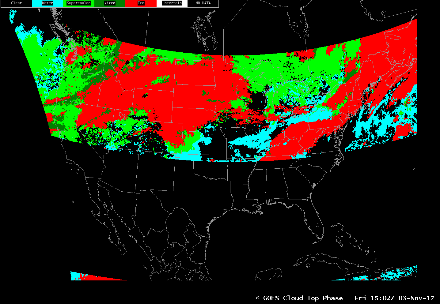
GOES-16 also has a Baseline Product that shows Cloud Type. That is shown below. The 1502 UTC Image was incomplete, so the 1507 UTC image is shown.
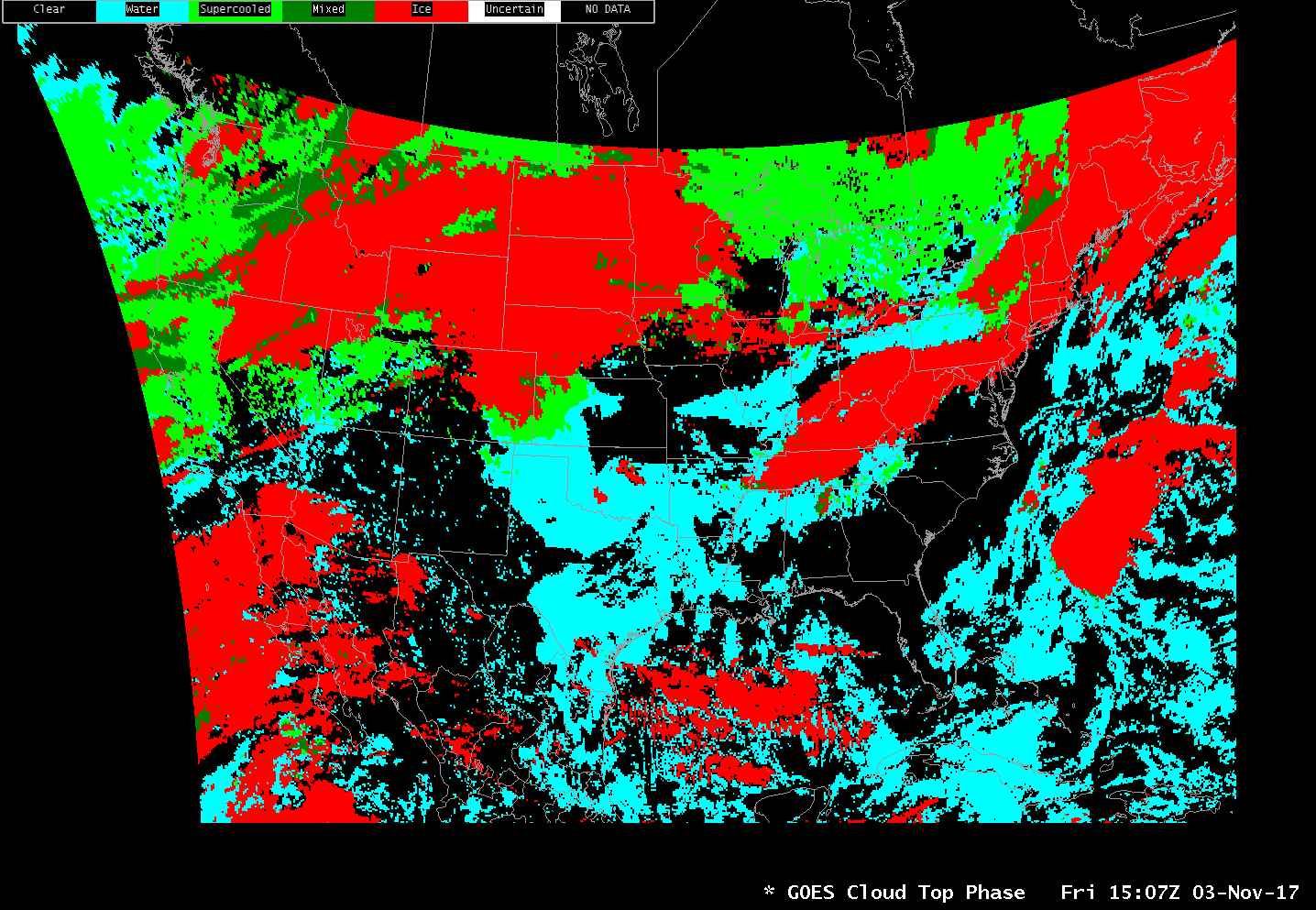
GOES-16 Cloud Phase, Baseline Product, 1507 UTC on 3 November 2017 (Click to enlarge)