Natural gas explosion and fire in Sun Prairie, Wisconsin
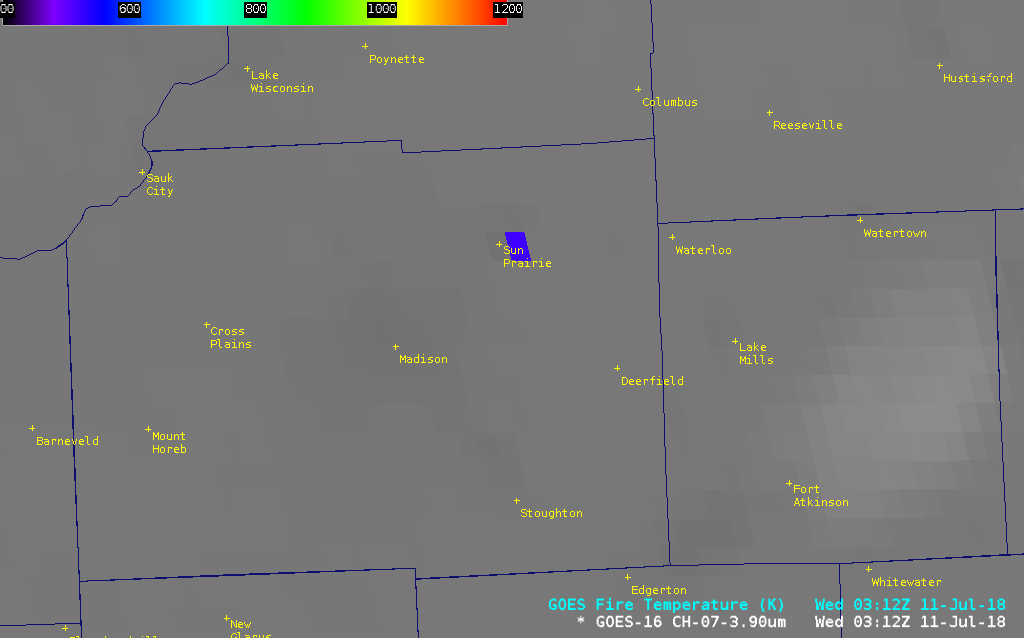
An explosion triggered by a damaged natural gas main in Sun Prairie, Wisconsin occurred around 0005 UTC / 7:05 pm CDT on 10 July 2018 (media story). Layered cloudiness was passing over the region at the time of the initial explosion, but once the clouds cleared a thermal signature (blue pixel)... Read More
