Record daily rainfall in southern California
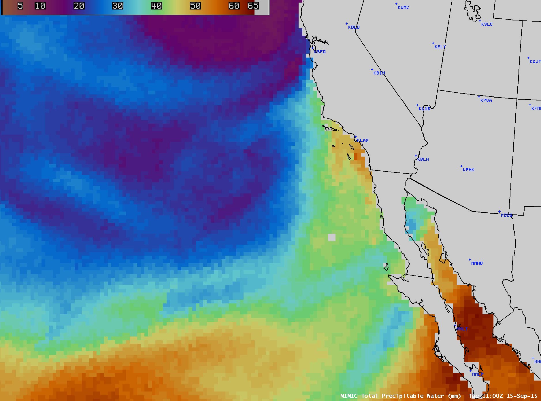
Some locations in southern California received record daily precipitation on 15 September 2015. A time series plot of weather conditions for Los Angeles International Airport is shown above; the 1.80 inches of rainfall received there made it the wettest September day on record.As mentioned in the NWS Los Angeles record event report, the moisture... Read More
