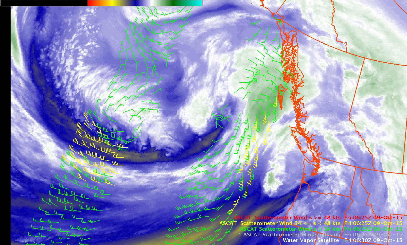
This website works best with a newer web browser such as Chrome, Firefox, Safari or Microsoft Edge. Internet Explorer is not supported by this website.

Category: GOES-15

Hurricane Olaf

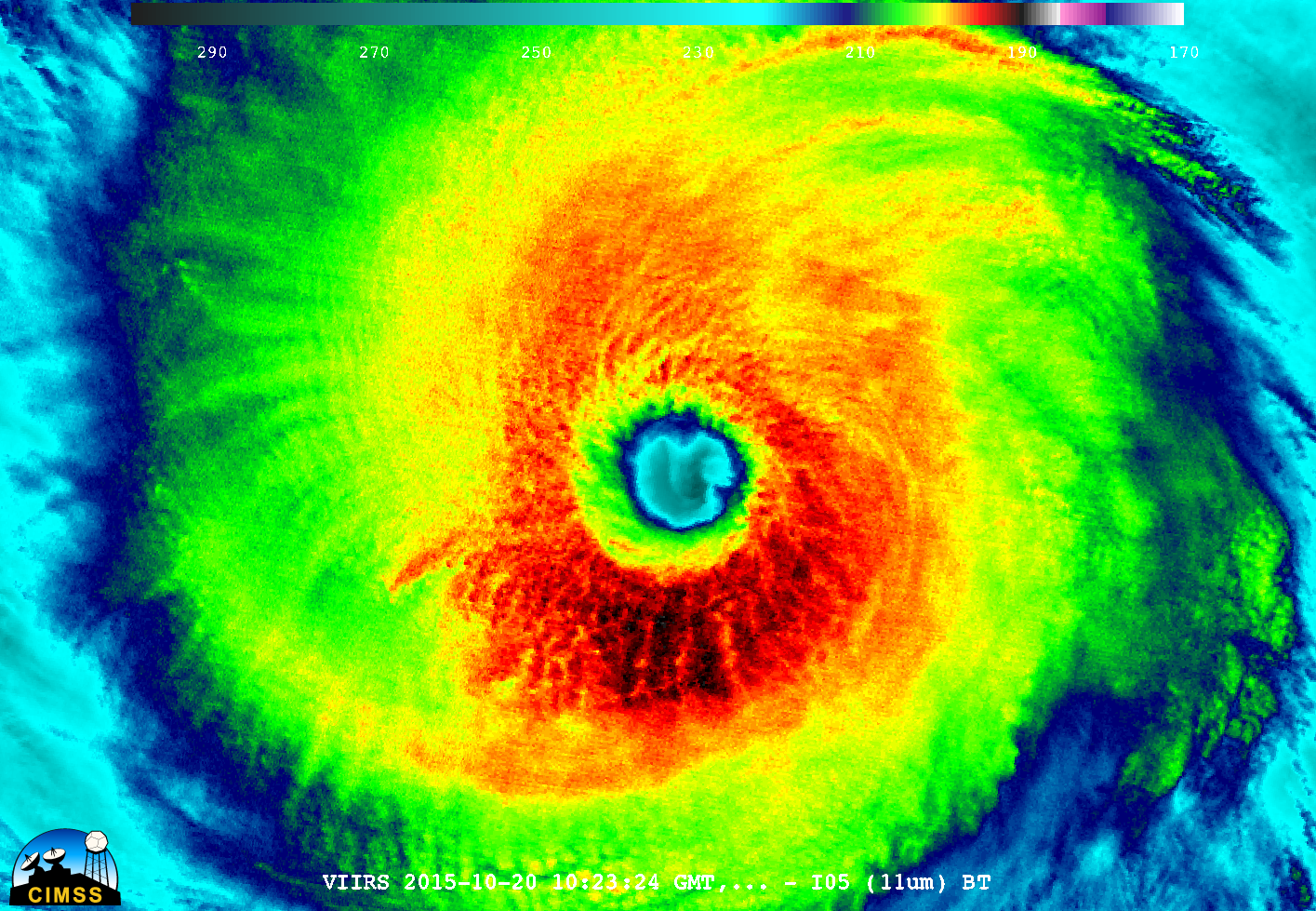
A plot of the Advanced Dvorak Technique (ADT) intensity estimate for Hurricane Olaf (above) showed that the storm went through a period of rapid intensification during the 19-20 October 2015 period, reaching Category 4 strength. The National Hurricane Center noted that Olaf became the 6th major hurricane in the eastern North Pacific during... Read More

Monthly Animations for September from GOES-15 and GOES-13

The YouTube video embedded above shows all GOES-13 (GOES-East) Full Disk Water Vapor (6.5 µm) images for all of September 2015. The 10.7 µm Infrared window channel animation is shown below. Animations for GOES-15 (GOES-West) are at the bottom.GOES-13 animations show more tropical activity over the Atlantic, as expected... Read More

Grass fire in Colorado

GOES-15 (GOES-West) and GOES-13 (GOES-East) Visible (0.63 µm) and Shortwave infrared (3.9 µm) images (above; click to play animation; also available as an MP4 movie file) showed the smoke plume and “hot spot” (dark black to red pixels) associated with a large and fast-burning grass fire in north-central Colorado on the afternoon... Read More