This website works best with a newer web browser such as Chrome, Firefox, Safari or Microsoft Edge. Internet Explorer is not supported by this website.

Category: GOES-15

Undular bore over Texas

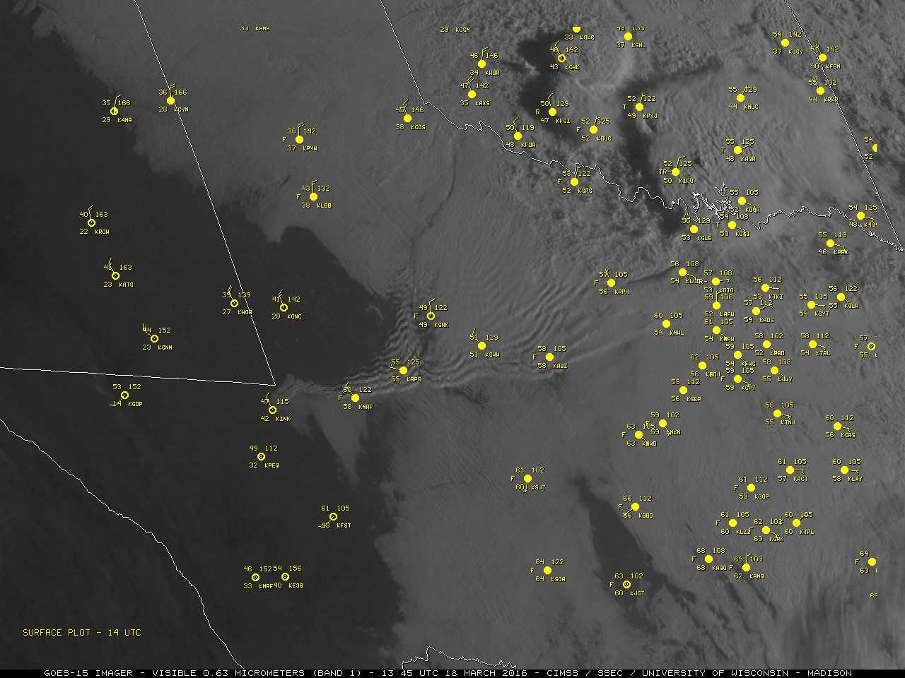
GOES-15 (GOES-West) Visible (0.63 µm) images (above) showed the wave clouds associated with an undular bore moving southeastward across Texas during the day on 18 March 2016. The leading undular bore (and packet of solitary waves behind it) were propagating ahead of the advancing cold front (reference).A nighttime Suomi NPP VIIRS Day/Night... Read More

The Genesis for the Coming East Coast Storm

When strong storms appear in Forecast Models, it is tempting to trace back in the atmosphere where the system originates. The water vapor animation above, from GOES-13, ends with the future East Coast Storm developing over the lower Mississippi River Valley (where it produced severe weather). The rocking animation, below, shows... Read More