Snow Squall Warnings over Duluth Minnesota and northwestern Wisconsin
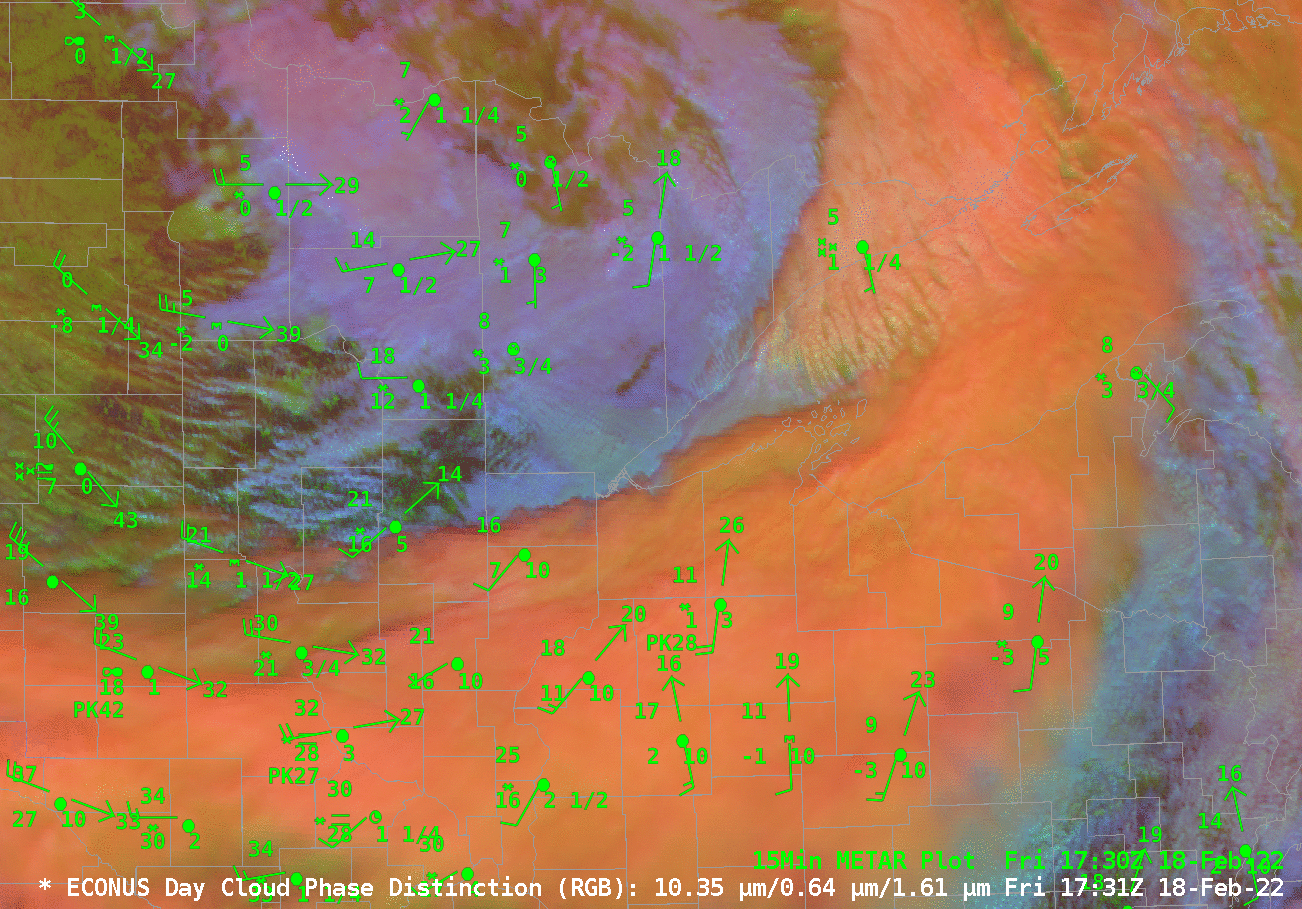
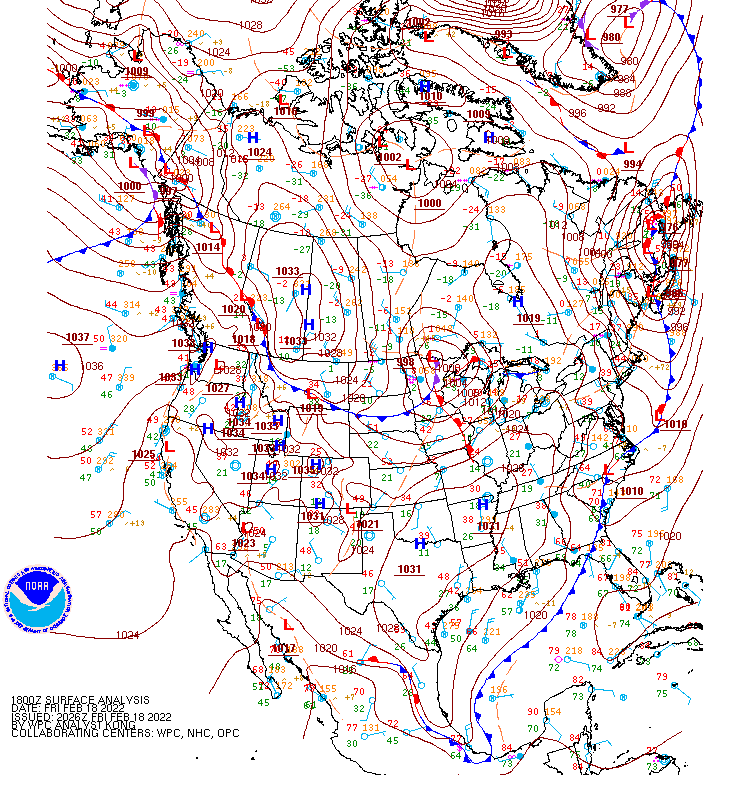
The animation above, of the Day Cloud Phase Distinction RGB, shows bands of snow showers/squalls rotating cyclonically through northern Minnesota and northwestern Wisconsin, to the south of a strong cyclone over northern Minnesota and northwestern Ontario (link to map from 1800 UTC on 18 February). The tops of these clouds are fairly... Read More
