Typhoon Kammuri in the West Pacific Ocean, with record cold cloud-top temperatures
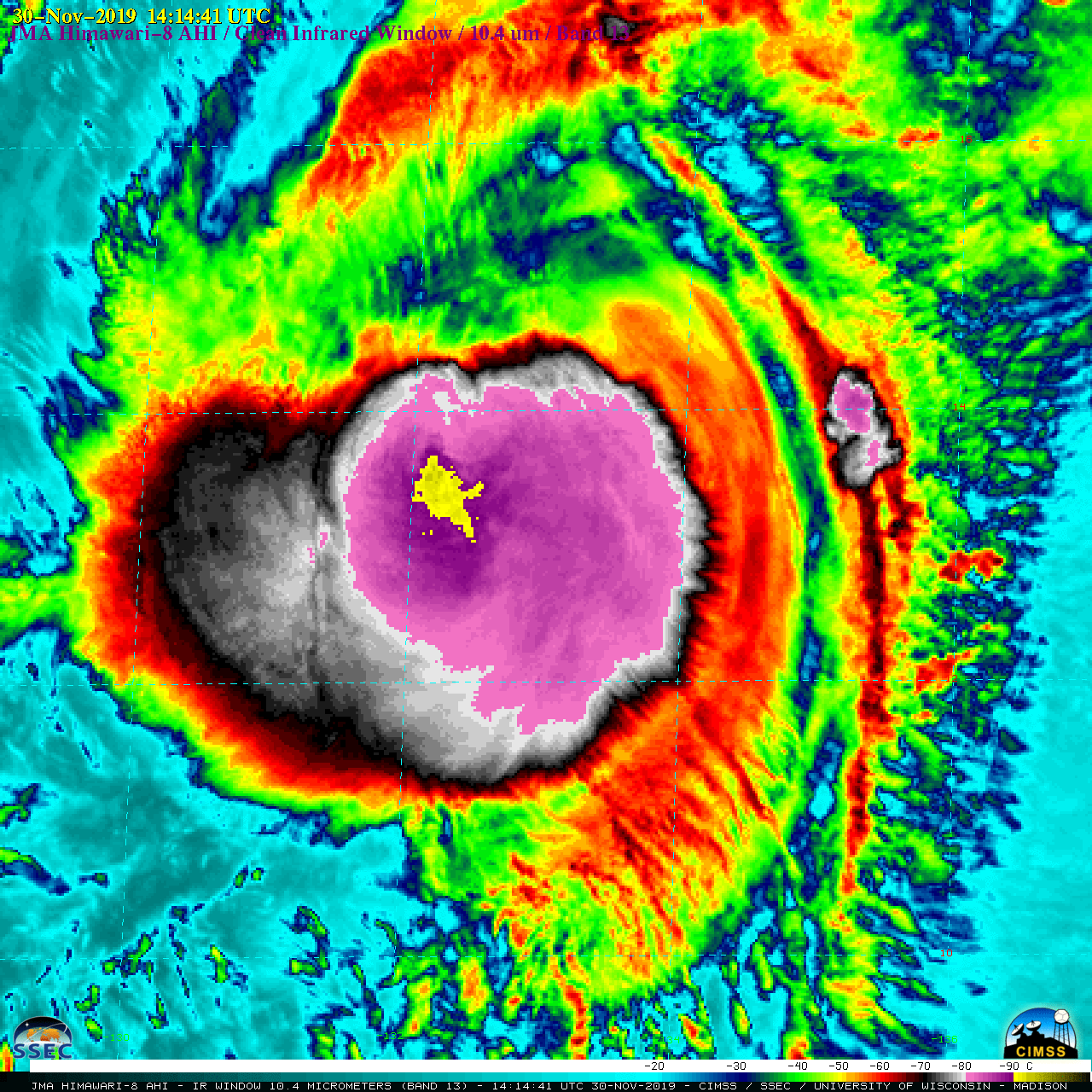
2.5-minute interval JMA Himawari-8 AHI “Clean” Infrared Window (10.4 µm) images (above) showed a large canopy of cold cloud-top infrared brightness temperatures (BTs) associated with Category 1 Typhoon Kammuri in the West Pacific Ocean on 30 November 2019. Between 00 UTC and 05 UTC, many of the pulsing overshooting tops exhibited... Read More
