Widespread power outages across Syria
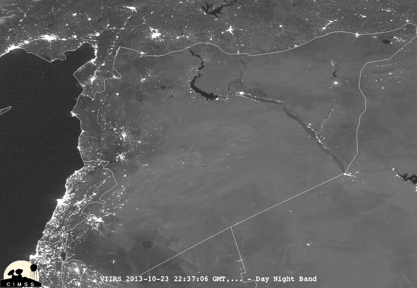
McIDAS-V “before” (22 October 2013) and “after” (23 October 2013) night-time images of Suomi NPP VIIRS 0.7 µm Day/Night Band data (above; courtesy of William Straka, CIMSS) showed the coverage of power outages across much of Syria, caused by a rebel attack on a gas pipeline (near Damascus International Airport)... Read More