Severe Cyclone Winston in the South Pacific Ocean
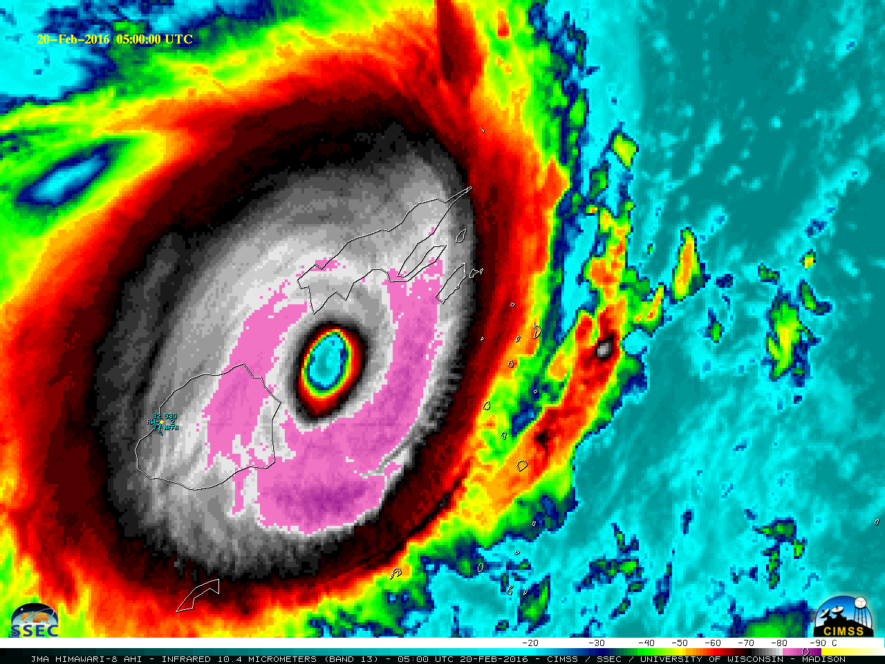
JMA Himawari-8 Visible (0.64 µm) images (above) revealed the presence of mesovortices within the large and well-defined eye of Category 5 Severe Cyclone Winston as the storm approached the largest Fiji islands of Vanua Levu and Viti Levu during the 19-20 February 2016 period.A longer animation of Himawari-8 Infrared Window (10.4 µm) images... Read More