Dry trade wind surge approaches Hawai’i
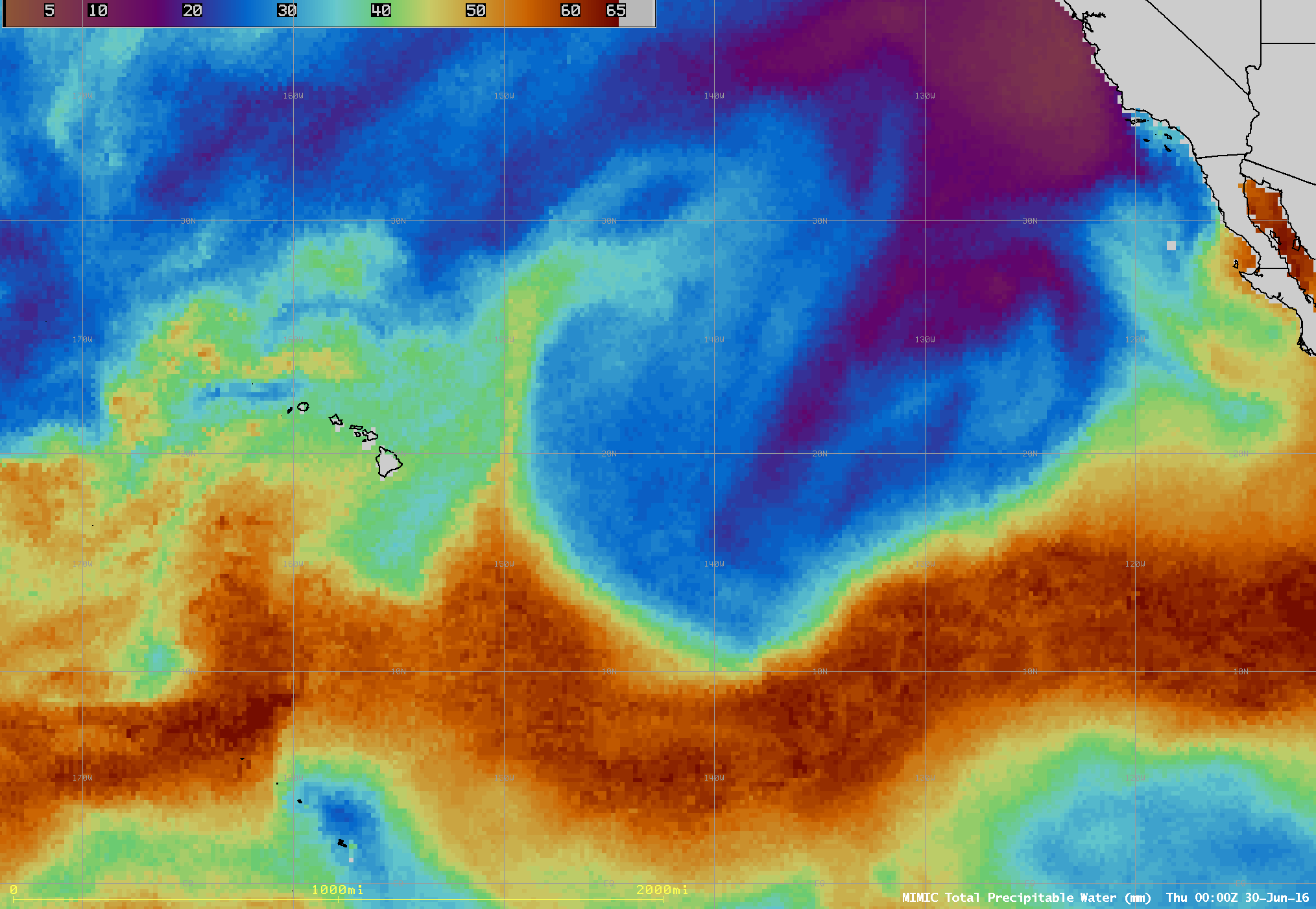
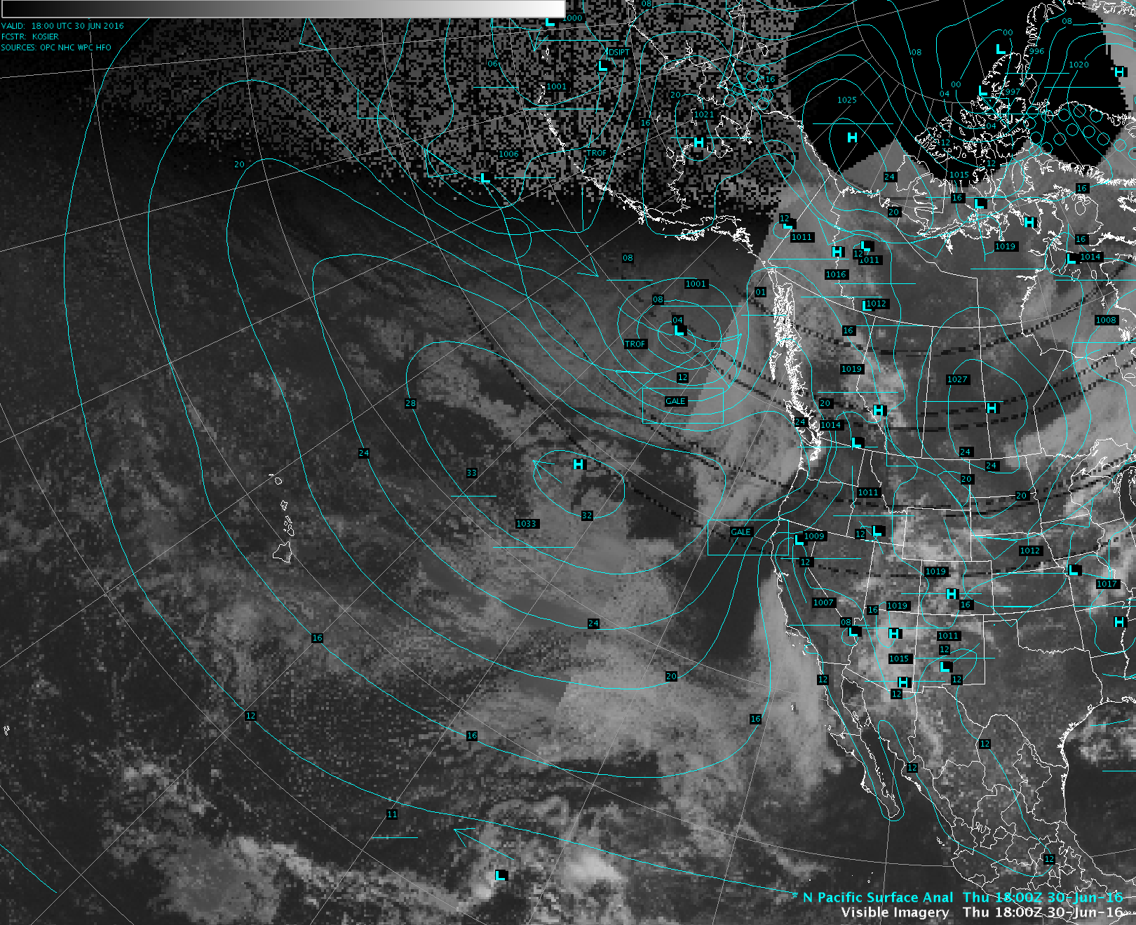
The MIMIC Total Precipitable Water product (above) showed the westward movement of a surge of dry trade winds toward Hawai’i during the 28 June – 01 July 2016 period. This push of dry air was being driven by a large area of high pressure centered about 1200 miles northeast of the island chain. A very sharp gradient... Read More
