Monitoring Convection as it develops with NUCAPS
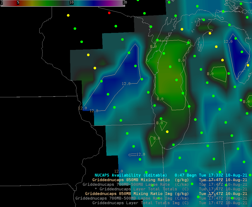
The Storm Prediction Center has placed much of southern Wisconsin in an Enhanced Risk (below; click here to view the image at the SPC website). By 1800 UTC, below, surface dewpoints in southern WI/eastern Iowa were at torrid levels, and mid-level lapse rates were steep as depicted in the SPC Mesoanalysis below.NOAA-20’s orbits... Read More

