Monitoring Convection as it develops with NUCAPS
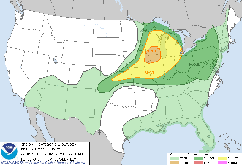
The Storm Prediction Center has placed much of southern Wisconsin in an Enhanced Risk (below; click here to view the image at the SPC website).
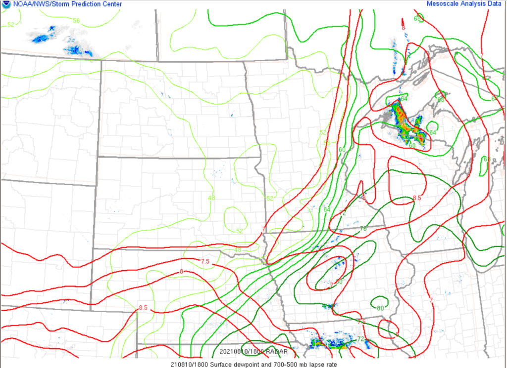
By 1800 UTC, below, surface dewpoints in southern WI/eastern Iowa were at torrid levels, and mid-level lapse rates were steep as depicted in the SPC Mesoanalysis below.
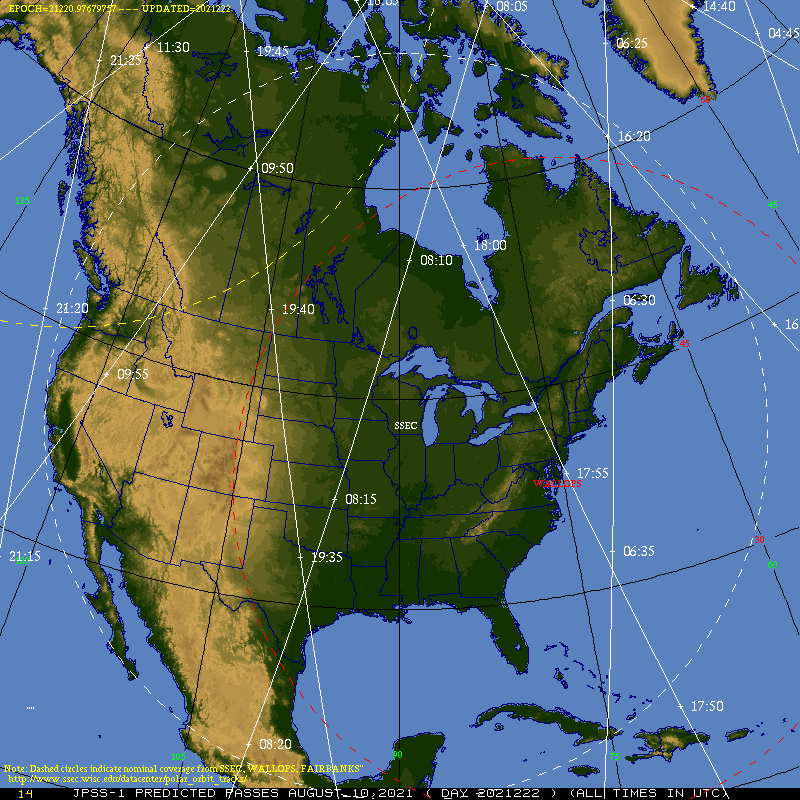
NOAA-20’s orbits on 10 August (as shown below, and here, from this site) suggest that, perhaps, sequential NUCAPS profiles (as discussed here) will be available over parts of southern WI on 10 August. (Update: YES! It happened!)
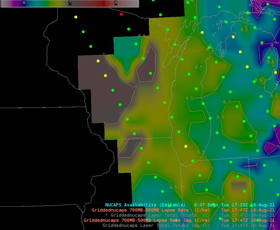
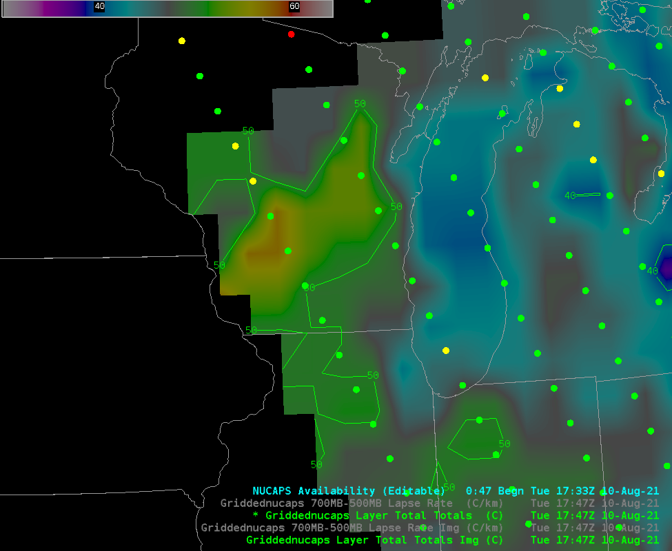
Gridded NUCAPS lapse rates from the ~1800 UTC NOAA-20 overpass are shown below. The most unstable mid-level air is over central WI, and these values were derived from retrievals that did converge properly to a solution. The Total Totals index, below, showed the most unstable air more isolated in central Wisconsin
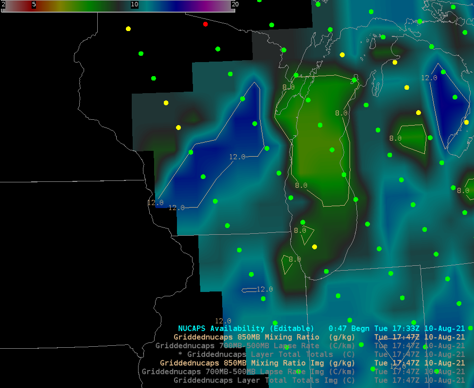
Moisture values from NUCAPS show a pronounced maximum oriented southwest-to-northeast over central Wisconsin.
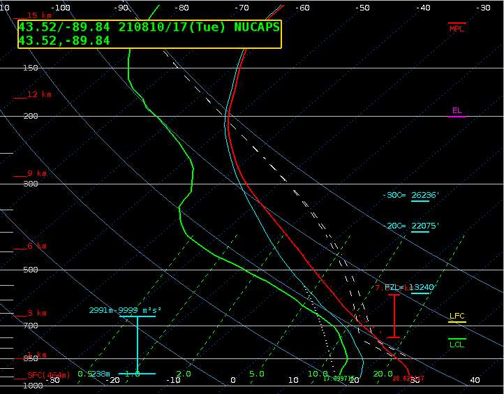
What do individual soundings look like over western Wisconsin? Let’s look at the one just south of the Total Totals maximum in central WI, at 43.5N, 89.9 W. The sounding is shown below. Note that the surface T/Td in the profile is 28.6 and 17.1, in a region where the dewpoint analysis shows values in the mid-70s! Thus, this sounding should be adjusted to better match near-surface conditions.
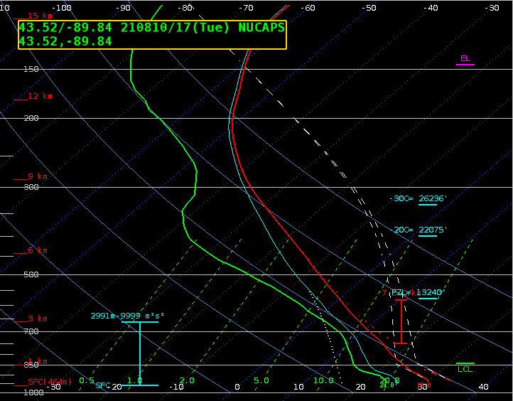
The modified sounding is shown below. (Note that Gridded NUCAPS fields do not use modified soundings). The LCL and EL levels have both changed, and the amount of CAPE has jumped! NSharp-computed Surface-based CAPE/LI has changed from 1018/-4 in the original sounding to almost 5000/-12 in the modified; ML 100 CAPE/LI has changed from 1442/-5 to 3800/-10.
SPC has issued a mesoscale discussion #1465 suggesting watch issuance will occur by 2100 UTC.
The second NUCAPS pass did provide overlapping points over southern Wisconsin. The 700-500 Lapse Rate, Total Totals index, and 850-mb Mixing Ratio are shown below. As with the previous pass, gridded values over Wisconsin are derived from infrared retrievals that converged to a solution. Mid-level stability is very weak over Wisconsin; moisture and instability as measured by the Total Totals index is more widespread at 1933 UTC vs. the pronounced corridor 90 minutes earlier.
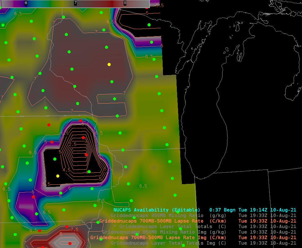
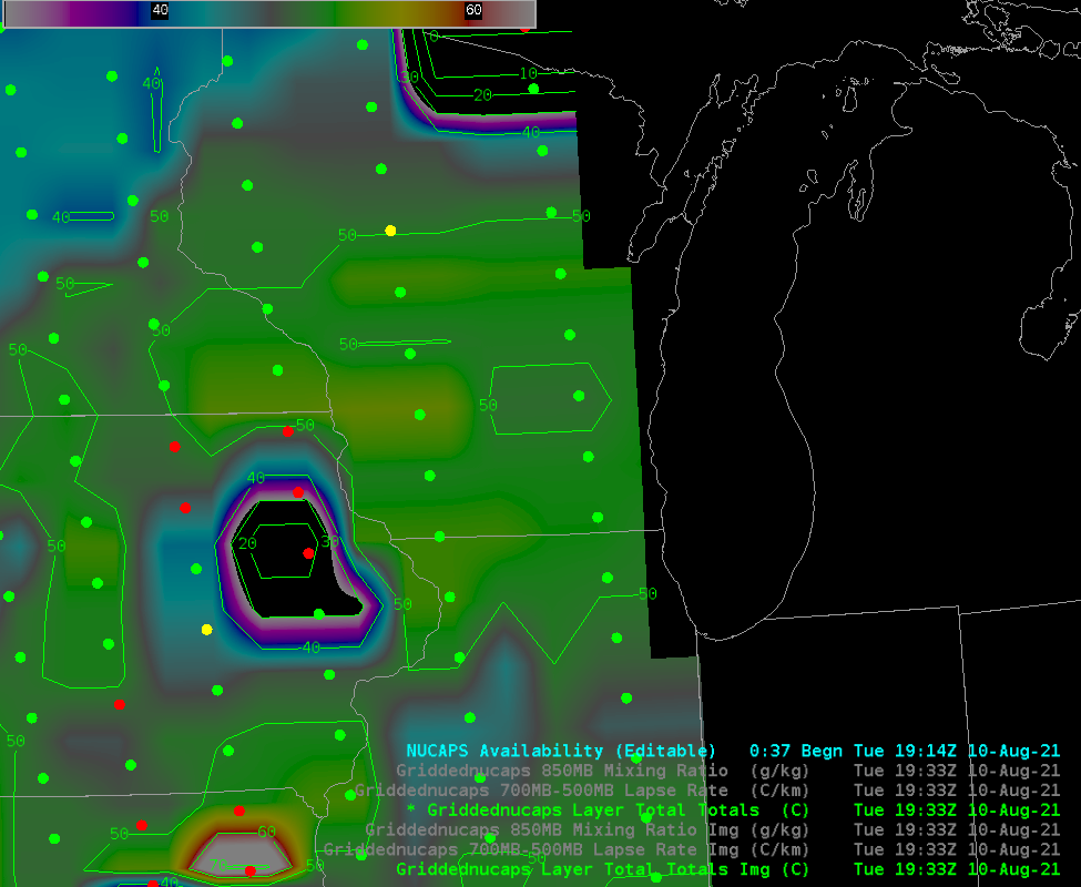
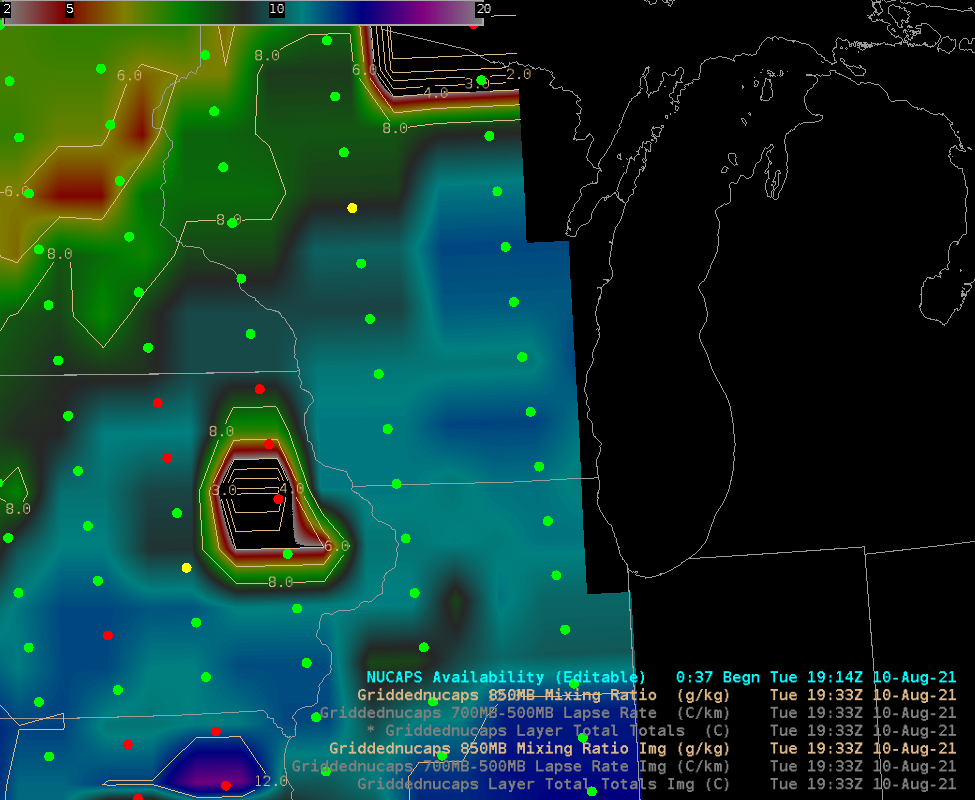
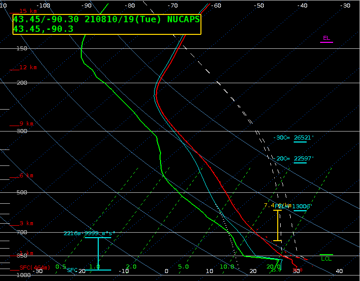
What do the individual profiles from this NUCAPS pass look like? The one below is from near the location chosen from the previous pass, but this time at 43.45 N, 90.3 W. It shows abundant moisture and modest amounts of CAPE above the boundary layer. As in the sounding above, however, the boundary layer is far too dry.
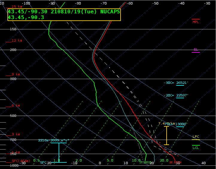
The sounding above has a surface T/Td of 28.8 and 17.2 ; again, this sounding will be modified to more accurately match surface conditions (in particular, the sounding is far too dry at low levels), and the modification changed the computed Surface-based CAPE/LI from 1104/-4 to 5600/-13 and the ML 100 CAPE/LI from 1272/-2 to 5300/-12!
When convective activity is possible, remember that NUCAPS soundings give ample information about thermodynamics at a convenient time: halfway between regular synoptic soundings.
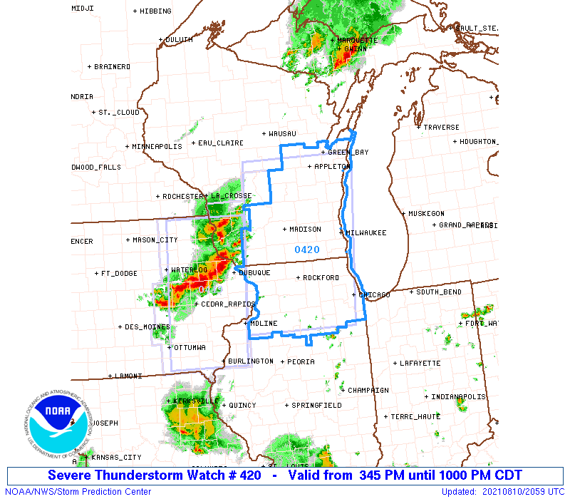
Severe Thunderstorm Watch #420 was issued at 2045 UTC. See below.
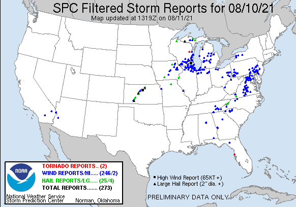
Storm Reports from SPC (above) show many incidents of wind damage in the southern part of the region of high instability diagnosed by NUCAPS. The mp4 animation (Click here for an animated gif) below shows the 1-minute mesoscale (Sector 2) GOES-16 “Red” Visible (0.64 µm), from 1900 UTC on 10 August through 0040 UTC 11 August 2021. Convection over Iowa moved into the unstable air over Wisconsin.

