Snow squalls (with some lightning) in Pennsylvania
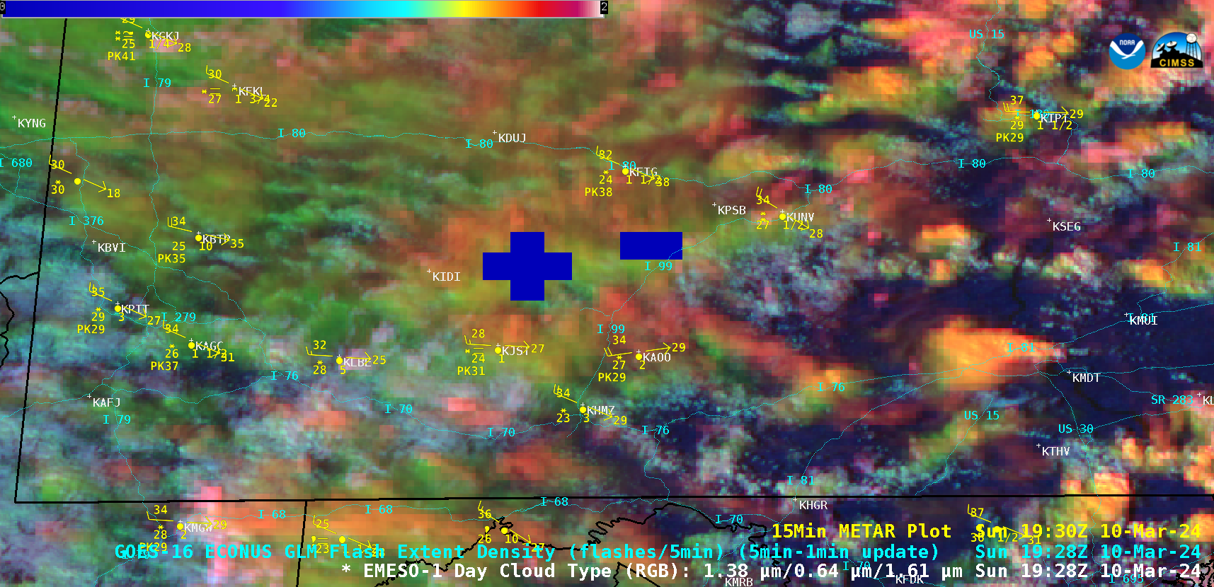
1-minute Mesoscale Domain Sector GOES-16 (GOES-East) Day Cloud Type RGB images (above) displayed narrow bands of mixed phase to glaciated (brighter shades of green to yellow) clouds that produced snow squalls as they moved eastward across western and central Pennsylvania in the wake of a cold frontal passage on 10 March 2024. Periodic lightning activity — denoted... Read More
