This website works best with a newer web browser such as Chrome, Firefox, Safari or Microsoft Edge. Internet Explorer is not supported by this website.

Stories by Scott Bachmeier

Tehuano gap wind event
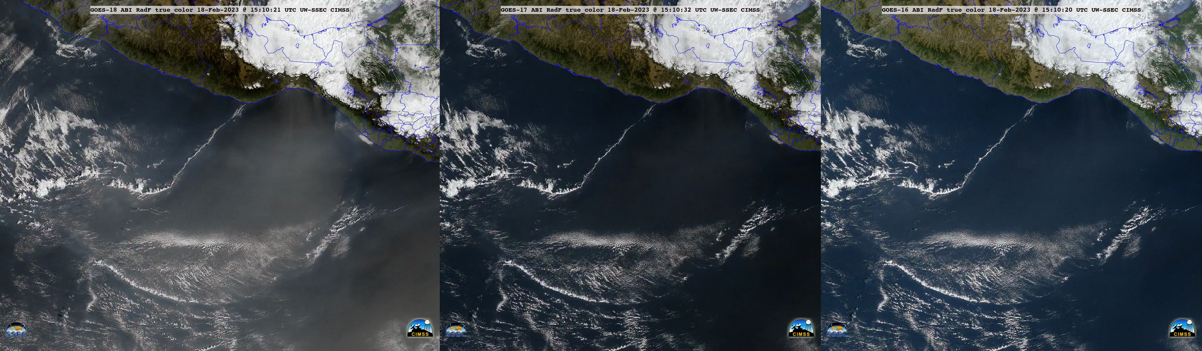
True Color RGB mages — created using Geo2Grid — from GOES-18 (GOES-West), GOES-17 and GOES-16 (GOES-East) (above) displayed the hazy signature of blowing dust associated with a Tehuano wind event, which was spreading south-southwestward from the Gulf of Tehuantepec across the Pacific Ocean on 18 February 2023. A narrow rope cloud... Read More
Mesoscale convective bands enhancing snowfall rates across the Upper Midwest

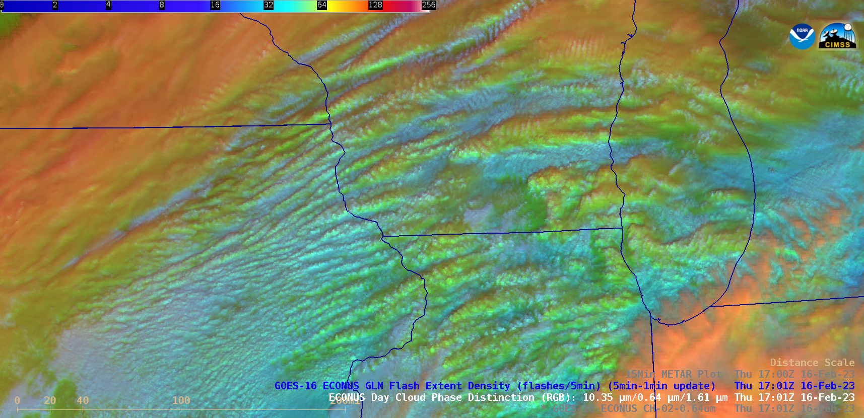
GOES-16 (GOES-East) “Red” Visible (0.64 µm) and Day Cloud Phase Distinction RGB images (above) showed widespread elevated convective banding that was helping to enhance snowfall rates — with some locations reporting 1.5 to 2.0 inches per hour — across parts of Minnesota, Wisconsin, Lower Michigan, Iowa and Illinois on 16 February 2023. There was no GLM indication... Read More

Cyclone Freddy intensifies to a Category 5 storm

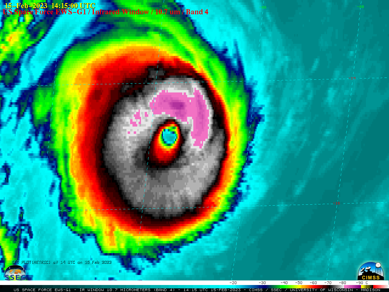
US Space Force EWS-G1 — formerly GOES-13 — Infrared Window (10.7 µm) images (above) showed Cyclone Freddy in the South Indian Ocean, after it re-intensified to a Category 4 storm at 0000 UTC on 15 February 2023. Freddy then briefly peaked at 145 knots at 0000 UTC on 16 February... Read More