Severe Thunderstorms on East Coast of United States
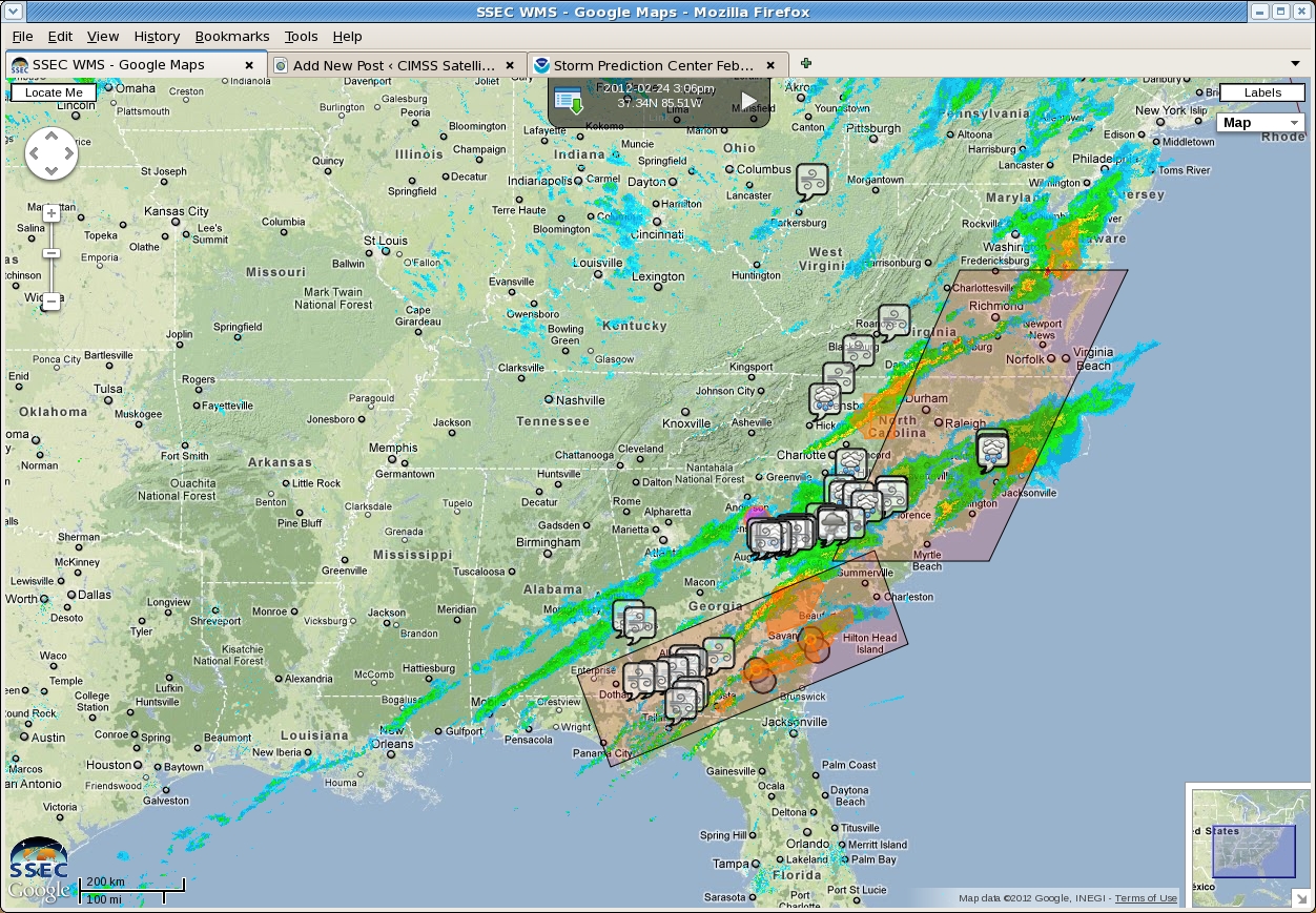
Unseasonably strong thunderstorms in the Piedmont on the East Coast produced a variety of severe weather on February 24th. (Storm reports are here.) The image above was produced by the SSEC/CIMSS web map service at 2006 UTC on 24 February and includes radar reflectivities, watches/warnings, storm reports, and satellite-detected cloud features (black circles indicate overshooting tops; pink circles indicate convective initiation) over the Eastern United States.
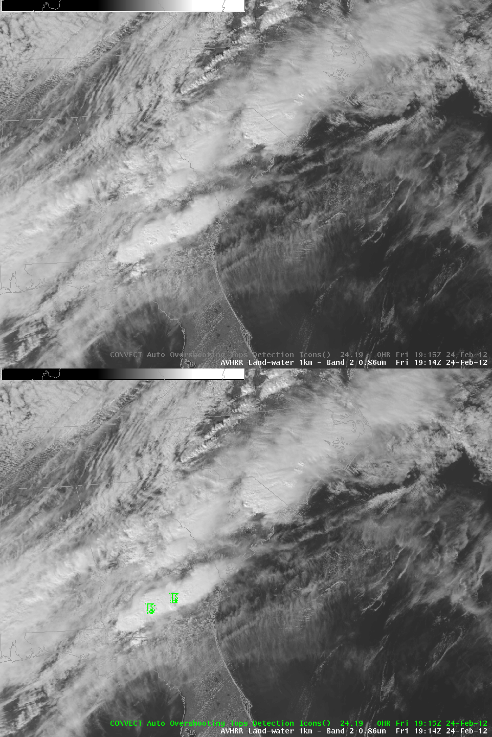
GOES-13 infrared data can be used to detect overshooting tops (see here) that are well-correlated with severe weather at the surface. The loop above shows 0.86-micron imagery from AVHRR at 1914 UTC, with satellite-detected overshooting tops designated by the green thunderstorm icon. As seen here, the tops do overlap a thunderstorm that, at 1915 UTC, was likely producing severe weather. 12-micron brightness temperatures on this top were as cold as -77 C. The automated overshooting top detection algorithm also identified the storm over central South Carolina at 1815 UTC that was producing a tornado in central South Carolina.
GOES-13 11-micron enhanced imagery with auto-detected Thermal Couplet (Enhanced V) indicated by white arrow
More than an hour later, at 2040 UTC, automated satellite detection suggested the presence of a thermal couplet — that is, a warm trench downwind of an overshoot — as shown above. This storm was part of a complex of warned severe storms over eastern Georgia. This storm continued to display tornadic features as it moved northeastward into coastal eastern South Carolina.


