Fog and low clouds over the Ohio River Valley region
")
GOES-13 fog/stratus product (click image to play animation)
AWIPS images of the GOES-13 fog/stratus product (above; click image to play animation) did not do a particularly good job of depicting a well-defined signal of the fog/stratus that was in place across parts of the Ohio River Valley region on 17 February 2012. Note that a number of stations were reporting night-time fog and/or freezing fog in parts of far eastern Missouri, southern Illinois and Indiana, and western Kentucky.

4-km resolution GOES-13 and 1-km resolution MODIS fog/stratus product
Even with the improved 1-km resolution of the MODIS fog/stratus product, no good signal was displayed at 03:40 UTCÂ (above) or at 07:52 UTC (below) over the areas that were reporting fog/freezing fog.

4-km resolution GOES-13 and 1-km resolution MODIS fog/stratus product
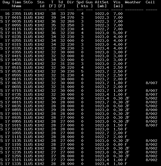
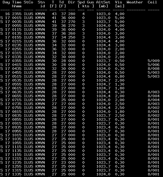
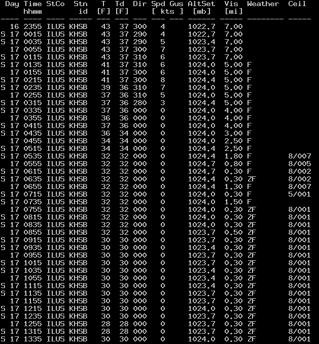
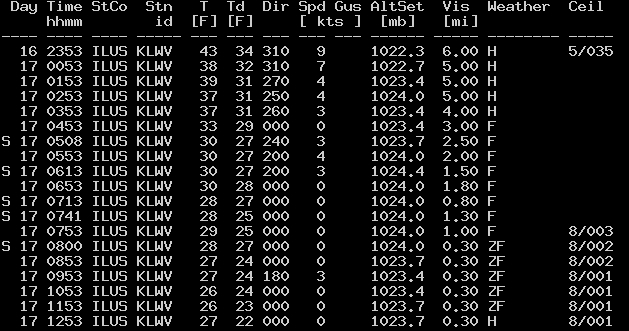
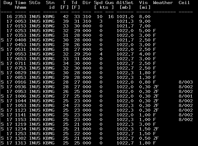
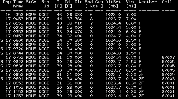
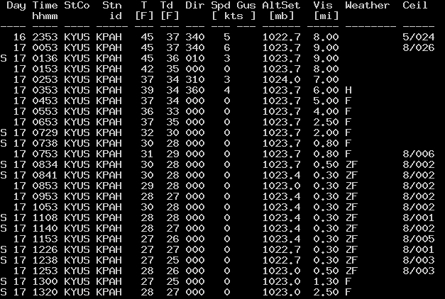
As part of CIMSS participation in GOES-R Proving Ground activities, new satellite products are being developed and tested — and one such product is an Instrument Flight Rules (IFR) Probability product (below; click image to play animation). This IFR Probability product blends satellite data and model fields to display regions where the cloud ceiling is likely to be between 500 and 1000 feet. The IFR Probability product did a much better job at highlighting the relatively large area where IFR cloud ceiling conditions were present at a number of reporting stations (some of which were experiencing cloud ceilings of 100 to 200 feet, along with freezing fog limiting the visibility to 0.3 miles at times) — for example: Effingham IL (K1H2) / Mount Vernon IL (KMVN) / Harrisburg IL (KHSB) / Lawrenceville IL (KLWV) / Bloomington IN (KBMG) / Cape Girardeau MO (KGCI) / Pahducah KY (KPAH).
")
GOES-13 IFR Probability product (click image to play animation)
GOES-13 0.63 µm visible channel images (below; click image to play animation) showed the areas of fog/stratus burning off quickly after sunrise — and the fog/stratus appeared to be relatively shallow in nature. The fact that the fog/stratus did not appear to be very thick may have been a factor that limited detection by the traditional GOES-13 (10.7-3.9 µm) and MODIS (11-3.7 µm) fog/stratus products.
")
GOES-13 0.63 µm visible channel image (click image to play animation)