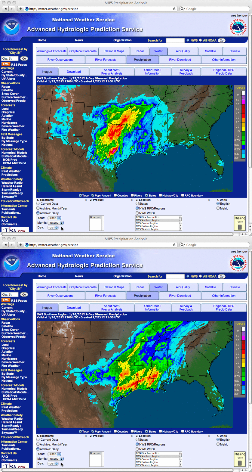
Rain-cooled ground across much of Texas and Oklahoma
Maps of the 1-day total precipitation for 25 January and 26 January 2012 (above) showed that much of Texas and Oklahoma received several inches of rainfall during that 48 hour period.
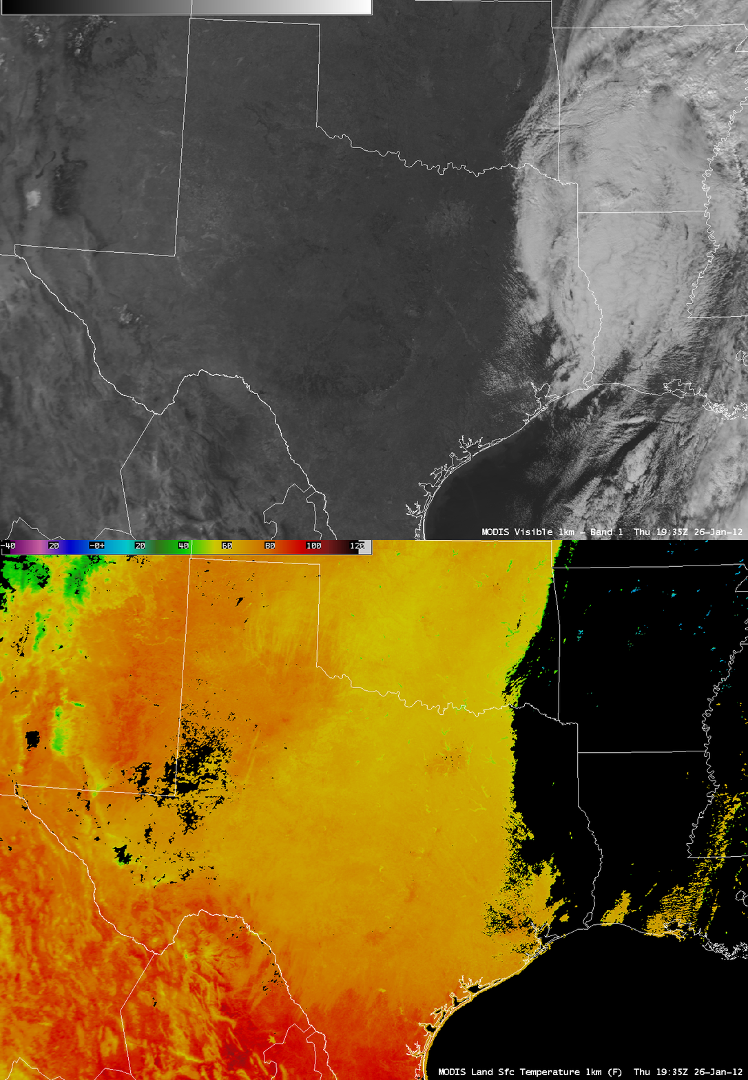
AWIPS images of the MODIS 0.65 µm visible channel and the corresponding MODIS Land Surface Temperature (LST) product (below) revealed a large swath of rain-cooled ground across much of that region. LST values where heavy rain fell were in the 60s F (yellow to light orange color enhancement), in contrast to LST values in the 70s and 80s F (darker orange to red color enhancement) to the north and the to the south of the rain-cooled areas.


