Snow cover increasing across the north-central US
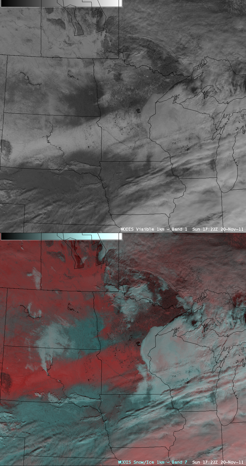
A comparison of an AWIPS image of 1-km resolution MODIS 0.65 µm visible channel data with the corresponding MODIS false color Red/Green/Blue (RGB) image created using the 2.1 µm “snow/ice channel” (above) showed that snow cover was beginning to increase in areal extent across parts of the north-central US on 20 November 2011. This example also demonstrates the utility of RGB imagery for helping to discriminate between snow cover (which shows up as shades of red on the RGB image) and supercooled water droplet clouds (which show up as varying shades of white). Snow depths at the time included 11 inches at Mount Rushmore, South Dakota, 10 inches at Rice, Minnesota and 5 inches at Minot, North Dakota.
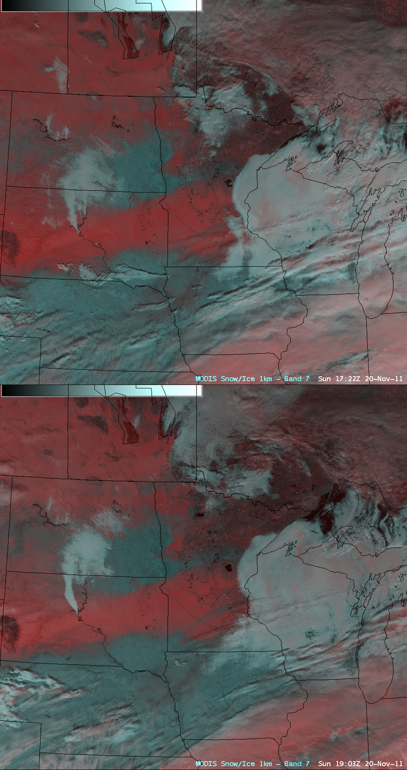
MODIS false color RGB images created using data from consecutive overpasses of the Terra (17:22 UTC) and Aqua (19:03 UTC) satellites (below) also show the movement of the low cloud features during that period.
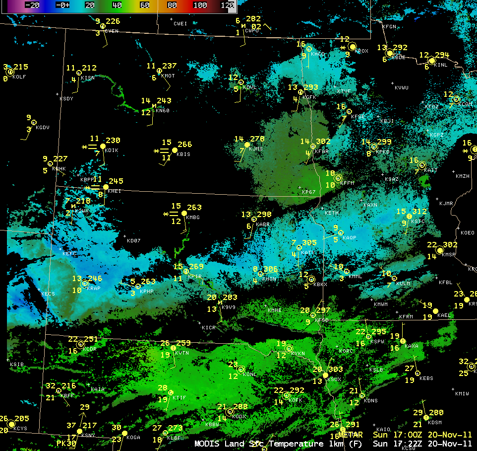
As pointed out in the NWS Minneapolis Area Forecast Discussion, the swath of fresh snow cover would have an impact on daily high and low temperatures at locations where the snow was deepest. An AWIPS image of the 1-km resolution MODIS Land Surface Temperature (LST) product (below) revealed that LST values were in the 0º F to +10º F range (cyan to blue color enhancement) over the areas with snow cover, in contrast to LST values in the 30s F (green color enhancement) over adjacent areas with bare ground.
CIMSS participation in GOES-R Proving Ground activities includes making a variety of MODIS images and products available for National Weather Service offices to add to their local AWIPS workstations. Currently there are 49 NWS offices receiving MODIS imagery and products from CIMSS.


