Typhoon Roke
")
MTSAT-2 10.8 µm IR channel images (click image to play animation)
MTSAT-2 10.8 µm IR channel images (above; click image to play animation) showed Category 4 Typhoon Roke as it approached Japan during the 19 September – 20 September 2011 period. Roke exhibited a well-defined eye during this time. Massive evacuations were urged by the Japanese government as this strong tropical cyclone approached major population centers in southern Japan.
On an MTSAT-2 IR image with surface and ship reports plotted from the CIMSS Tropical Cyclones site (below), the large radius of strong winds could be seen from the ship report of 50 knots a fair distance east of the storm center.

MTSAT-2 IR image + surface and ship reports
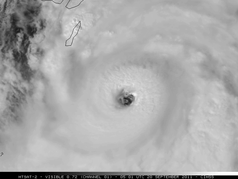
MTSAT-2 0.72 µm visible channel images (below; click image to play animation) showed the eye on 20 September — and there was a hint of meso-vortices within the eye of Roke on the 05:01 UTC visible image.
")
MTSAT-2 0.72 µm visible channel images (click image to play animation)