Smoke from Arizona fires spreads eastward and northeastward over much of the central US
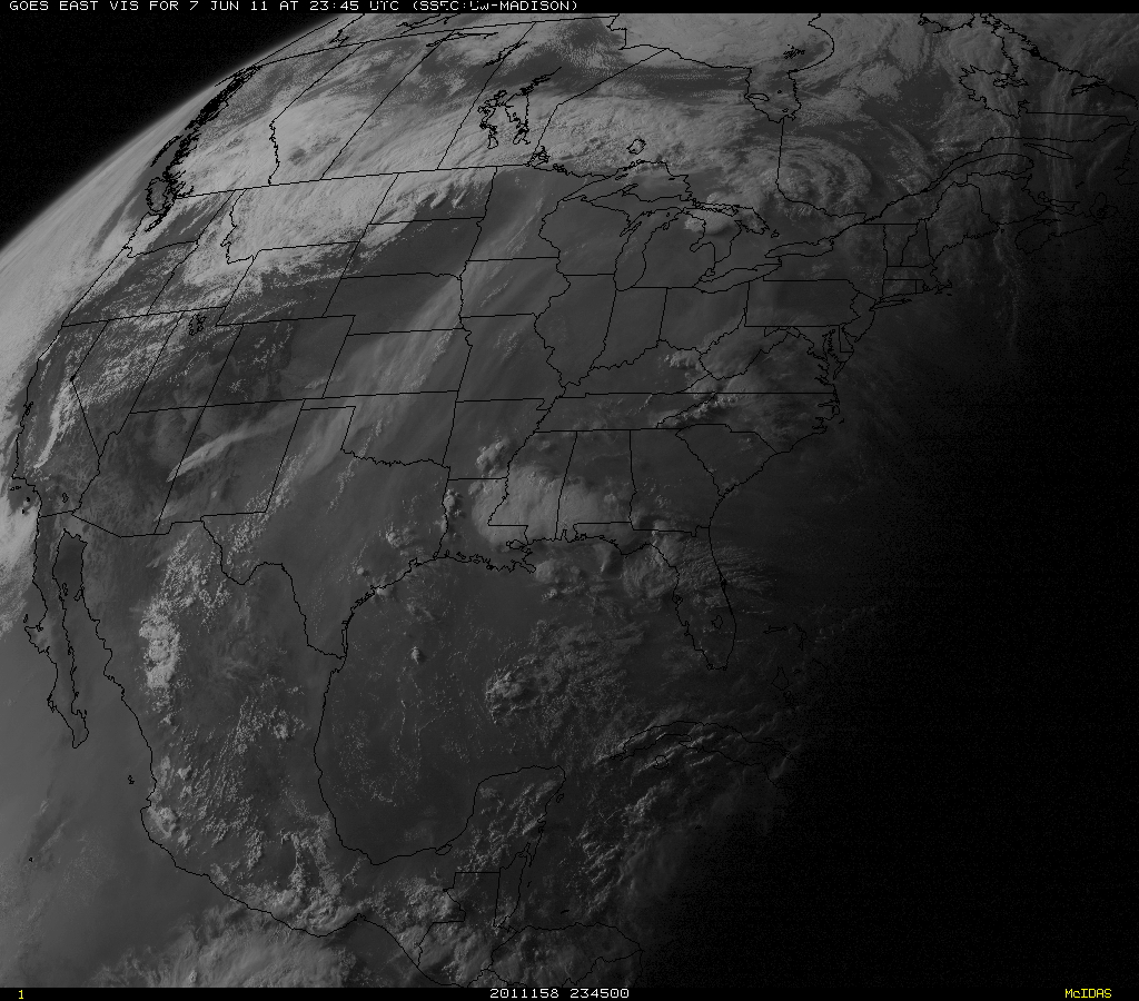
The Wallow Fire continued to burn out of control, becoming the second largest fire on record in the state of Arizona on 07 June 2011. McIDAS images of 1-km resolution GOES-13 0.63 µm visible channel data (above; click image to play animation) showed the dense plume of smoke that stretched from Texas northward to Minnesota and Wisconsin (this was smoke from the previous day of burning).
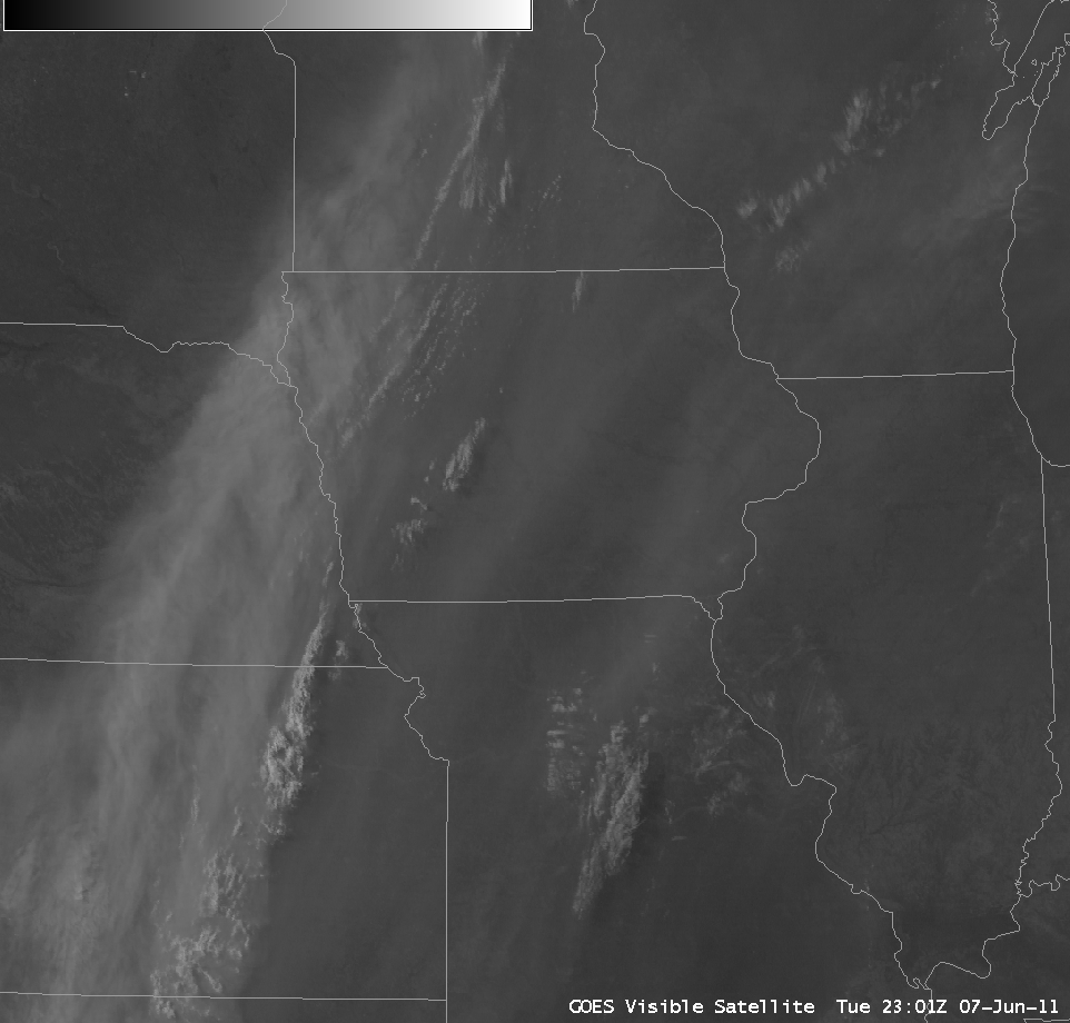
AWIPS images of GOES-13 visible channel data (below) showed a closer view of areas of smoke of varying height and density covering the Upper Midwest region of the US. The areal coverage of the smoke became more apparent later in the day, as the forward scattering angle increased between the GOES-13 satellite (positioned at 75º West longitude) and the setting sun.
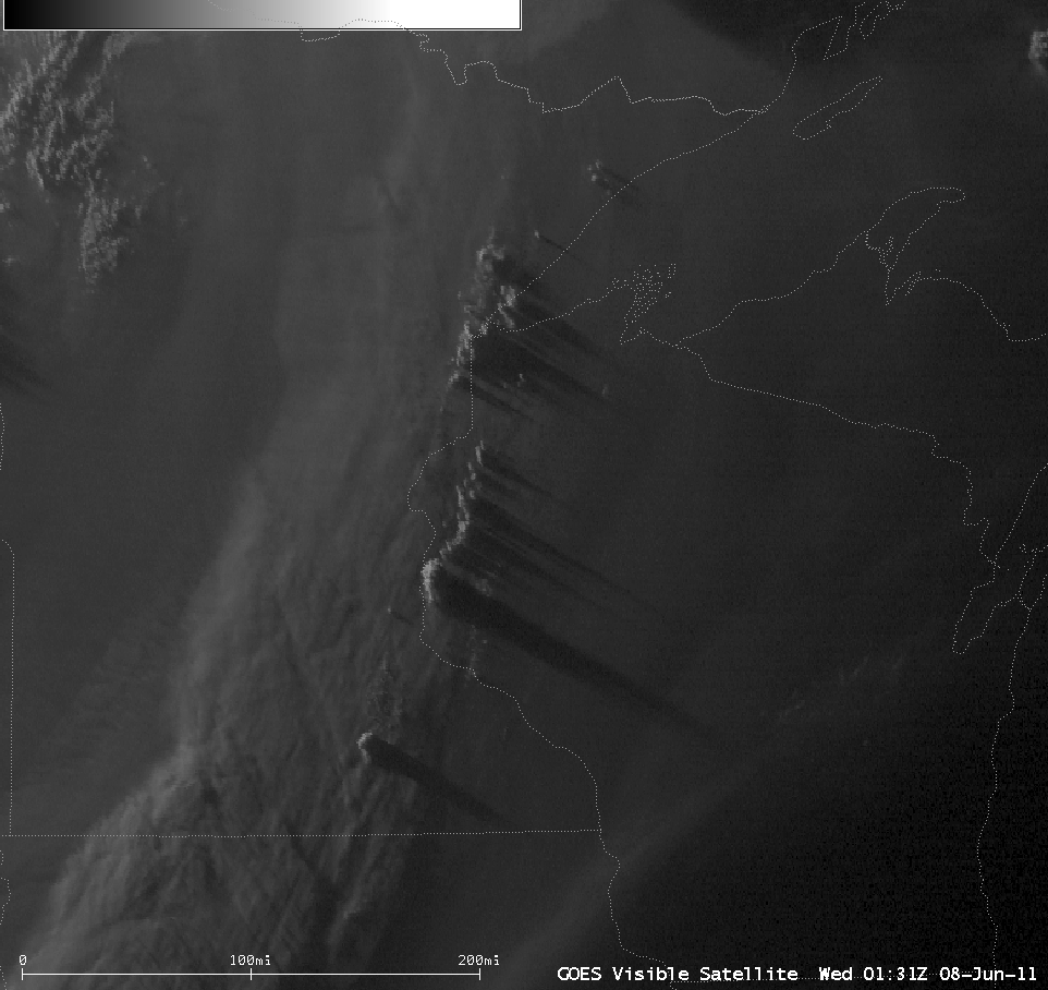
A line of convective cells began to develop around sunset along the Minnesota-Wisconsin border (below) — these towering cumulonimbus clouds were able to cast very long shadows (some over 100 miles long) onto the top of the dense smoke layer below.
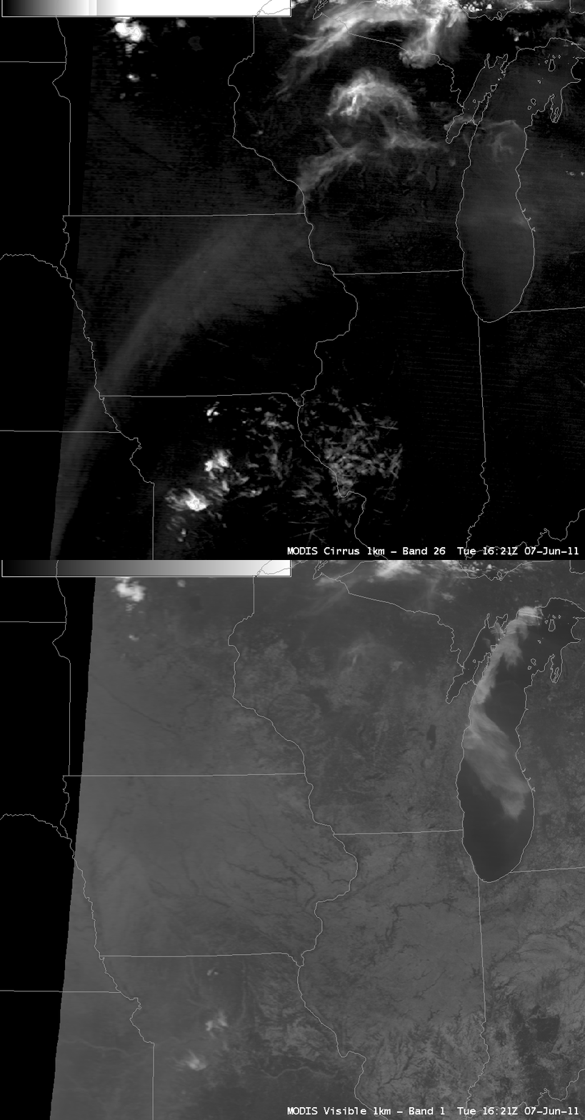
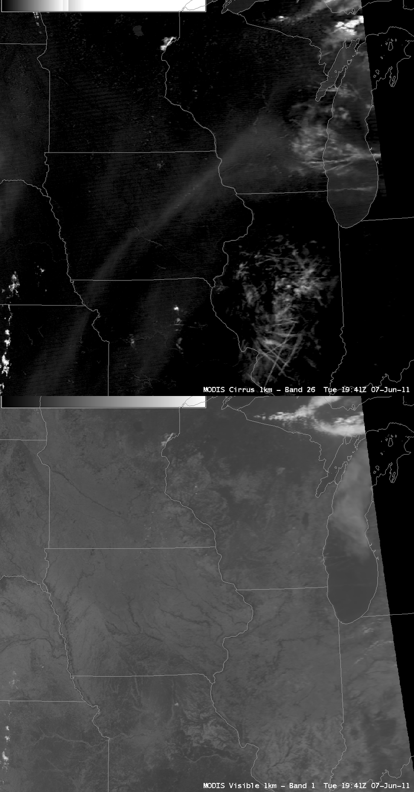
During the middle of the day, when the forward scattering angles are not as favorable to allow the best view of the areal coverage of the smoke, other satellite channels can be employed to help locate the areas where the smoke is most dense. Two comparisons of 1-km resolution MODIS 0.65 µm visible channel and the MODIS near-IR 1.38 µm “cirrus detection” channel data (below) demonstrated the utility of the cirrus channel for helping to locate the areas where the smoke was most dense during the daytime at 16:21 UTC and 19:21 UTC. The cirrus detection channel is helpful at identifying airborne particles that are efficient scatterers of light (ice crystals, dust particles, smoke particles) — so the thicker areas of smoke showed up as the slightly brighter arc-shaped features across pars of Kansas, Iowa, and Wisconsin.


