Convective Heat Burst in South Dakota
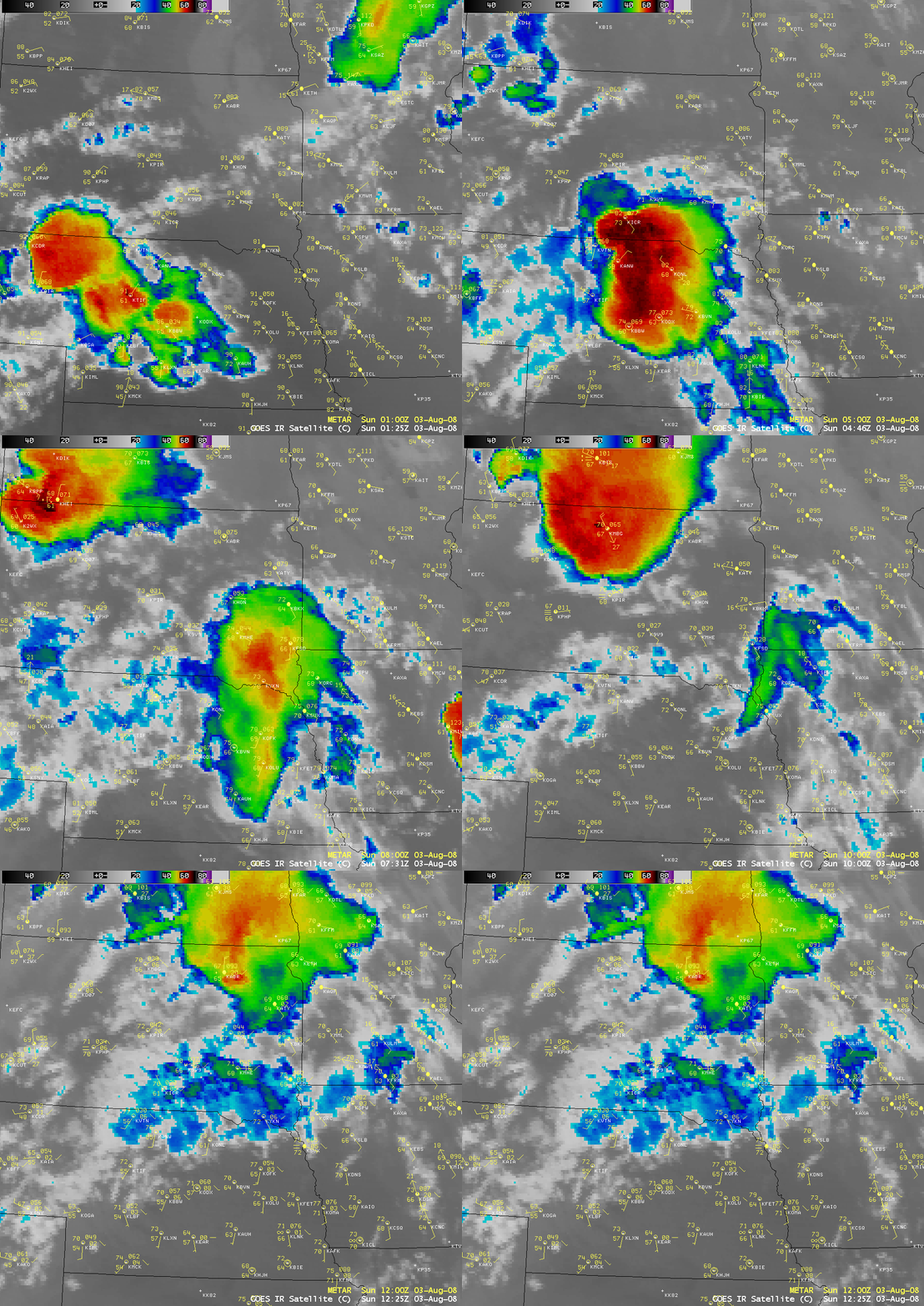
AWIPS images of the GOES-12 10.7 µm IR channel (above) showed a cluster of strong thunderstorms moving eastward across parts of Nebraska and South Dakota on 03 August 2008 — at one point these storms exhibited an “enhanced-v” signature on the IR imagery around 02:32 UTC over north-central Nebraska. As the cluster of storms began to dissipate and collapse, a convective heat burst was observed at Sioux Falls in southeastern South Dakota around 09:15-09:45 UTC (04:15-04:45 am local time). The surface temperature abruptly rose from 74º F to 101º F, with wind gusts of 50-60 mph.
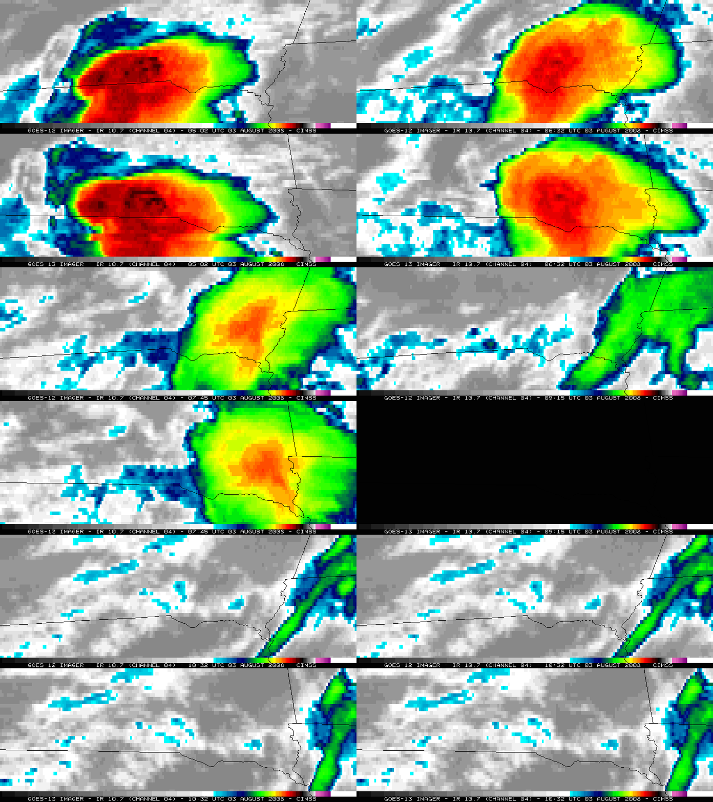
A comparison of GOES-12 and GOES-13 10.7 µm IR channel images (above) showed a closer view of the dissipating convection (GOES-13 had just been taken out of on-orbit storage for a period of operational testing). Note the rapidly warming cloud top temperatures as the convection approached Sioux Falls — the coldest cloud top IR brightness temperatures warmed from -68/-69º C at 05:02 UTC to -42/-43º C at 09:45 UTC (below).


