Flooding along the Red River in North Dakota
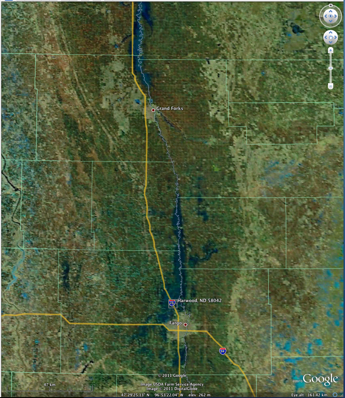
A MODIS false color Red/Green/Blue (RGB) image from the SSEC MODIS Today site (above; courtesy of Kathy Strabala, CIMSS) showed the areal extent of the unprecedented overland flooding that was occurring along parts of the Red River in North Dakota on 11 April 2011. Spring snow-melt along with recent heavy rainfall were contributing to the flooding. Interstate 29 north of Fargo was closed on the previous day due to rising floodwater covering the roadway.
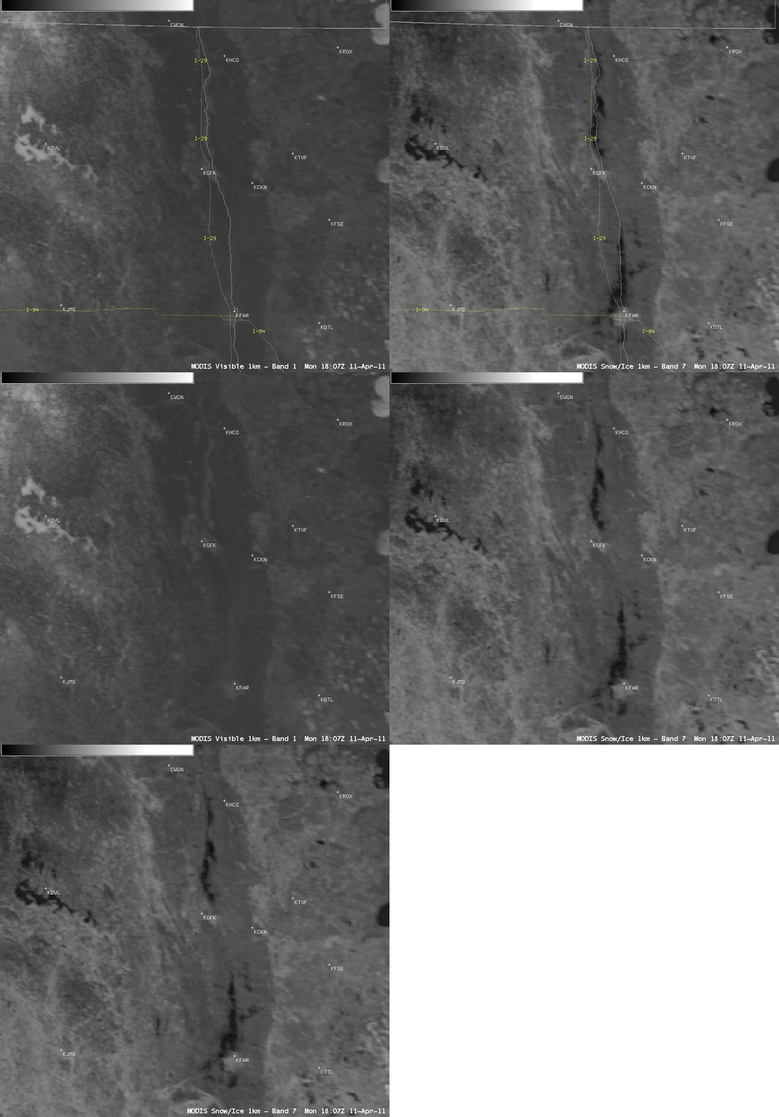
AWIPS images of 1-km resolution MODIS 0.65 µm visible channel and 2.1 µm near-IR “snow/ice” channel data (below) was also useful for helping to highlight the location of the flooded areas. Both water and frozen lakes appear as very dark features on the 2.1 µm “snow/ice” channel image — but the frozen lakes are brighter white on the visible image.
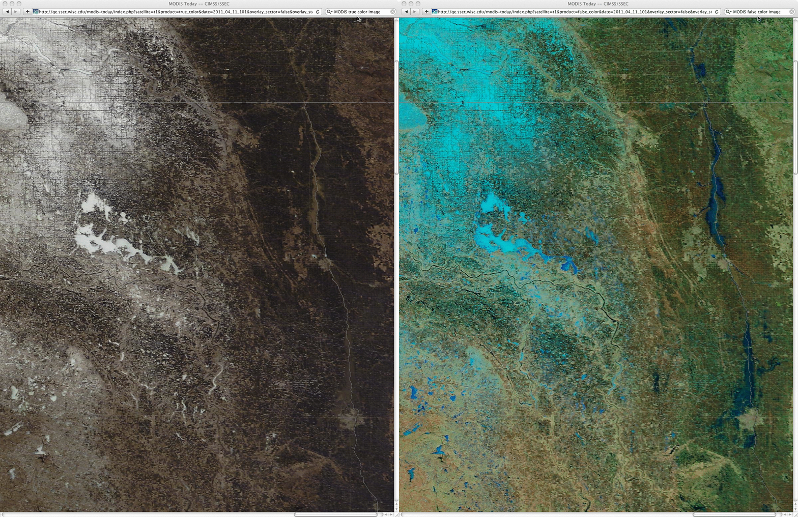
A comparison of 250-meter resolution MODIS true color and false color RGB images (below) offered a more detailed view of the flooding in the Fargo and Grand Forks areas. The flooded areas exhibited a “muddy” light brown appearance on the true color image. Farther to the west, the still-frozen Devils Lake (whose water level had reached a new record high level) and portions of northeastern North Dakota that still had snow cover (as much as 6 inches remaining on the ground) could also be seen (snow cover and frozen lakes appeared as lighter blue to cyan features on the false color image).


