Mountain waves over Utah
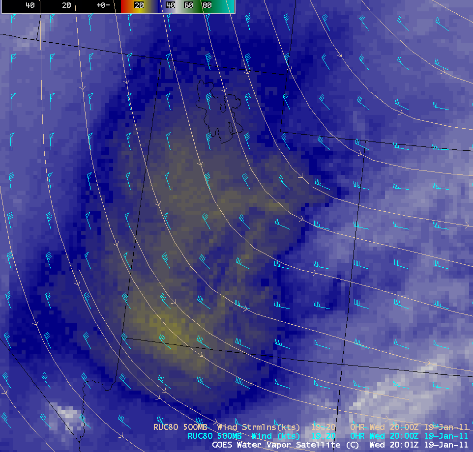
AWIPS images of GOES-13 6.5 µm ‘water vapor channel” data (above) showed a large area of dry air aloft moving southward across the state of Utah behind a shortwave trough axis on 19 January 2011. The 500 hPa wind fields from the RUC80 model indicated that winds turned more northerly and increased in speed behind the trough axis.
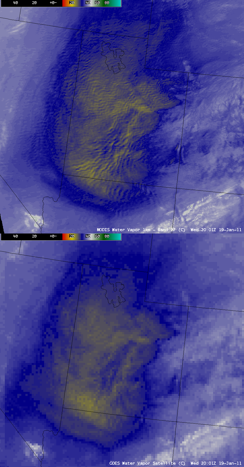
At 20:01 UTC, a comparison of the GOES-13 6.5 µm water vapor image with the corresponding 1-km resolution MODIS 6.7 µm water vapor image (below) demonstrated the value of higher spatial resolution for detecting the presence of widespread mesoscale mountain waves that covered a good deal of the state of Utah. Such a mountain wave signature on water vapor imagery can indicate the presence of a potential for turbulence — however, in this case there were no pilot reports of turbulence that showed up over Utah during that particular time period.
There was also an obvious northwestward parallax shift in the image features on the GOES-13 image, due to the large viewing angle from that geostationary satellite (which was positioned over the Equator at 75 degrees West longitude).


