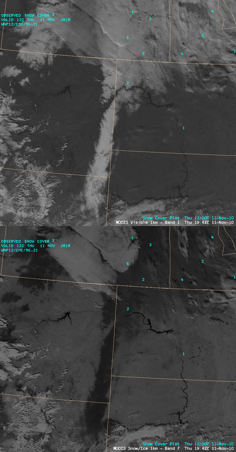
Long, narrow swath of snow cover across Wyoming, Montana, and North Dakota
AWIPS images of MODIS 0.65 µm “visible channel” and 2.1 µm “snow/ice channel” data (above) revealed a long, narrow band of snow cover oriented from south to north across far northeastern Wyoming, far eastern Montana, and far western North Dakota at 19:42 UTC (12:42 pm local time) on 11 November 2010.  Both snow cover and clouds appear as brighter white features on the visible image, but the near-IR snow/ice channel image helps to discriminate between snow cover and clouds (since snow and ice are strong absorbers at the 2.1 µm wavelength, they appear very dark on that particular image).  NOHRSC snow depth data indicated that as much as 5-6 inches of snow remained on the ground that morning, which explains the strong signal on the MODIS snow/ice channel image. According to National Weather Service local storm reports, total snowfall amounts during the preceding 24 hours in that particular area were as high as 17 inches at Hulett, Wyoming and 12 inches at Carlyle, Montana.
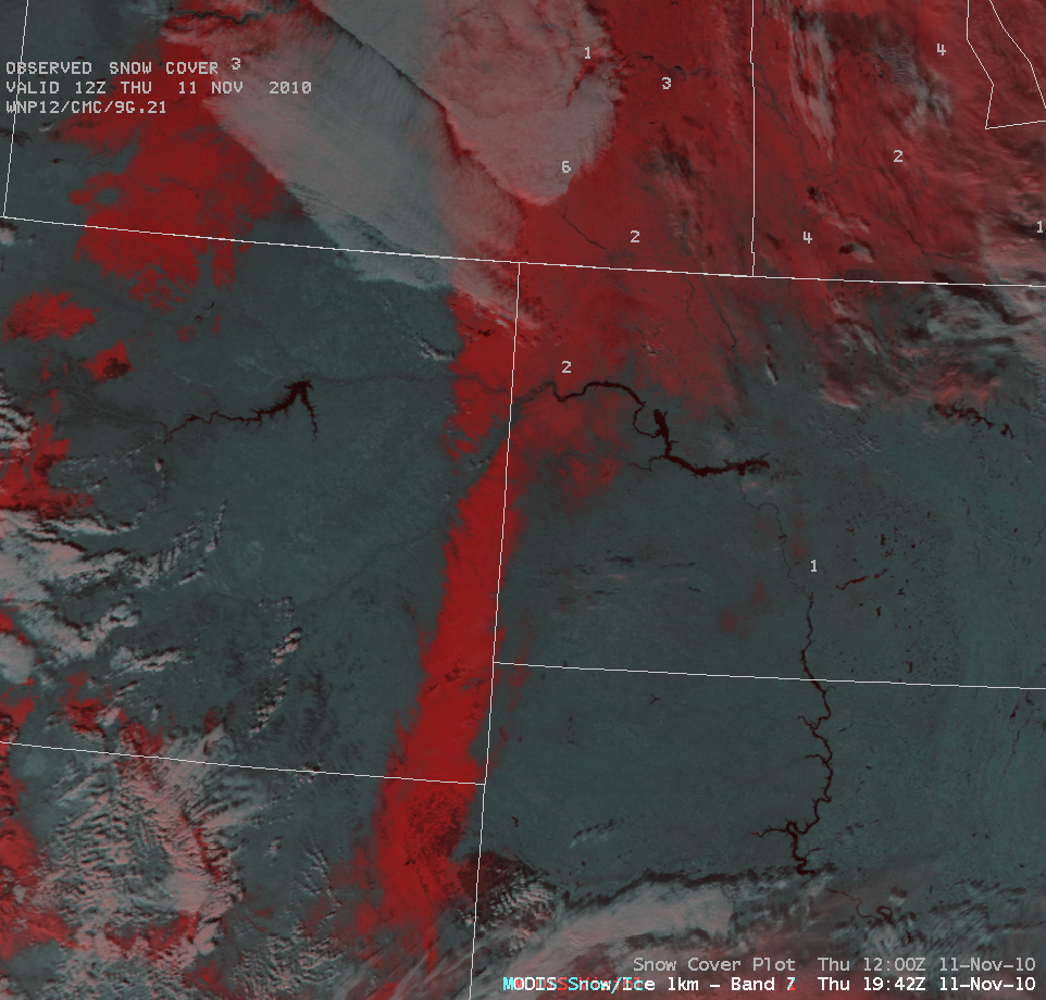
On a MODIS false-color Red/Green/Blue (RGB) image using the visible and snow/ice images (below), snow cover appears as varying shades of red, while water droplet clouds appear as brighter white features. Note the lack of first-order stations reporting snow depth within the area of the heavy snow swath — this highlights the value of using high spatial resolution satellite imagery for helping to determine the areal coverage of the snow on the ground.
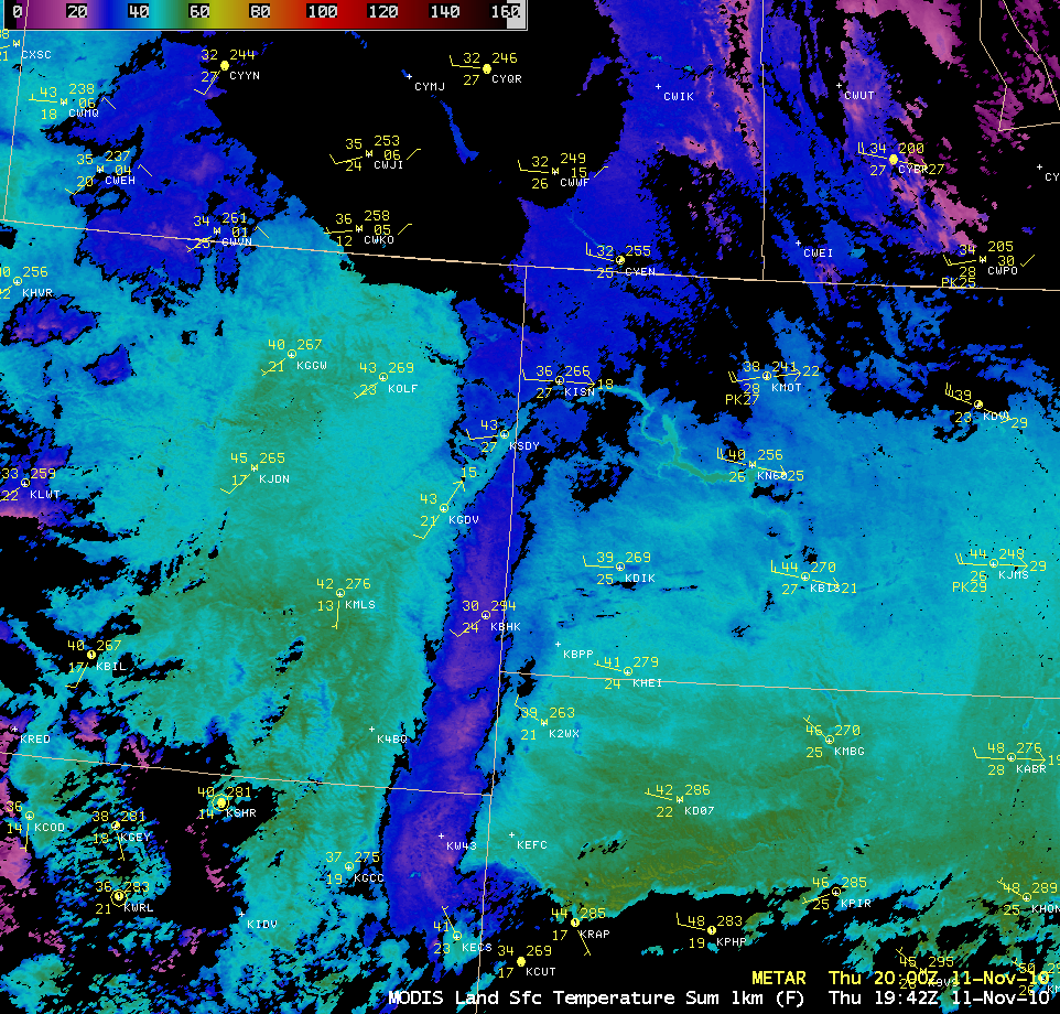
The MODIS Land Surface Temperature (LST) product (below) indicated that LST values were being held in the mid 20s to low 30s F (violet to blue colors) within the snow band, while LST values across the adjacent bare ground areas were rising in the upper 40s to low 50s F (cyan to green colors). However, there was not quite that large of a contrast in instrument shelter air temperatures across that area.


