MODIS imagery over Colorado
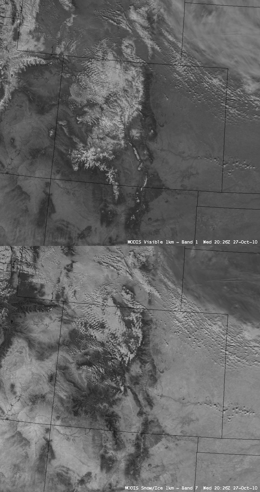
Snow cover was beginning to accumulate into the 12-24 inch range at some locations across the higher terrain of the Rocky Mountains in Colorado on 27 October 2010. While the snow-covered mountains appeared as brighter white features in contrast to the surrounding bare ground areas on AWIPS images of the MODIS 0.65 µm visible channel data, a comparison with the corresponding MODIS 2.1 µm “snow/ice channel” image (above) showed how it was possible to easily discriminate between areas with deep snow cover (which appeared as much darker features on the snow/ice image) and supercooled water droplet clouds (which appeared as brighter white features on the snow/ice image). The large area of cirrus clouds covering the northeastern corner of the image also appeared as a slightly darker shade of gray on the snow/ice image, due to their ice crystal composition.
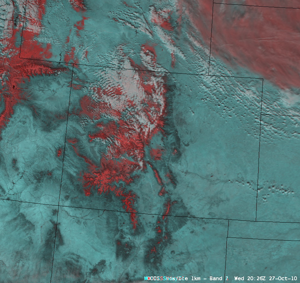
Another method to easily discriminate between deep snow cover and supercooled water droplet clouds is to use a false color Red/Green/Blue (RGB) image (below), generated using the MODIS visible channel as the Red component and the MODIS snow/ice channel as the Green and Blue components of the image. Deep snow cover then appears as darker red features, in contrast to supercooled water droplet clouds which appear as brighter white features on the image. Again, the large area of cirrus clouds covering the northeastern corner of the image also appeared as a lighter shade of red on the RGB image, due to their ice crystal composition.
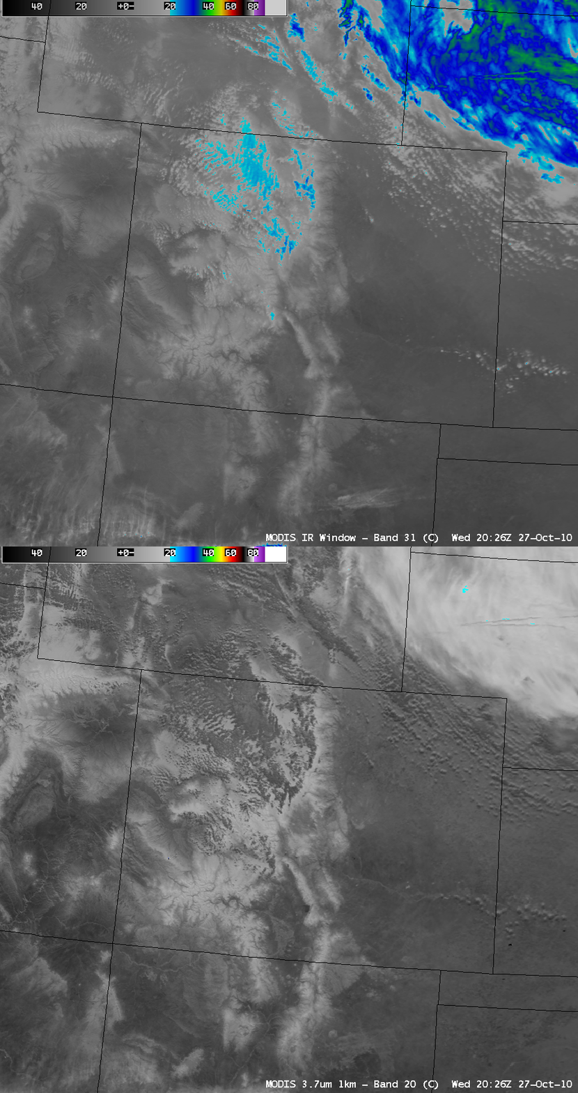
It can also be informative to compare the MODIS 3.7 µm shortwave IR image to the corresponding MODIS 11.0 µm IR window image (below). Some of the cloud features over northwestern Colorado were exhibiting 11.0 µm IR window brightness temperatures of -20º C and colder (cyan to blue color enhancement), suggesting that they could possibly be getting cold enough for glaciation to occur — however, these cloud features still appeared as darker features on the 3.7 µm shortwave IR image, indicating a strong component of reflection of incident solar radiation off of supercooled water droplets.
One of the more interesting comparisons is between the 0.65 µm MODIS visible channel image and the corresponding MODIS 6.7 µm water vapor image (below). Note the presence of widespread mountain waves to the lee of the higher terrain of the Rocky Mountains on the water vapor image — the vast majority of these waves were in cloud-free air according to the visible channel image. Such mountain wave signatures on water vapor imagery can indicate regions where clear air turbulence might be likely.
CIMSS has been making MODIS imagery and products available in AWIPS format to National Weather Service forecast offices as a part of the GOES-R Proving Ground project.


