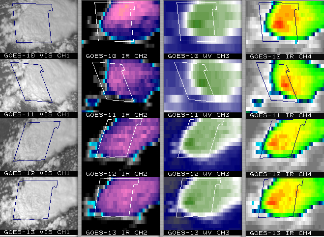
Severe convection: from 4 GOES satellites, or every 1 minute
Severe convection developed in eastern portions of the Texas panhandle region, which produced wind gusts to 67 mph and golf-ball size hail (1.75 inch diameter) around 20:20 to 20:30 UTC (3:20 to 3:30 PM local time) in parts of Cottle county, TX (the county outlined on the images above); a few hours later, this convection was also responsible for flash flooding in that particular county. The 16-panel image (above) shows visible and IR channel images from all 4 of the current operating GOES satellites (GOES-10, GOES-11, GOES-12, and GOES-13) at 20:30 UTC; the development of that same storm can also be viewed at 1-minute intervals from GOES-10 (below), which is still in Super Rapid Scan Operations (SRSO) as the satellite is being re-positioned to 60 W longitude. During the hours leading up to convective initiation, a curved outflow boundary from earlier thunderstorms was apparent across that region, and AWIPS GOES sounder-derived lifted index and total precipitable water depicted an axis of instability (LI = -10.4 C) and moisture (PW = 51 mm / 2.00 in) that was extending west-northwestward into Cottle county along that outflow boundary.


