MODIS detects warm cities and cold upwelling
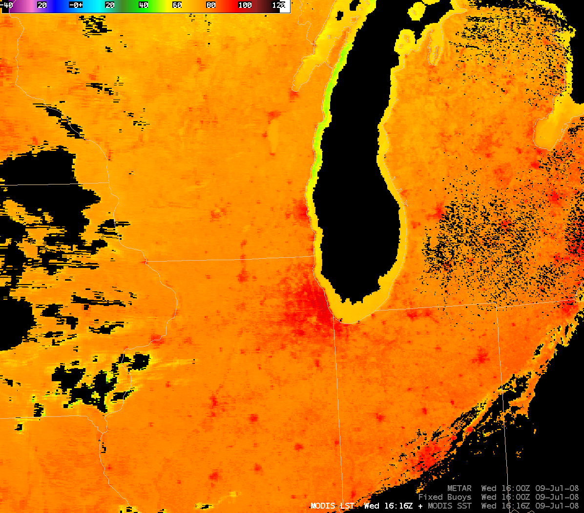
Mostly cloud-free skies in the wake of a cold frontal passage (MODIS true color image) allowed some interesting temperature signatures to be observed across the Upper Midwest and western Great Lakes states on 09 July 2008. An AWIPS image of the MODIS Land Surface Temperature (LST) product (above) revealed significantly warmer LST values (90-95º F, red colors) associated with the many cities across the region. The higher density of buildings, roadways, and paved surfaces in cities and urban areas contributes to the markedly higher surface (or “skin”) temperatures observed on satellite imagery — in fact, MODIS LST values were as hot as 101º F in the Chicago area. However, outside of the cities and urban areas, the MODIS LST values were generally in the 70s F, closer to the observed air temperatures (which are usually reported at suburban airports, away from the city centers).
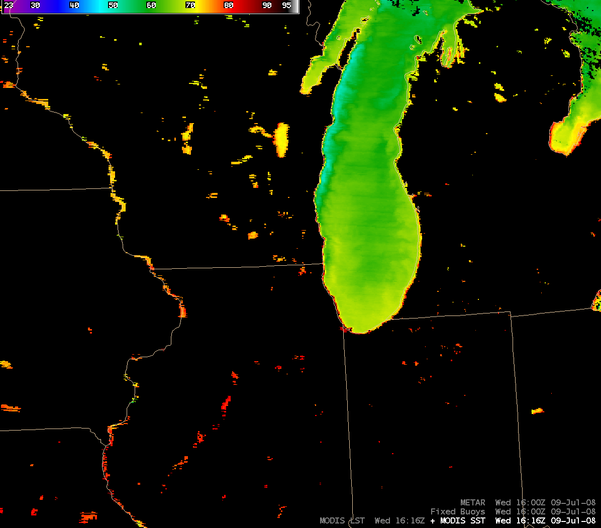
The MODIS Sea Surface Temperature (SST) product (below) revealed a ribbon of significantly colder SST values (around 50º F, cyan colors) in Lake Michigan, along the nearshore waters off eastern Wisconsin. A cold front had moved eastward through the region on the previous day, and post-frontal winds gusting to 20-25 mph helped to aid the process of cold water upwelling immediately off the coast. Mid-lake MODIS SST values were about 10º F warmer (green colors), which was supported by Lake Michigan buoy data.


