Urban Heat Island Inhibiting Fog in Atlanta
A common sight on calm nights and early mornings is radiation fog: as the surface cools at night, the air above the ground cools as well. The absolute moisture content of the air remains the same, but since the temperature is dropping less water vapor can be contained in equilibrium and thus the relative humidity goes up. If the temperature cools enough, it will reach the dew point and fog will form.
But what happens when you throw a dense city into the mix? Cities are warmer than the surrounding land for a number of reasons. First and foremost, the building materials like concrete and asphalt that are prevalent in cities are better at absorbing the sun’s energy than vegetation is. The vertical dimension of cities also matters: the perpendicular surfaces of tall buildings strongly absorb the sun’s rays when the sun is low in the sky and the rest of the landscape is absorbing very little, and the infrared radiation that is emitted outward by one building is often absorbed by a different building right next door. Thus, cities retain their heat at night in a phenomenon known as the urban heat island, or UHI.
On the morning of 5 January 2026, widespread areas of radiation fog were visible over the southeastern continental United States, as large scale nocturnal cooling took place over the Carolinas and Georgia. This can be seen in the Day Cloud Phase Distinction RGB from the GOES-19 geostationary satellite as large regions of cyan clouds. Note how the clouds seem to follow terrain, which is expected for fogs. This particular loop spans the period from before to after sunrise, and (as one can guess from the name) the Day Cloud Phase Distinction product is a daytime only product, so it really only the end of the loop that can be interpreted in this way.
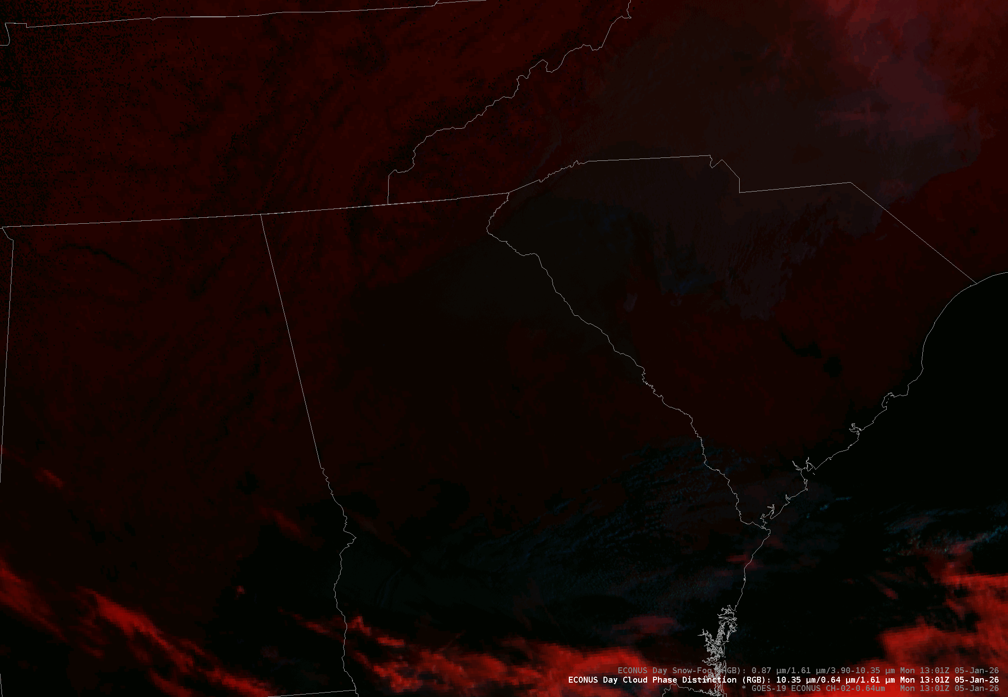
However, something interesting happens when you zoom in on Atlanta, Georgia. While the population of the city of Atlanta proper is relatively small (fewer than 500,000 people), it is the heart of the nation’s 8th largest metropolitan area, ranking it ahead of the Philadelphia, Phoenix, or Boston metros. With so much development, it has a well-pronounced UHI. Let’s look at the same product, zoomed into the Atlanta metro. This map shows the Interstate highways, and the center of the image where the highways all converge is the heart of Atlanta.

Note the gap in the fog right in the heart of the city. This is because the urban heat island kept the temperature of the central core of the city from cooling enough to allow fog to form. In the regions further out, however, the UHI was weaker. Out there, the air cooled more and condensation was able to take place. Sometimes, if you want to avoid the fog, all you have to do is head downtown.