Russian smoke over the Pacific Northwest?
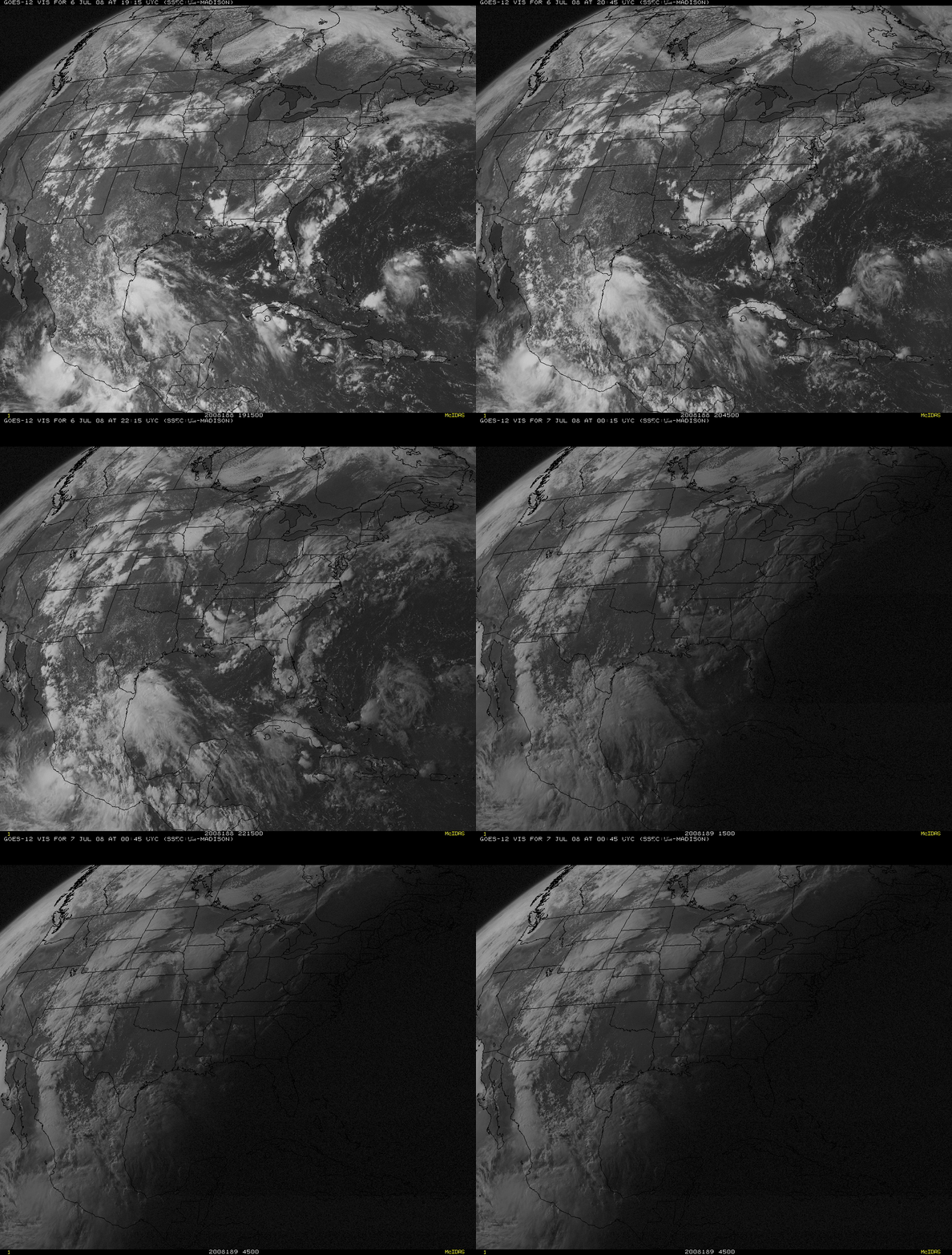
A suspicious area of “haziness” began to appear over the Pacific Northwest region (specifically, Washington state and adjacent parts of northern Oregon and southern British Columbia) on the late afternoon and early evening GOES-12 visible images (above) on 06 July 2008. A MODIS true color image from the SSEC MODIS Today site (below) also shows the haziness over the Pacific Northwest and the adjacent offshore waters, as well as thick smoke farther to the south due to active fires that continued to burn in parts of California.
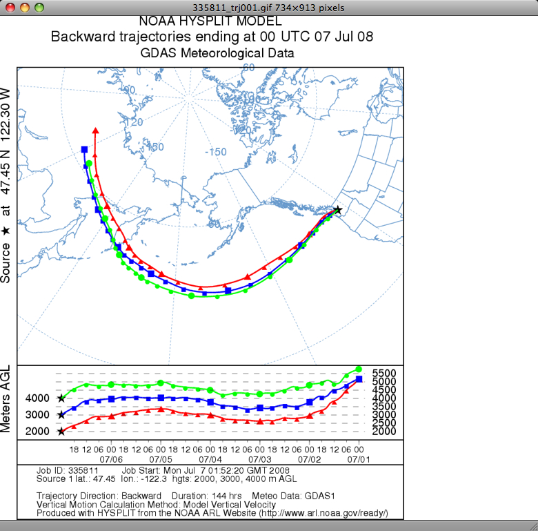
My first thought was: “Wow, all that smoke from the California fires has moved that far north again today (like it did on the first 3 days of July)?” — but that didn’t seem like a meteorologically plausible scenario for this particular day. Then I recalled seeing MODIS true color imagery of thick smoke from fires burning in far eastern Russia that was moving across the Sea of Okhotsk and the Kamchatka Peninsula on 30 June and 02 July; could this haziness seen on the GOES-12 visible imagery possibly be smoke from those Russian fires? Backward airmass trajectories using the NOAA ARL HYSPLIT model (below) seem to support that idea — air parcels arriving over Washington state at 2000, 3000, and 4000 meters above ground level came from the region where the thick smoke was seen on MODIS true color imagery several days earlier.
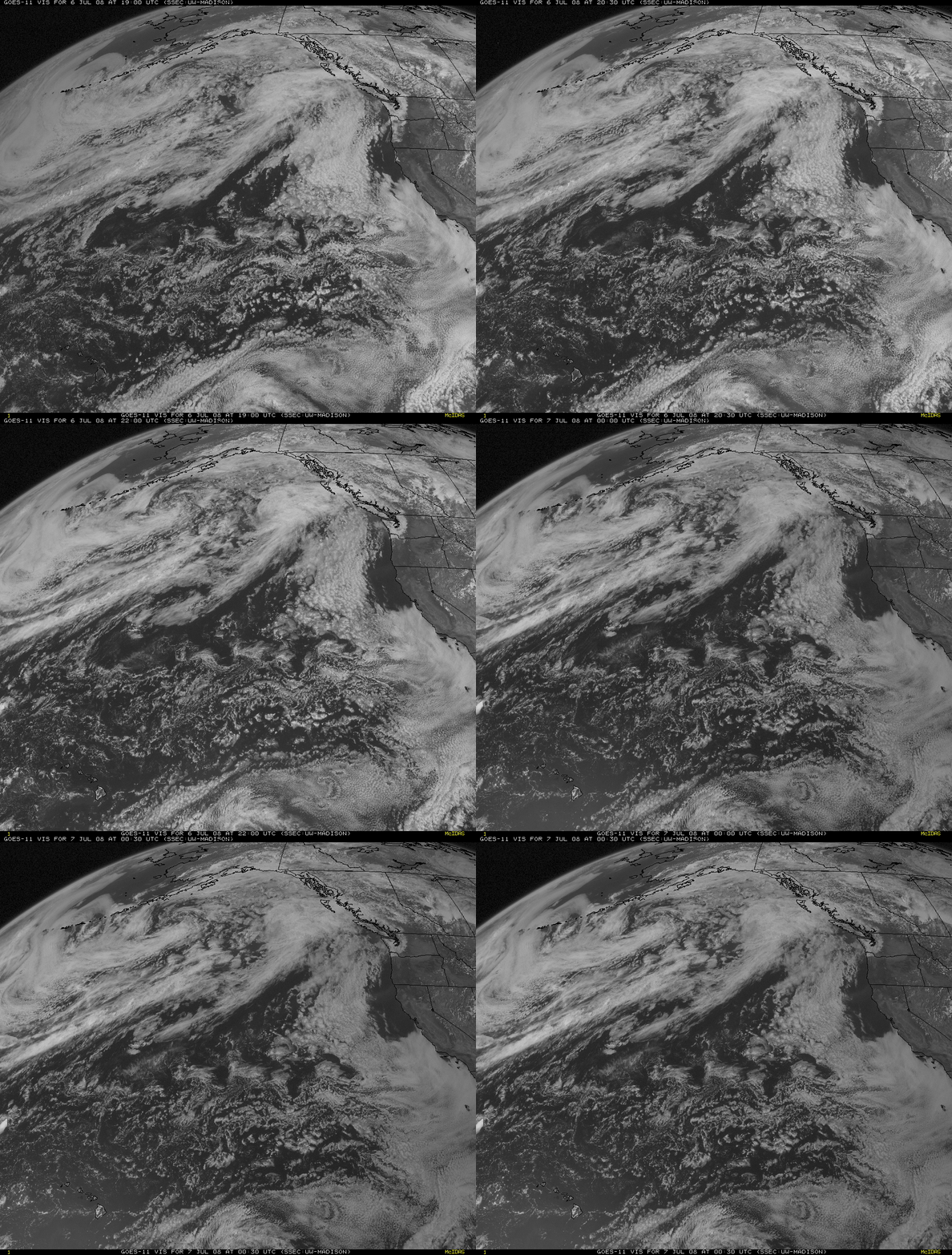
It is also interesting to examine the corresponding GOES-11 visible imagery (below) from the same time period as the GOES-12 imagery shown above. Why is the haziness over the Pacific Northwest region not as apparent? The answer to that question is: forward scattering. The forward scattering of light by the relatively small smoke particles increases as the angle between the sun, the smoke particles, and the GOES-12 (GOES-East) satellite approaches 180 degrees — this forward-scattered light makes the smoke appear “brighter” during late afternoon and early evening. The GOES-11 (GOES-West) satellite is positioned much farther to the west (at 135º W longitude, compared to 35º W longitude for GOES-12), so there is no forward scattering geometry to enhance the appearance of the airborne smoke over the Pacific Northwest region.
However, note that the hazy signature of the airborne smoke is evident on GOES-11 visible imagery from the next morning, when the sun was illuminating the smoke from the east (thereby creating a favorable forward scattering geometry with respect to the GOES-West satellite).


