Bronco Fire in Arizona produces a pyrocumulonimbus cloud

5-minute GOES-18 Clean Infrared Window (10.3 µm, left) and Red Visible (0.64 µm right) images with overlays of the Fire Mask derived product (semi-transparent red areas), from 2001 UTC on 07 August to 0101 UTC on 08 August [click to play MP4 animation]
Note that smoke drifting north-northeastward from the Bronco Fire eventually reduced the surface visibility to 4 miles at Show Low (METAR identifier KSOW) by 0100 UTC on 08 August (below).
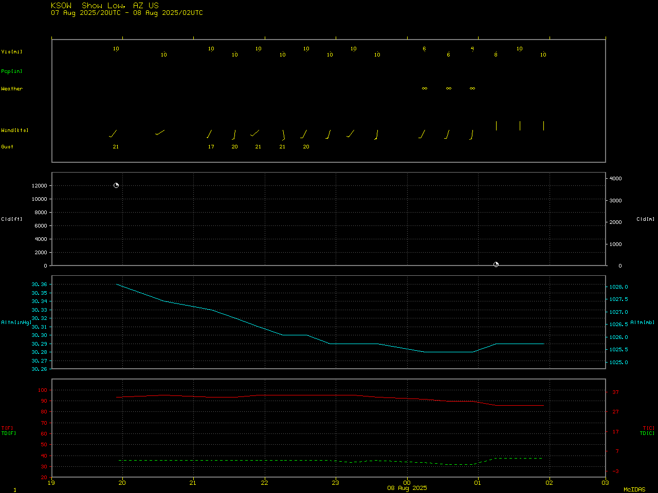
Time series of surface observation data at Show Low, Arizona [click to enlarge]

5-minute GOES-18 True Color RGB images, from 2001 UTC on 07 August to 0101 UTC on 08 August [click to play MP4 animation]
____________

GOES-18 Infrared image at 0016 UTC on 08 August, with a cursor sample of the coldest pyroCb cloud-top infrared brightness temperature [click to enlarge]

Plot of rawinsonde data from Tucson, Arizona at 0000 UTC on 08 August [click to enlarge]

GOES-18 Shortwave Infrared (3.9 µm) image at 2111 UTC on 07 August, with a cursor sample of the hottest brightness temperature over the Bronco Fire [click to enlarge]

GOES-18 Shortwave Infrared (3.9 µm) image at 0016 UTC on 08 August, with a cursor sample of the hottest brightness temperature over the Bronco Fire [click to enlarge]