Heavy rainfall causes flooding in Grand Island, Nebraska
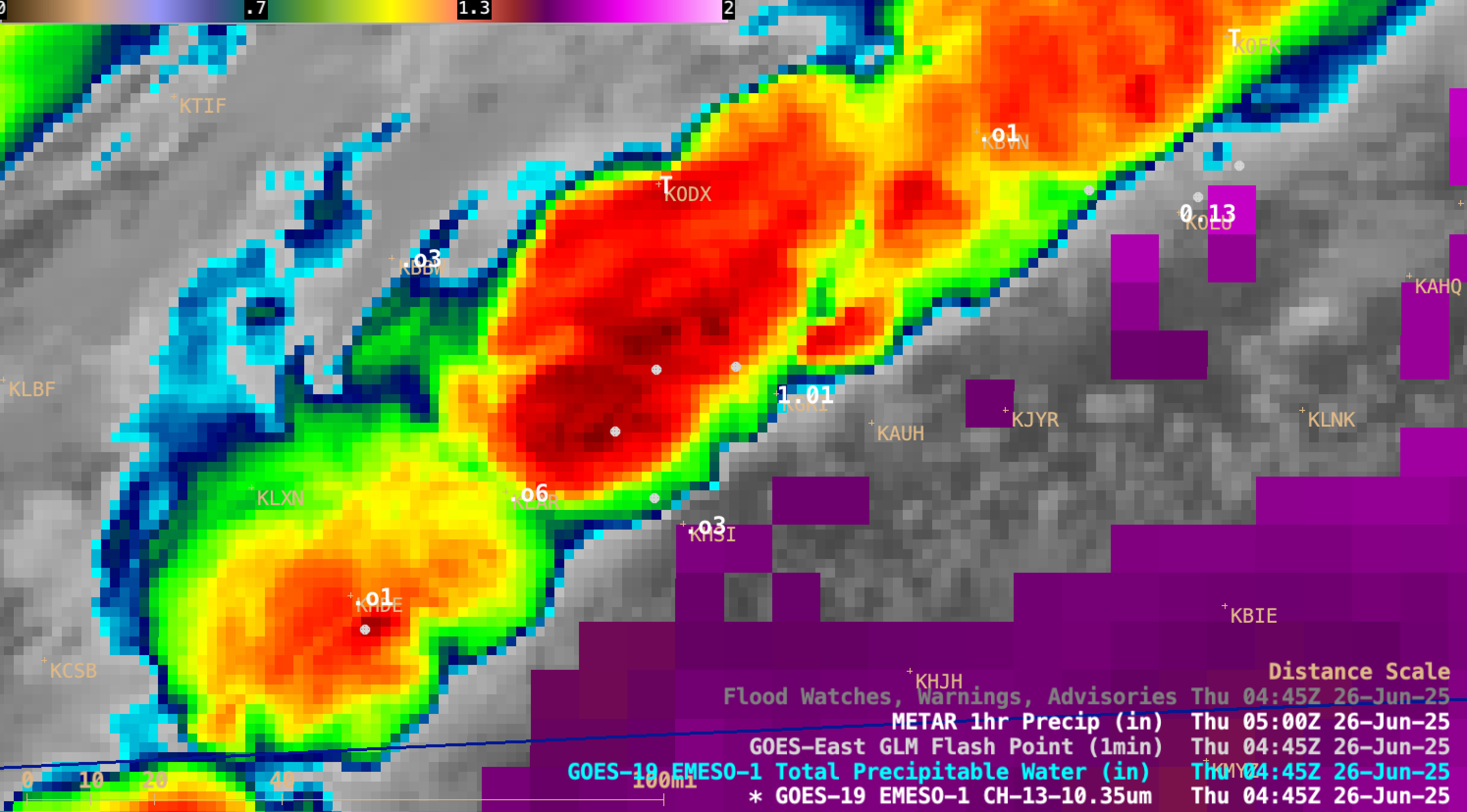
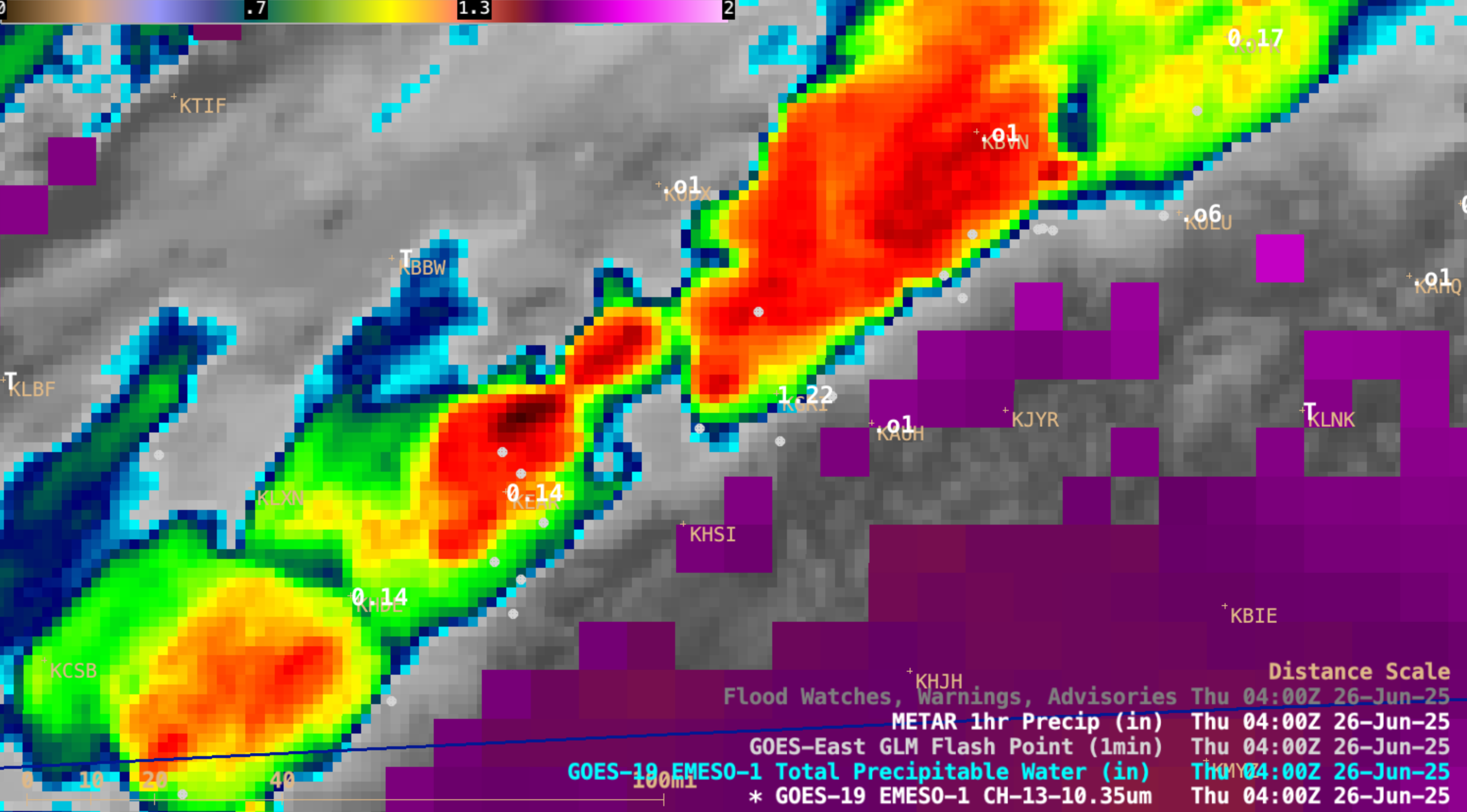
1-minute GOES-19 Infrared images centered at Grand Island, Nebraska (KGRI) with an overlay of Total Precipitable Water, GLM Flash Points and 1-hour Precipitation, from 0001-1100 UTC on 26 June [click to play MP4 animation]
Grand Island, Nebraska received 6.41″ of rainfall during the calendar day on 25 June 2025 — which set a new record for the date and for any single day during the month of June. 1-minute Mesoscale Domain Sector GOES-19 (GOES-East) Infrared images centered at Grand Island (above) included an overlay of the Total Precipitable Water derived product, GLM Flash Points and 1-hour Precipitation during the 11-hour period from 0001-1100 UTC on 26 June (which was a period during which a large portion of the 25 June record rainfall occurred — with rainfall rates as high as 1.22 inches per hour).
The same set of GOES-19 imagery that also includes Flood Watch/Warning/Advisory polygons is shown below. Note the appearance of the bold red Flash Flood Emergency for Grand Island area, beginning at 0445 UTC (image | text).
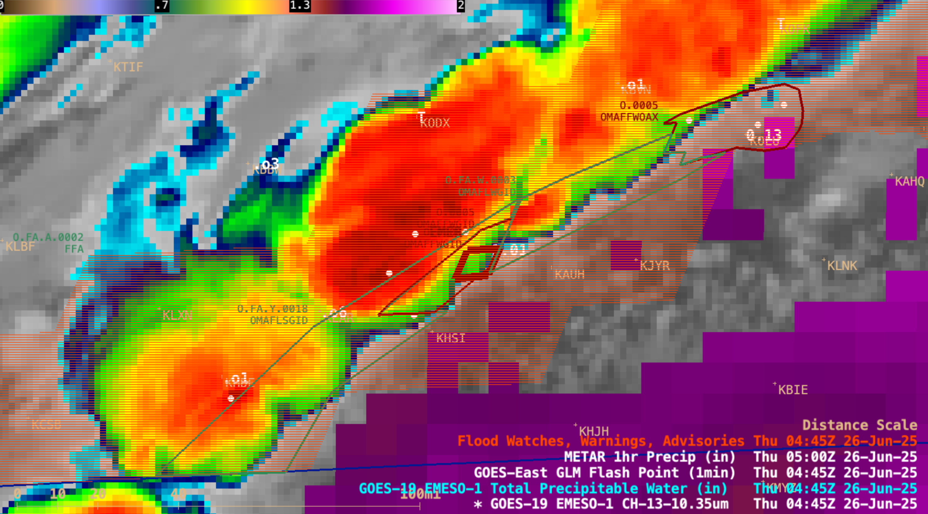
1-minute GOES-19 Infrared images centered at Grand Island, Nebraska (KGRI) with an overlay of Total Precipitable Water, GLM Flash Points, 1-hour Precipitation and Flood Watch/Warning/Advisory polygons, from 0001-1100 UTC on 26 June [click to play MP4 animation]
The GOES-19 imagery at 1100 UTC (below) included plots of 24-hour precipitation — which displayed 7.13 inches at Grand Island (ending at 1200 UTC on 26 June).
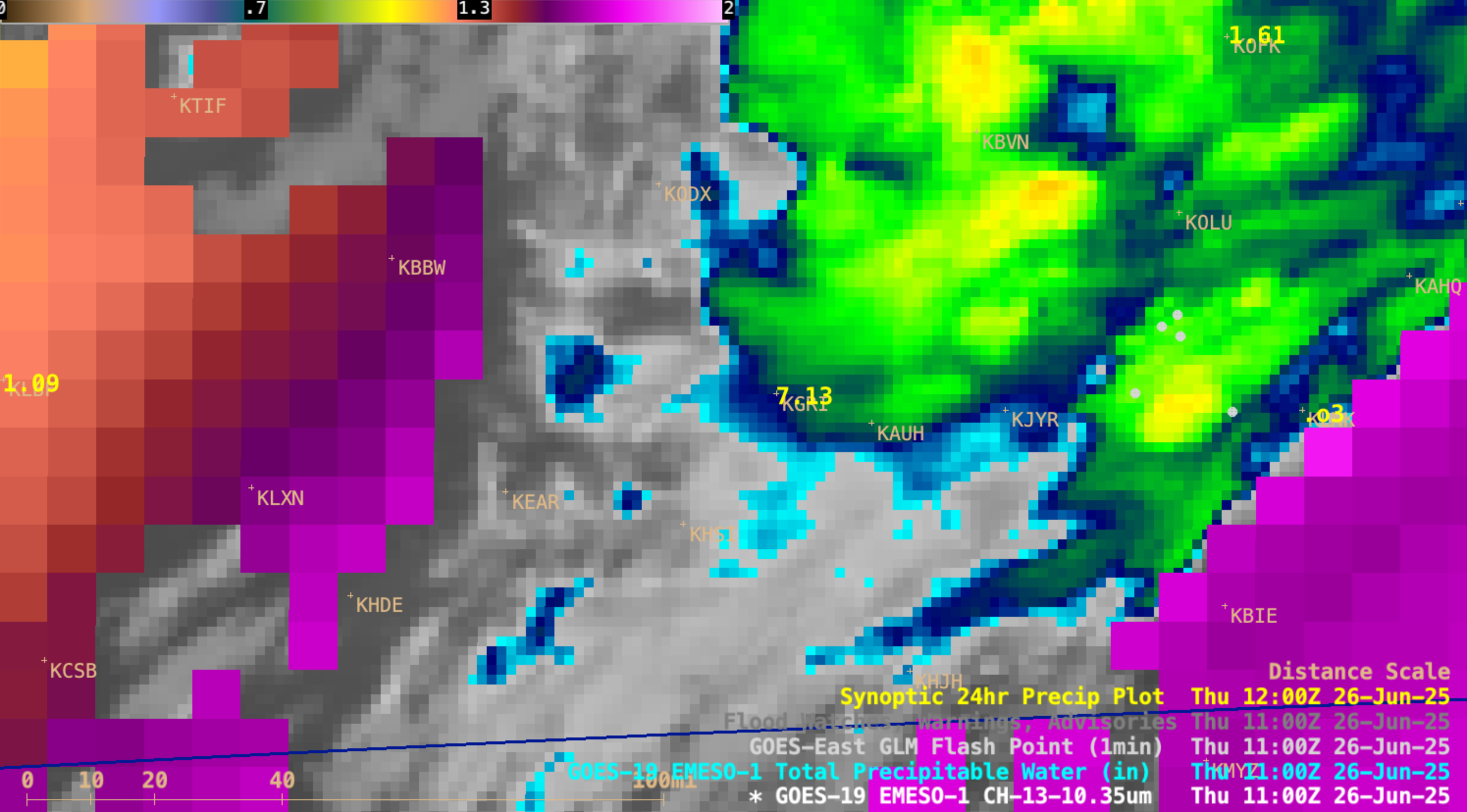
GOES-19 Infrared image with overlay of Total Precipitable Water and GLM Flash Points at 1100 UTC on 26 June — with 24-hour Precipitation (inches, ending at 1200 UTC) plotted in yellow [click to enlarge]
Prior to the onset of this period of heavy rain, the GOES-19 Total Precipitable Water value in the vicinity of Grand Island was as high as 1.74 inches (below).
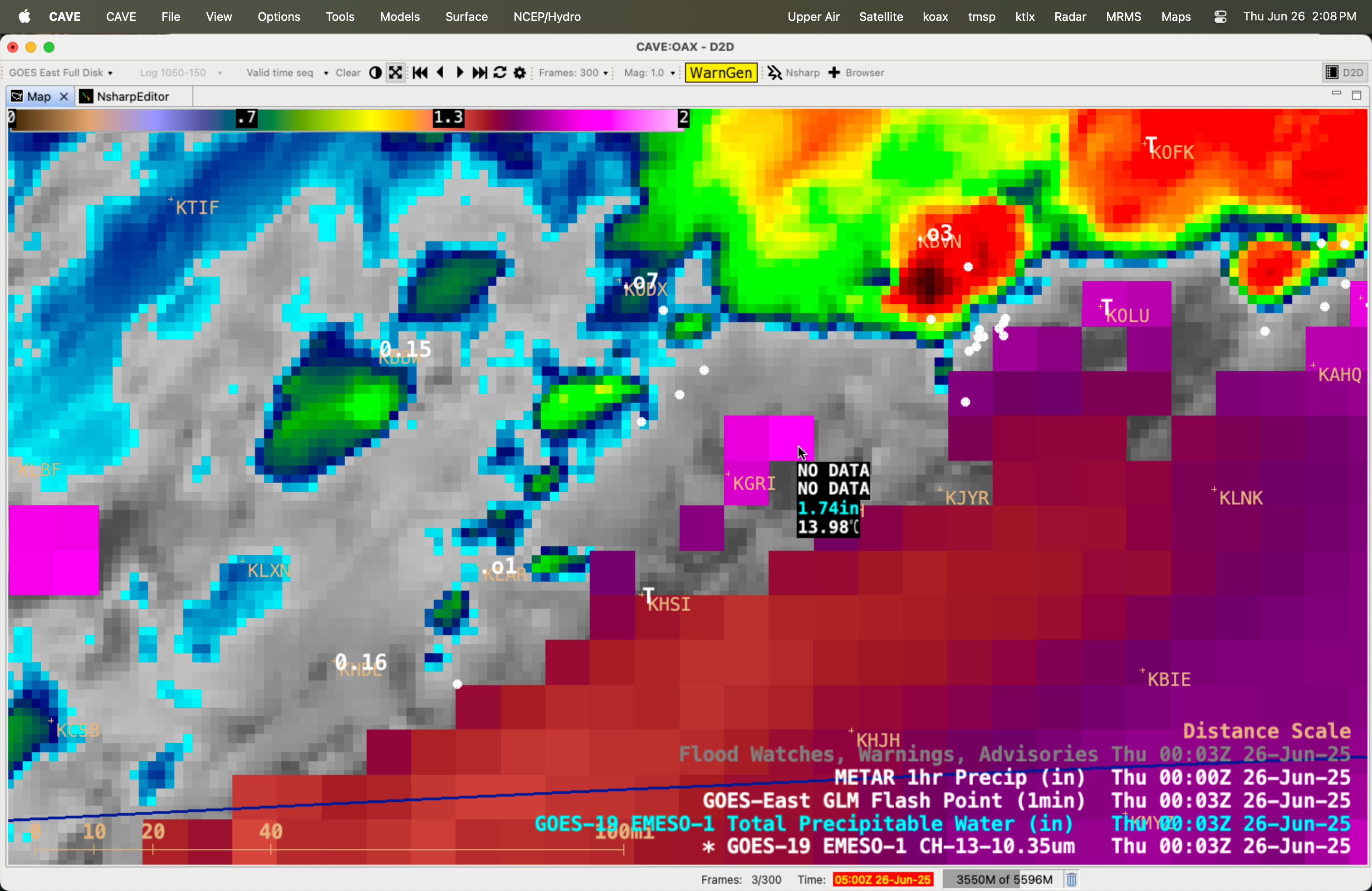
Cursor sample of GOES-19 Total Precipitable Water derived product just northeast of Grand Island (KGRI) at 0003 UTC on 26 June [click to enlarge]