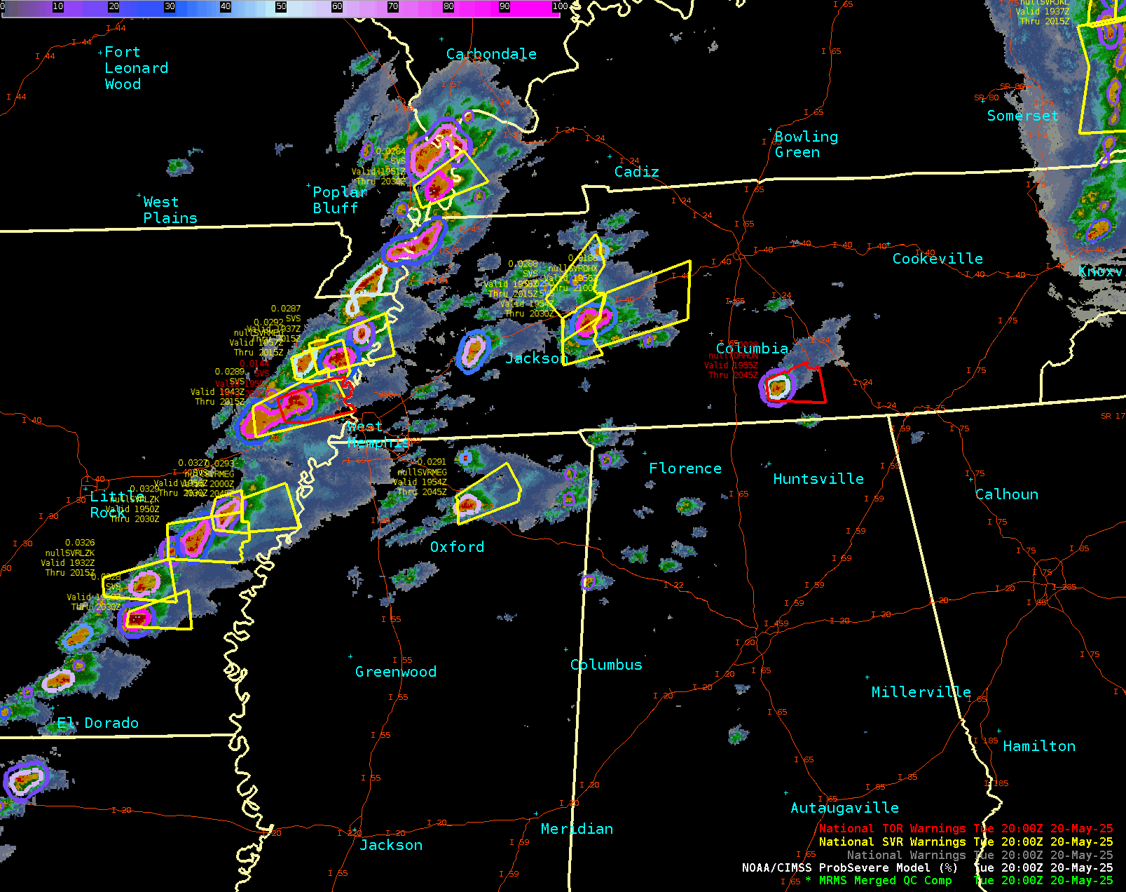
Southeast Supercells
A shortwave impulse spawned numerous supercell thunderstorms in a highly unstable and well-sheared environment in the Southeast U.S. ProbSevere v3 readily tracked numerous severe and tornadic storms across the region.
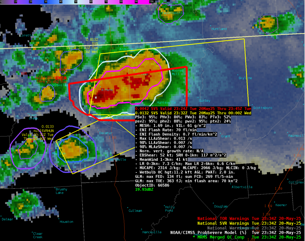
One storm in particular produced tornadoes in Madison, Alabama, and prompted a tornado emergency warning. In this example, the ProbTor v3 was much higher than ProbTor v2, due to some unrepresentative environmental data in the RAP (used in ProbTor v2). The 52% value is very high for ProbTor, which uses MRMS, GOES, Earth Networks, and HRRR inputs.
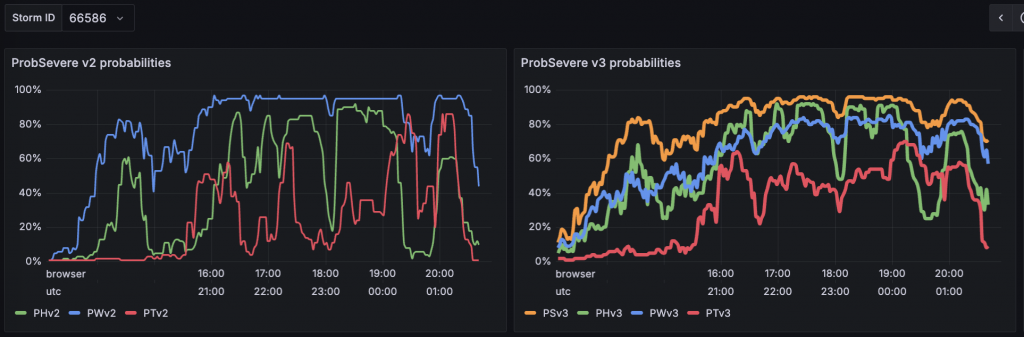
Looking at the time series of ProbSevere v2 vs. v3 (Figure 3), we notice a couple things:
- ProbSevere v3 was higher early in the storm’s lifetime, which has been a consistent finding. The ML models of v3 are more skillful when combining the environmental and observational parameters in nascent storms.
- ProbTor v3 does a much better job maintaining elevated probabilities for the majority of the storm’s lifetime. As implied previously, we believe this is due to more accurate environmental data in the HRRR model.
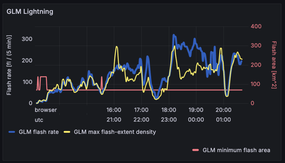
The long-lived supercell exhibited several lightning jumps. Shortly before the first tornado report at 23:20 UTC, there was a very large lightning jump (see the yellow bars in the image below). However, the large increase in flash rate was partially due to a storm merger, and not a meteorological intensification in updraft strength.
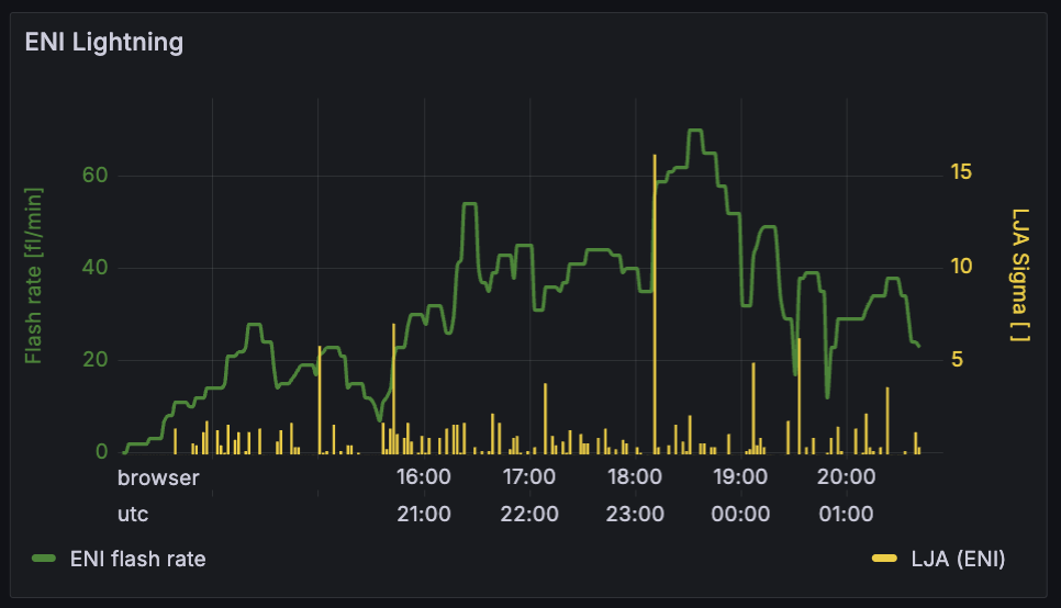
I say partially, because the change in maximum GLM flash-extent density also increased, and before the storm merger at 23:10 UTC. The GLM flash-extent density (yellow line in Figure 5) shows increases around 23:00 UTC. This field is not affected by a storm-object’s boundaries. Therefore, it seems that intensification was already occurring in the tornadic storm when the storm merger happened. The merger did seem to either further intensify the flash rate in our supercell or at least did not impede the intensification that was already occurring.
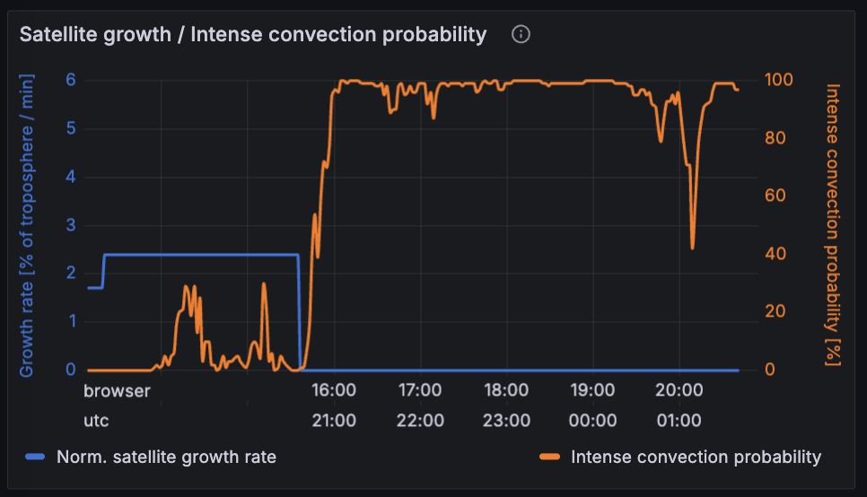
Lastly, the meteogram below shows values for some satellite-based storm attributes. The satellite growth rate (blue) is an important predictor for growing storms, and can help boost probabilities before radar predictors are nearing severe thresholds.
Once a storm is nearing or at maturity, the “intense convection probability” from IntenseStormNet provides a fused ABI+GLM-based perspective on the “intensity” of the storm. In this storm, the probability was over 95% for much its lifetime. The probability jumped up 8 minutes prior to the first local storm report at 20:52 UTC.
These “intense” probabilities can also be plotted on a 2D view (Figure 7). This product works well for many developing and mature supercells, and could be useful on its own in lieu of radar data. Even with good radar coverage, we’ve found that it skillfully contributes to ProbSevere v3 models.