Wildfire in Saskatchewan produces a pyrocumulonimbus cloud

GOES-19 “Red” Visible (0.64 µm, top), Shortwave Infrared (3.9 µm, center) and “Clean” Infrared Window (10.3 µm, bottom) images [click to play animated GIF | MP4]
The coldest pyroCb cloud-top 10.3 µm IRBT was -47.7ºC — which was slightly colder than the air temperature of the Maximum Parcel Level (MPL) analyzed from rawinsonde data at The Pas, Manitoba (below).
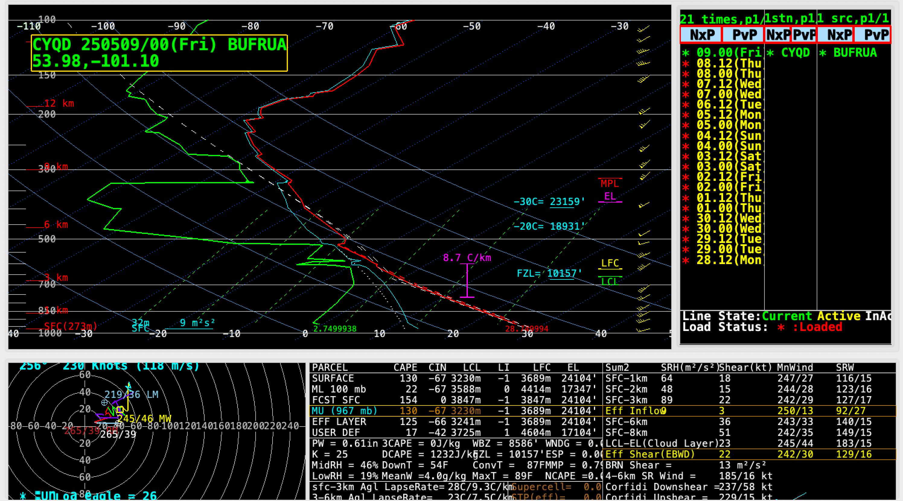
Plot of rawinsonde data from The Pas, Manitoba at 0000 UTC on 09 May [click to enlarge]
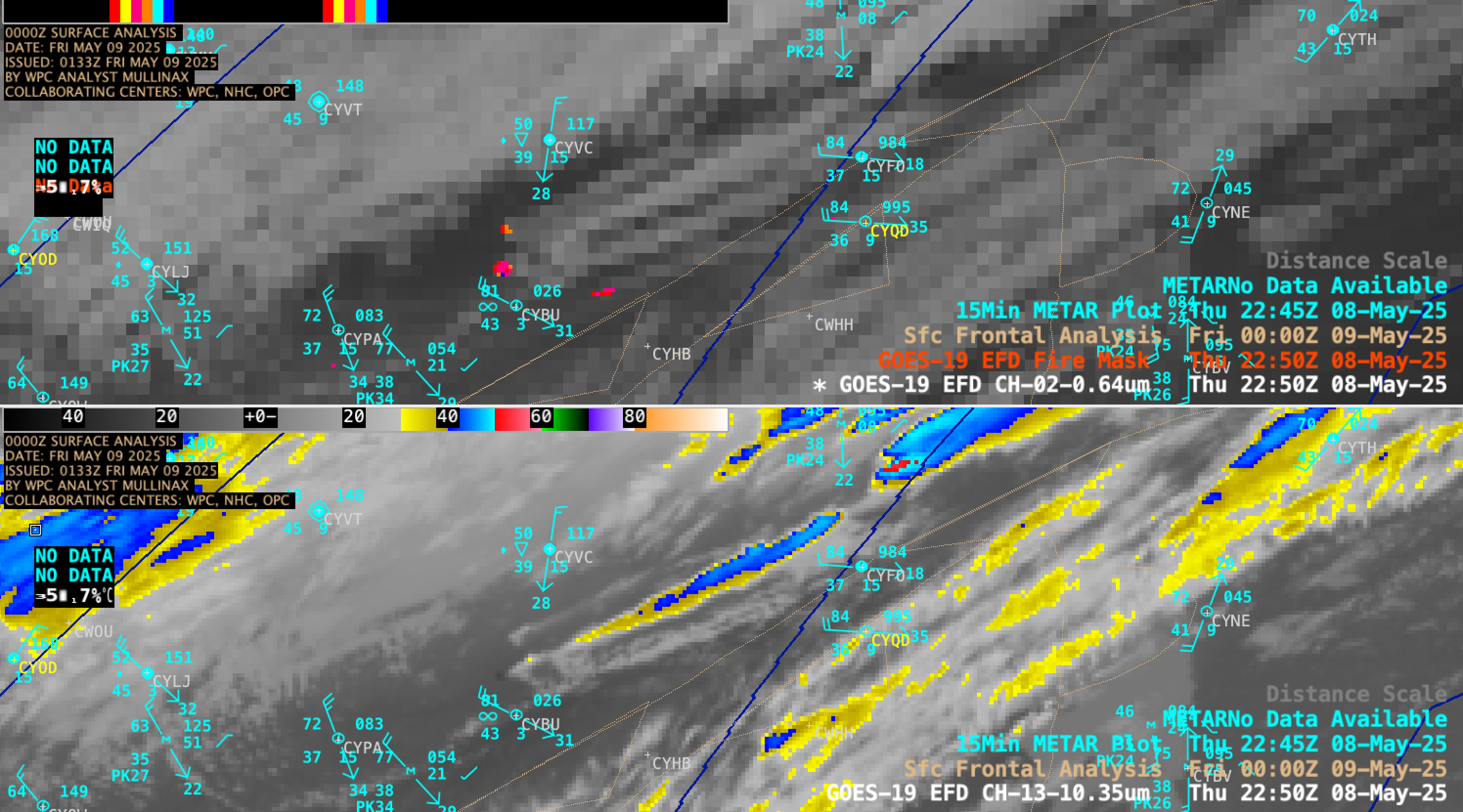
GOES-19 Visible (0.64 µm) + Fire Mask derived product (top) and Infrared Window (10.3 µm, bottom) images, from 2000 UTC on 08 May to 0000 UTC on 09 May [click to play MP4 animation]
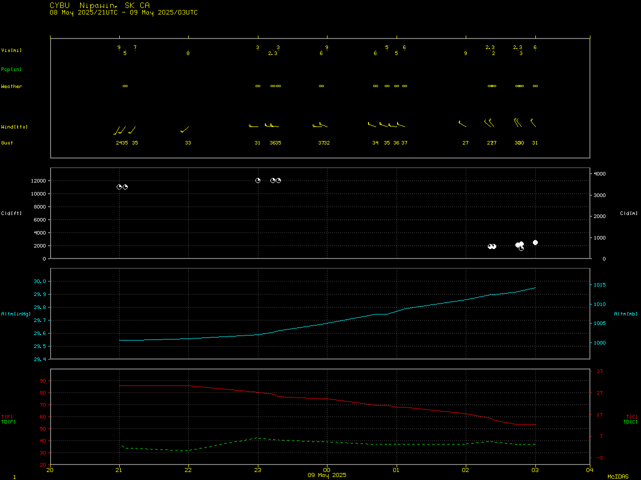
Plot of surface observation data at Nipawin, Saskatchewan [click to enlarge]