Atmospheric spectra over the west Pacific
When Himawari-10 launches (currently scheduled for late 2028/early 2029), it will carry the GHMS, the Geostationary HiMawari Sounder, planned to give hourly sounder imagery (with more frequent observations — about 4 per hour — in smaller targetable domains, including one over Japan.) The Sounder will observe with about 4-km spatial resolution within two spectral ranges, 4.44 µm – 5.92 µm and 9.13 µm – 14.7 µm. (The information above comes from this presentation). That spectral resolution is similar to the midwave/longwave converage on the CrIS instrument that flies on JPSS Satellites NOAA-20/NOAA-21 and Suomi-NPP. This blog post, the first in a series, shows spectra from CrIS and relates it to the observed atmosphere as a way of preparing National Weather Service staff in the Guam office to use the data. (CrIS data are downloaded in real time at the Direct Broadcast antenna at the Guam Office).
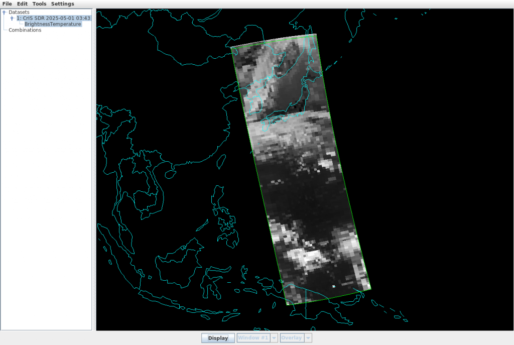
On 1 May 2025, NOAA-20 overflew the Marianas Islands at around 0350 UTC. Following the steps outlined in this blog post, NOAA-20 CrIS data were ordered from the NOAA CLASS site (here’s the list of files; Hydra expects the CrIS data — ‘SCRIF’ — and geolocation data — ‘GCRSO’ — to be combined) and were uploaded into a version of McIDAS-V that can read and interpret CrIS files. The swath loaded is shown below with the Hydra window spawned by McIDAS-V. Note the ‘Display’ button at the bottom of this window.
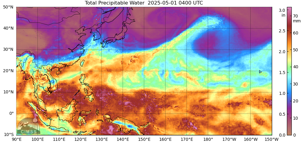
What did other satellite data show over the region? MIMIC Total Precipitable Water (TPW) fields (from this source), below, show relatively dry air around Japan and over the central Pacific between 10o and 20oN.
I also used geo2grid software applied to Himawari Standard Data (HSD) files and created the True Color and airmass RGB images below. The relative dryness in a longitudinal strip through Guam is apparent, as are the more moist regions to the north and south.

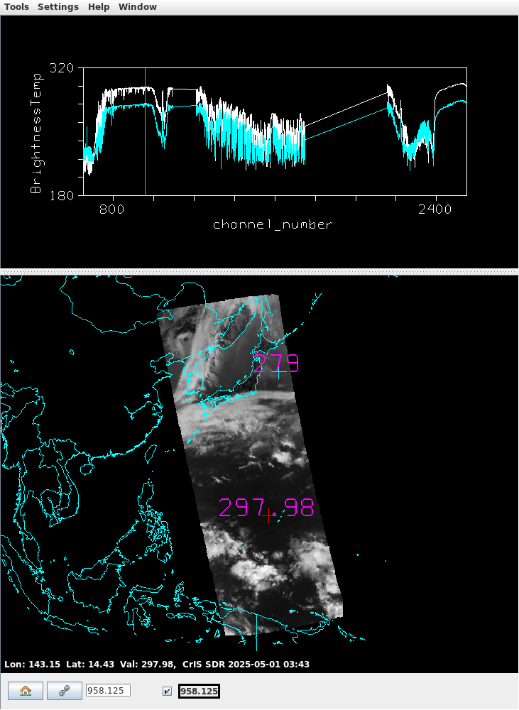
Now that you have a gross understanding of the atmosphere in this region, what do you expect the spectra to look like over this region? Clicking that ‘Display’ button in the McIDAS-V Hydra window spawns an interactive window, two examples of which are shown below. Two spectra are shown: the cyan spectra is derived from data at the northernmost point, showed over Japan; the white spectra is derived from data closer to Guam. The horizontal mapping of data in the images on the bottom in the figures is at the wavenumber that matches the vertical green line, i.e., wavenumber 828.75 (equivalent to 12.07 µm) on the left and 958.125 (equivalent to 10.44 µm) on the right. The wavenumber to wavelength conversion was done here.
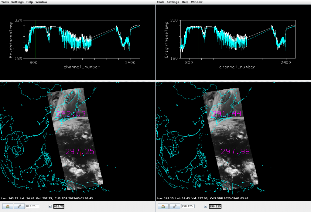
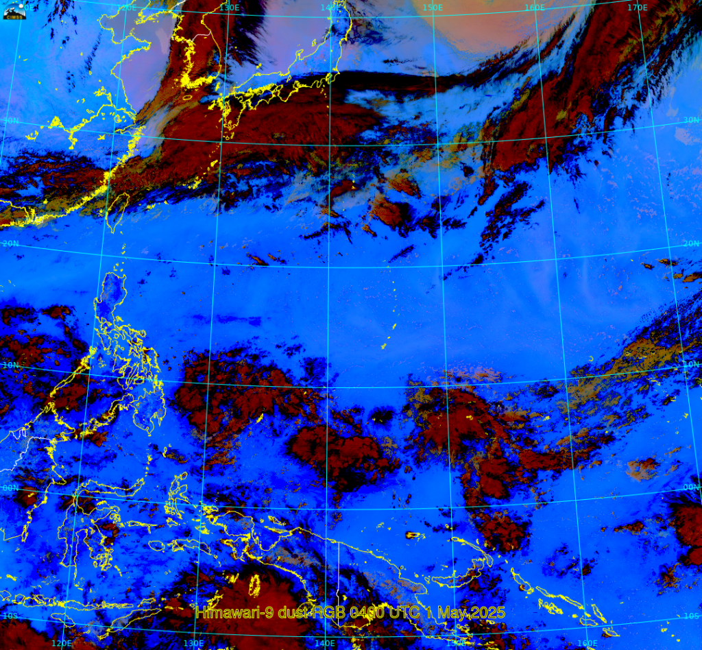
What can you infer from those spectra at the two different points? Note first the strong cooling where ozone absorption is present at wavenumbers around 1050. Wavenumbers exceeding 2200 — the shortwave part of the electromagnetic spectrum — are not slated to be observed by GHMS. Pay attention to the slope of the two spectra between 800 and 1000; in the white line, brightness temperature change more over the range over Guam — the white line — compared to over Japan — the cyan line. Brightness temperature differences plotted at the points on the map over Guam are 297.98 K in the clean window at 10.44 µm and 297.25 K in dirty window at 12.07 µm, for a difference of 0.73 K and over Japan are 291.44 K in the clean window (10.44 µm) and 292.03 (12.07 µm), for a difference of -0.59K! (Editors note: I was not expecting this, and when I saw that, my reaction was to create the dust RGB below) The negative difference suggest the presence of dust and the dust RGB shows a pinkish hue around Japan, a color in that RGB that is consistent with dust. You can infer something about the atmosphere from the slope of the the spectrum between wavenumbers 830 and 960. If it shows increasing temperatures, i.e., warming, then the atmosphere is likely moist. If it shows level or decreasing brightness temperatures, maybe dust is present.
In the spectrum below, the northern point has been moved out of the region where the dust RGB suggests dust is present. The slope of the cyan spectra shows warming brightness temperatures from wavenumbers 800 to 980 is consistent with a decrease of water vapor absorption as observations move from the dirty window to the clean window in the infrared spectrum.
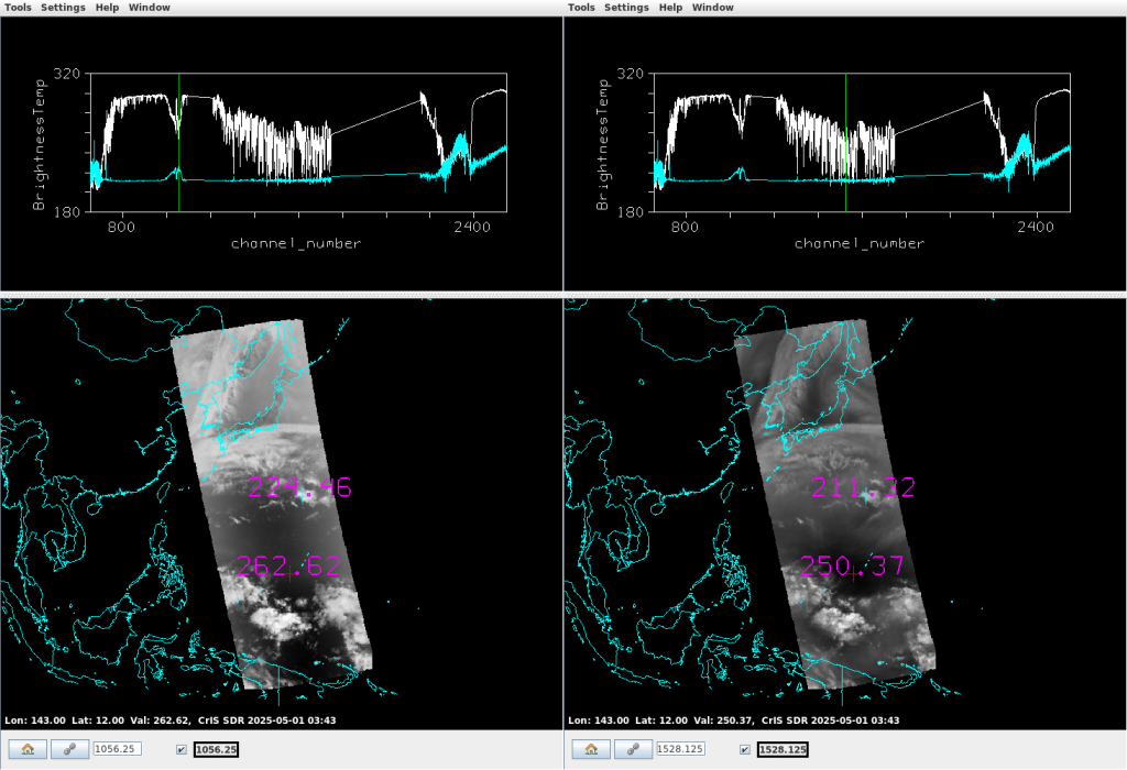
Two different points are examined in the plots below. The greyscale plot on the left is wavenumber 1056.25 (or 9.46 µm, in a region of ozone absorption) and the one of the right is 1528.125 (or 6.5 µm, a region of water vapor absorption). The cyan spectra corresponds to the point centered over convection; the white spectra is in the warmest region at 6.5 µm. The cyan spectrum — a region of cloudiness, as the ‘+’ is centered over a convective cloud — is (mostly) uniformly cold except in the Ozone Absorption band where the spectra shows a local maximum in brightness temperature, and in the shortwave infrared (wavenumbers around 2400 are at 4) where solar radiation is present and in the longwave (wavenumbers around 750 are at 13.3) where CO2 absorption will have an effect. In the white spectrum, at a point in clear air, ozone absorption does not have a warming effect, and the large valley of variable water vapor absorption from wavenumbers 1200-1600 is apparent. In addition, surface features are not discernible at these wavenumbers unlike in the window channels (wavenumbers 828 and 958) shown above.
This is the first of several posts on this topic. Stay tuned!

